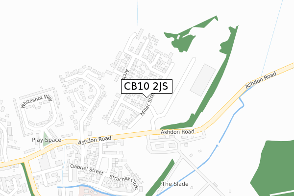
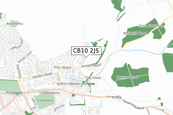
CB10 2JS is located in the Saffron Walden Castle electoral ward, within the local authority district of Uttlesford and the English Parliamentary constituency of Saffron Walden. The Sub Integrated Care Board (ICB) Location is NHS Hertfordshire and West Essex ICB - 07H and the police force is Essex. This postcode has been in use since February 2018.


GetTheData
Source: OS Open Zoomstack (Ordnance Survey)
Licence: Open Government Licence (requires attribution)
Attribution: Contains OS data © Crown copyright and database right 2025
Source: Open Postcode Geo
Licence: Open Government Licence (requires attribution)
Attribution: Contains OS data © Crown copyright and database right 2025; Contains Royal Mail data © Royal Mail copyright and database right 2025; Source: Office for National Statistics licensed under the Open Government Licence v.3.0
| Easting | 555290 |
| Northing | 239021 |
| Latitude | 52.027877 |
| Longitude | 0.262133 |
GetTheData
Source: Open Postcode Geo
Licence: Open Government Licence
| Country | England |
| Postcode District | CB10 |
➜ See where CB10 is on a map ➜ Where is Saffron Walden? | |
GetTheData
Source: Land Registry Price Paid Data
Licence: Open Government Licence
| Ward | Saffron Walden Castle |
| Constituency | Saffron Walden |
GetTheData
Source: ONS Postcode Database
Licence: Open Government Licence
17, MILLER STREET, SAFFRON WALDEN, CB10 2JS 2020 30 JUN £478,500 |
15, MILLER STREET, SAFFRON WALDEN, CB10 2JS 2020 30 JUN £481,000 |
13, MILLER STREET, SAFFRON WALDEN, CB10 2JS 2020 27 MAR £549,995 |
PEPPER TREE HOUSE, 33, MILLER STREET, SAFFRON WALDEN, CB10 2JS 2020 27 MAR £449,995 |
31, MILLER STREET, SAFFRON WALDEN, CB10 2JS 2020 20 MAR £599,995 |
29, MILLER STREET, SAFFRON WALDEN, CB10 2JS 2020 28 FEB £574,995 |
25, MILLER STREET, SAFFRON WALDEN, CB10 2JS 2019 29 NOV £580,000 |
27, MILLER STREET, SAFFRON WALDEN, CB10 2JS 2019 7 NOV £569,995 |
23, MILLER STREET, SAFFRON WALDEN, CB10 2JS 2019 30 SEP £544,995 |
21, MILLER STREET, SAFFRON WALDEN, CB10 2JS 2019 30 SEP £589,995 |
GetTheData
Source: HM Land Registry Price Paid Data
Licence: Contains HM Land Registry data © Crown copyright and database right 2025. This data is licensed under the Open Government Licence v3.0.
| Commercial Centre (Ashdon Road) | Saffron Walden | 157m |
| Commercial Centre (Ashdon Road) | Saffron Walden | 164m |
| Whiteshot Way (Ashdon Road) | Saffron Walden | 404m |
| Whiteshot Way (Ashdon Road) | Saffron Walden | 412m |
| Elizabeth Way | Saffron Walden | 543m |
| Audley End Station | 4.6km |
| Great Chesterford Station | 5.9km |
GetTheData
Source: NaPTAN
Licence: Open Government Licence
| Percentage of properties with Next Generation Access | 100.0% |
| Percentage of properties with Superfast Broadband | 100.0% |
| Percentage of properties with Ultrafast Broadband | 100.0% |
| Percentage of properties with Full Fibre Broadband | 100.0% |
Superfast Broadband is between 30Mbps and 300Mbps
Ultrafast Broadband is > 300Mbps
| Percentage of properties unable to receive 2Mbps | 0.0% |
| Percentage of properties unable to receive 5Mbps | 0.0% |
| Percentage of properties unable to receive 10Mbps | 0.0% |
| Percentage of properties unable to receive 30Mbps | 0.0% |
GetTheData
Source: Ofcom
Licence: Ofcom Terms of Use (requires attribution)
GetTheData
Source: ONS Postcode Database
Licence: Open Government Licence


➜ Get more ratings from the Food Standards Agency
GetTheData
Source: Food Standards Agency
Licence: FSA terms & conditions
| Last Collection | |||
|---|---|---|---|
| Location | Mon-Fri | Sat | Distance |
| Whiteshot Road | 17:45 | 12:00 | 419m |
| Elizabeth Way | 17:30 | 12:00 | 557m |
| Tesco Stores | 17:45 | 11:00 | 713m |
GetTheData
Source: Dracos
Licence: Creative Commons Attribution-ShareAlike
The below table lists the International Territorial Level (ITL) codes (formerly Nomenclature of Territorial Units for Statistics (NUTS) codes) and Local Administrative Units (LAU) codes for CB10 2JS:
| ITL 1 Code | Name |
|---|---|
| TLH | East |
| ITL 2 Code | Name |
| TLH3 | Essex |
| ITL 3 Code | Name |
| TLH35 | West Essex |
| LAU 1 Code | Name |
| E07000077 | Uttlesford |
GetTheData
Source: ONS Postcode Directory
Licence: Open Government Licence
The below table lists the Census Output Area (OA), Lower Layer Super Output Area (LSOA), and Middle Layer Super Output Area (MSOA) for CB10 2JS:
| Code | Name | |
|---|---|---|
| OA | E00112191 | |
| LSOA | E01022077 | Uttlesford 001C |
| MSOA | E02004591 | Uttlesford 001 |
GetTheData
Source: ONS Postcode Directory
Licence: Open Government Licence
| CB10 2BN | De Vigier Avenue | 180m |
| CB10 2AY | De Vigier Avenue | 270m |
| CB10 2GT | Howland Close | 272m |
| CB10 2GQ | Clutton Road | 342m |
| CB10 2GN | Strachey Close | 347m |
| CB10 2GR | Gabriel Street | 395m |
| CB10 2AW | Whiteshot Way | 399m |
| CB10 2AN | Whiteshot Way | 427m |
| CB10 2TN | St James Court | 475m |
| CB11 3GA | Radwinter Road | 520m |
GetTheData
Source: Open Postcode Geo; Land Registry Price Paid Data
Licence: Open Government Licence