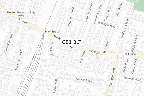
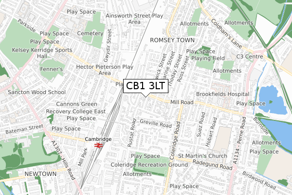
CB1 3LT is located in the Romsey electoral ward, within the local authority district of Cambridge and the English Parliamentary constituency of Cambridge. The Sub Integrated Care Board (ICB) Location is NHS Cambridgeshire and Peterborough ICB - 06H and the police force is Cambridgeshire. This postcode has been in use since May 2019.


GetTheData
Source: OS Open Zoomstack (Ordnance Survey)
Licence: Open Government Licence (requires attribution)
Attribution: Contains OS data © Crown copyright and database right 2025
Source: Open Postcode Geo
Licence: Open Government Licence (requires attribution)
Attribution: Contains OS data © Crown copyright and database right 2025; Contains Royal Mail data © Royal Mail copyright and database right 2025; Source: Office for National Statistics licensed under the Open Government Licence v.3.0
| Easting | 546611 |
| Northing | 257649 |
| Latitude | 52.197598 |
| Longitude | 0.143741 |
GetTheData
Source: Open Postcode Geo
Licence: Open Government Licence
| Country | England |
| Postcode District | CB1 |
➜ See where CB1 is on a map ➜ Where is Cambridge? | |
GetTheData
Source: Land Registry Price Paid Data
Licence: Open Government Licence
| Ward | Romsey |
| Constituency | Cambridge |
GetTheData
Source: ONS Postcode Database
Licence: Open Government Licence
| The Broadway (Mill Road) | Romsey Town | 32m |
| The Broadway (Mill Road) | Romsey Town | 36m |
| Romsey Terrace (Mill Road) | Romsey Town | 173m |
| Romsey Terrace (Mill Road) | Romsey Town | 238m |
| Greville Road (Coleridge Road) | Romsey Town | 374m |
| Cambridge Station | 0.6km |
GetTheData
Source: NaPTAN
Licence: Open Government Licence
| Percentage of properties with Next Generation Access | 100.0% |
| Percentage of properties with Superfast Broadband | 100.0% |
| Percentage of properties with Ultrafast Broadband | 100.0% |
| Percentage of properties with Full Fibre Broadband | 0.0% |
Superfast Broadband is between 30Mbps and 300Mbps
Ultrafast Broadband is > 300Mbps
| Percentage of properties unable to receive 2Mbps | 0.0% |
| Percentage of properties unable to receive 5Mbps | 0.0% |
| Percentage of properties unable to receive 10Mbps | 0.0% |
| Percentage of properties unable to receive 30Mbps | 0.0% |
GetTheData
Source: Ofcom
Licence: Ofcom Terms of Use (requires attribution)
GetTheData
Source: ONS Postcode Database
Licence: Open Government Licence


➜ Get more ratings from the Food Standards Agency
GetTheData
Source: Food Standards Agency
Licence: FSA terms & conditions
| Last Collection | |||
|---|---|---|---|
| Location | Mon-Fri | Sat | Distance |
| Romsey Town Post Office | 19:00 | 12:00 | 150m |
| Petersfield P.o. | 19:15 | 12:45 | 425m |
| Coleridge Road | 18:30 | 13:00 | 439m |
GetTheData
Source: Dracos
Licence: Creative Commons Attribution-ShareAlike
The below table lists the International Territorial Level (ITL) codes (formerly Nomenclature of Territorial Units for Statistics (NUTS) codes) and Local Administrative Units (LAU) codes for CB1 3LT:
| ITL 1 Code | Name |
|---|---|
| TLH | East |
| ITL 2 Code | Name |
| TLH1 | East Anglia |
| ITL 3 Code | Name |
| TLH12 | Cambridgeshire CC |
| LAU 1 Code | Name |
| E07000008 | Cambridge |
GetTheData
Source: ONS Postcode Directory
Licence: Open Government Licence
The below table lists the Census Output Area (OA), Lower Layer Super Output Area (LSOA), and Middle Layer Super Output Area (MSOA) for CB1 3LT:
| Code | Name | |
|---|---|---|
| OA | E00167069 | |
| LSOA | E01018000 | Cambridge 009D |
| MSOA | E02003727 | Cambridge 009 |
GetTheData
Source: ONS Postcode Directory
Licence: Open Government Licence
| CB1 3DZ | Stockwell Street | 49m |
| CB1 3NB | Cockburn Street | 54m |
| CB1 3LP | Mill Road | 76m |
| CB1 3ND | Stockwell Street | 85m |
| CB1 3NE | Campbell Street | 88m |
| CB1 3FZ | Cavendish Road | 101m |
| CB1 3AA | Mill Road | 110m |
| CB1 3NA | Hope Street | 115m |
| CB1 3NF | Mill Road | 118m |
| CB1 3LR | Argyle Street | 131m |
GetTheData
Source: Open Postcode Geo; Land Registry Price Paid Data
Licence: Open Government Licence