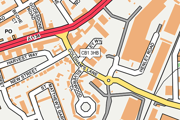
CB1 3HB is located in the Abbey electoral ward, within the local authority district of Cambridge and the English Parliamentary constituency of Cambridge. The Sub Integrated Care Board (ICB) Location is NHS Cambridgeshire and Peterborough ICB - 06H and the police force is Cambridgeshire. This postcode has been in use since July 2007.


GetTheData
Source: OS OpenMap – Local (Ordnance Survey)
Source: OS VectorMap District (Ordnance Survey)
Licence: Open Government Licence (requires attribution)
| Easting | 546602 |
| Northing | 258840 |
| Latitude | 52.208287 |
| Longitude | 0.144096 |
GetTheData
Source: Open Postcode Geo
Licence: Open Government Licence
| Country | England |
| Postcode District | CB1 |
➜ See where CB1 is on a map ➜ Where is Cambridge? | |
GetTheData
Source: Land Registry Price Paid Data
Licence: Open Government Licence
Elevation or altitude of CB1 3HB as distance above sea level:
| Metres | Feet | |
|---|---|---|
| Elevation | 10m | 33ft |
Elevation is measured from the approximate centre of the postcode, to the nearest point on an OS contour line from OS Terrain 50, which has contour spacing of ten vertical metres.
➜ How high above sea level am I? Find the elevation of your current position using your device's GPS.
GetTheData
Source: Open Postcode Elevation
Licence: Open Government Licence
| Ward | Abbey |
| Constituency | Cambridge |
GetTheData
Source: ONS Postcode Database
Licence: Open Government Licence
| New Street (Coldham's Lane) | Cambridge | 55m |
| New Street (Coldham's Lane) | Cambridge | 94m |
| Homebase (Cambridge Retail Park) | Cambridge | 96m |
| Homebase (Cambridge Retail Park) | Cambridge | 136m |
| River Lane (Newmarket Road) | Cambridge | 161m |
| Cambridge Station | 1.6km |
GetTheData
Source: NaPTAN
Licence: Open Government Licence
GetTheData
Source: ONS Postcode Database
Licence: Open Government Licence


➜ Get more ratings from the Food Standards Agency
GetTheData
Source: Food Standards Agency
Licence: FSA terms & conditions
| Last Collection | |||
|---|---|---|---|
| Location | Mon-Fri | Sat | Distance |
| Silverwood Close | 18:00 | 12:30 | 57m |
| Cambridge Delivery Office | 17:45 | 12:45 | 257m |
| Newmarket Road Post Office | 18:00 | 12:00 | 266m |
GetTheData
Source: Dracos
Licence: Creative Commons Attribution-ShareAlike
The below table lists the International Territorial Level (ITL) codes (formerly Nomenclature of Territorial Units for Statistics (NUTS) codes) and Local Administrative Units (LAU) codes for CB1 3HB:
| ITL 1 Code | Name |
|---|---|
| TLH | East |
| ITL 2 Code | Name |
| TLH1 | East Anglia |
| ITL 3 Code | Name |
| TLH12 | Cambridgeshire CC |
| LAU 1 Code | Name |
| E07000008 | Cambridge |
GetTheData
Source: ONS Postcode Directory
Licence: Open Government Licence
The below table lists the Census Output Area (OA), Lower Layer Super Output Area (LSOA), and Middle Layer Super Output Area (MSOA) for CB1 3HB:
| Code | Name | |
|---|---|---|
| OA | E00090513 | |
| LSOA | E01017943 | Cambridge 006A |
| MSOA | E02003724 | Cambridge 006 |
GetTheData
Source: ONS Postcode Directory
Licence: Open Government Licence
| CB1 3EP | Coldhams Lane | 50m |
| CB1 3HA | Silverwood Close | 105m |
| CB1 2QX | New Street | 184m |
| CB1 2PJ | St Matthews Gardens | 202m |
| CB1 2PH | St Matthews Gardens | 204m |
| CB5 8JE | Newmarket Road | 221m |
| CB5 8HR | Godesdone Road | 232m |
| CB1 2PT | St Matthews Gardens | 248m |
| CB5 8HZ | Beche Road | 251m |
| CB5 8HP | River Lane | 257m |
GetTheData
Source: Open Postcode Geo; Land Registry Price Paid Data
Licence: Open Government Licence