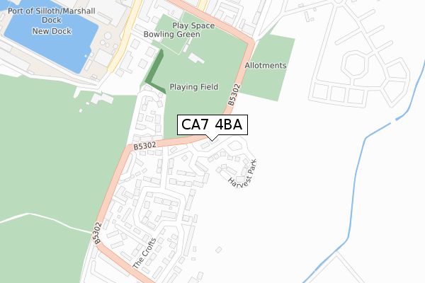
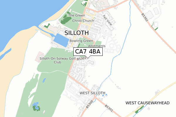
CA7 4BA is located in the Solway Coast electoral ward, within the unitary authority of Cumberland and the English Parliamentary constituency of Workington. The Sub Integrated Care Board (ICB) Location is NHS North East and North Cumbria ICB - 01H and the police force is Cumbria. This postcode has been in use since April 2020.


GetTheData
Source: OS Open Zoomstack (Ordnance Survey)
Licence: Open Government Licence (requires attribution)
Attribution: Contains OS data © Crown copyright and database right 2025
Source: Open Postcode Geo
Licence: Open Government Licence (requires attribution)
Attribution: Contains OS data © Crown copyright and database right 2025; Contains Royal Mail data © Royal Mail copyright and database right 2025; Source: Office for National Statistics licensed under the Open Government Licence v.3.0
| Easting | 311101 |
| Northing | 553162 |
| Latitude | 54.865314 |
| Longitude | -3.386626 |
GetTheData
Source: Open Postcode Geo
Licence: Open Government Licence
| Country | England |
| Postcode District | CA7 |
➜ See where CA7 is on a map ➜ Where is Silloth? | |
GetTheData
Source: Land Registry Price Paid Data
Licence: Open Government Licence
| Ward | Solway Coast |
| Constituency | Workington |
GetTheData
Source: ONS Postcode Database
Licence: Open Government Licence
| The Cumberland Inn (B5300) | Greenrow | 267m |
| Prospect Place | Greenrow | 279m |
| Eden Street | Silloth | 302m |
| Eden Street | Silloth | 307m |
| The Crofts (B5300) | Greenrow | 357m |
GetTheData
Source: NaPTAN
Licence: Open Government Licence
GetTheData
Source: ONS Postcode Database
Licence: Open Government Licence

➜ Get more ratings from the Food Standards Agency
GetTheData
Source: Food Standards Agency
Licence: FSA terms & conditions
| Last Collection | |||
|---|---|---|---|
| Location | Mon-Fri | Sat | Distance |
| Greenrow | 16:45 | 11:00 | 354m |
| Silloth S O | 17:30 | 12:00 | 387m |
| Esk Street | 16:45 | 11:00 | 458m |
GetTheData
Source: Dracos
Licence: Creative Commons Attribution-ShareAlike
The below table lists the International Territorial Level (ITL) codes (formerly Nomenclature of Territorial Units for Statistics (NUTS) codes) and Local Administrative Units (LAU) codes for CA7 4BA:
| ITL 1 Code | Name |
|---|---|
| TLD | North West (England) |
| ITL 2 Code | Name |
| TLD1 | Cumbria |
| ITL 3 Code | Name |
| TLD11 | West Cumbria |
| LAU 1 Code | Name |
| E07000026 | Allerdale |
GetTheData
Source: ONS Postcode Directory
Licence: Open Government Licence
The below table lists the Census Output Area (OA), Lower Layer Super Output Area (LSOA), and Middle Layer Super Output Area (MSOA) for CA7 4BA:
| Code | Name | |
|---|---|---|
| OA | E00096675 | |
| LSOA | E01019126 | Allerdale 001A |
| MSOA | E02003965 | Allerdale 001 |
GetTheData
Source: ONS Postcode Directory
Licence: Open Government Licence
| CA7 4HW | Holliday Crescent | 91m |
| CA7 4HA | The Crofts | 151m |
| CA7 4AP | Bridge View | 164m |
| CA7 4ES | Links Close | 165m |
| CA7 4HD | Roddan Terrace | 183m |
| CA7 4EZ | The Crofts | 186m |
| CA7 4HE | Beaconsfield Terrace | 208m |
| CA7 4GL | Orchard Place | 218m |
| CA7 4HF | 242m | |
| CA7 4HG | Osborne Terrace | 251m |
GetTheData
Source: Open Postcode Geo; Land Registry Price Paid Data
Licence: Open Government Licence