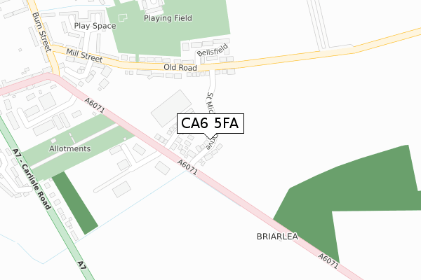
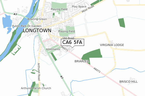
CA6 5FA is located in the Longtown electoral ward, within the unitary authority of Cumberland and the English Parliamentary constituency of Penrith and The Border. The Sub Integrated Care Board (ICB) Location is NHS North East and North Cumbria ICB - 01H and the police force is Cumbria. This postcode has been in use since July 2019.


GetTheData
Source: OS Open Zoomstack (Ordnance Survey)
Licence: Open Government Licence (requires attribution)
Attribution: Contains OS data © Crown copyright and database right 2025
Source: Open Postcode Geo
Licence: Open Government Licence (requires attribution)
Attribution: Contains OS data © Crown copyright and database right 2025; Contains Royal Mail data © Royal Mail copyright and database right 2025; Source: Office for National Statistics licensed under the Open Government Licence v.3.0
| Easting | 338538 |
| Northing | 568427 |
| Latitude | 55.006598 |
| Longitude | -2.962497 |
GetTheData
Source: Open Postcode Geo
Licence: Open Government Licence
| Country | England |
| Postcode District | CA6 |
➜ See where CA6 is on a map ➜ Where is Longtown? | |
GetTheData
Source: Land Registry Price Paid Data
Licence: Open Government Licence
| Ward | Longtown |
| Constituency | Penrith And The Border |
GetTheData
Source: ONS Postcode Database
Licence: Open Government Licence
7, ST MICHAELS DRIVE, LONGTOWN, CARLISLE, CA6 5FA 2024 26 JUL £165,000 |
15, ST MICHAELS DRIVE, LONGTOWN, CARLISLE, CA6 5FA 2024 12 JUL £220,000 |
5, ST MICHAELS DRIVE, LONGTOWN, CARLISLE, CA6 5FA 2022 3 OCT £197,995 |
45, ST MICHAELS DRIVE, LONGTOWN, CARLISLE, CA6 5FA 2022 31 AUG £179,995 |
43, ST MICHAELS DRIVE, LONGTOWN, CARLISLE, CA6 5FA 2022 31 AUG £176,995 |
9, ST MICHAELS DRIVE, LONGTOWN, CARLISLE, CA6 5FA 2021 5 NOV £182,995 |
21, ST MICHAELS DRIVE, LONGTOWN, CARLISLE, CA6 5FA 2021 20 SEP £162,995 |
33, ST MICHAELS DRIVE, LONGTOWN, CARLISLE, CA6 5FA 2021 28 MAY £161,995 |
31, ST MICHAELS DRIVE, LONGTOWN, CARLISLE, CA6 5FA 2021 28 MAY £156,995 |
27, ST MICHAELS DRIVE, LONGTOWN, CARLISLE, CA6 5FA 2021 9 APR £153,995 |
GetTheData
Source: HM Land Registry Price Paid Data
Licence: Contains HM Land Registry data © Crown copyright and database right 2025. This data is licensed under the Open Government Licence v3.0.
| Mary St (Mary Street) | Longtown | 421m |
| Lochinvar School (Mary Street) | Longtown | 440m |
| Moor Road | Longtown | 474m |
| Mary Street | Longtown | 510m |
| Albert Street (English Street) | Longtown | 514m |
GetTheData
Source: NaPTAN
Licence: Open Government Licence
| Percentage of properties with Next Generation Access | 100.0% |
| Percentage of properties with Superfast Broadband | 100.0% |
| Percentage of properties with Ultrafast Broadband | 14.3% |
| Percentage of properties with Full Fibre Broadband | 14.3% |
Superfast Broadband is between 30Mbps and 300Mbps
Ultrafast Broadband is > 300Mbps
| Percentage of properties unable to receive 2Mbps | 0.0% |
| Percentage of properties unable to receive 5Mbps | 0.0% |
| Percentage of properties unable to receive 10Mbps | 0.0% |
| Percentage of properties unable to receive 30Mbps | 0.0% |
GetTheData
Source: Ofcom
Licence: Ofcom Terms of Use (requires attribution)
GetTheData
Source: ONS Postcode Database
Licence: Open Government Licence


➜ Get more ratings from the Food Standards Agency
GetTheData
Source: Food Standards Agency
Licence: FSA terms & conditions
| Last Collection | |||
|---|---|---|---|
| Location | Mon-Fri | Sat | Distance |
| Moor Road | 17:00 | 11:00 | 483m |
| Arthured Drive | 17:15 | 09:15 | 571m |
| Longtown | 17:30 | 12:00 | 591m |
GetTheData
Source: Dracos
Licence: Creative Commons Attribution-ShareAlike
The below table lists the International Territorial Level (ITL) codes (formerly Nomenclature of Territorial Units for Statistics (NUTS) codes) and Local Administrative Units (LAU) codes for CA6 5FA:
| ITL 1 Code | Name |
|---|---|
| TLD | North West (England) |
| ITL 2 Code | Name |
| TLD1 | Cumbria |
| ITL 3 Code | Name |
| TLD12 | East Cumbria |
| LAU 1 Code | Name |
| E07000028 | Carlisle |
GetTheData
Source: ONS Postcode Directory
Licence: Open Government Licence
The below table lists the Census Output Area (OA), Lower Layer Super Output Area (LSOA), and Middle Layer Super Output Area (MSOA) for CA6 5FA:
| Code | Name | |
|---|---|---|
| OA | E00097187 | |
| LSOA | E01019228 | Carlisle 001C |
| MSOA | E02003987 | Carlisle 001 |
GetTheData
Source: ONS Postcode Directory
Licence: Open Government Licence
| CA6 5YS | Briar Lea Court | 67m |
| CA6 5TH | Old Road | 113m |
| CA6 5XS | Bellsfield | 168m |
| CA6 5TG | Mill Street | 258m |
| CA6 5TF | Mill Street | 312m |
| CA6 5WD | Sutton Close | 320m |
| CA6 5TN | Brampton Road | 338m |
| CA6 5XU | Lochinvar Close | 352m |
| CA6 5XF | Ladyseat Gardens | 373m |
| CA6 5TQ | Raefield | 374m |
GetTheData
Source: Open Postcode Geo; Land Registry Price Paid Data
Licence: Open Government Licence