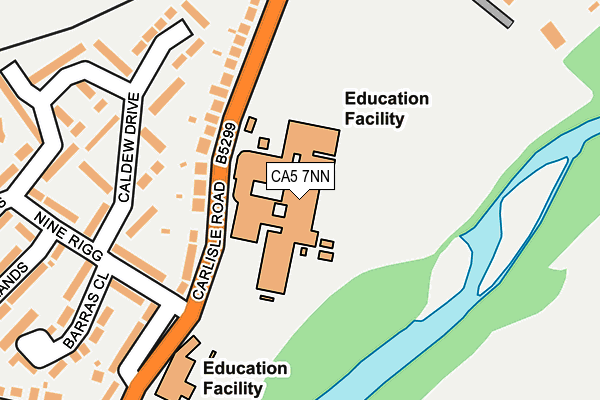
CA5 7NN is located in the Dalston and Burgh electoral ward, within the unitary authority of Cumberland and the English Parliamentary constituency of Carlisle. The Sub Integrated Care Board (ICB) Location is NHS North East and North Cumbria ICB - 01H and the police force is Cumbria. This postcode has been in use since January 1980.


GetTheData
Source: OS OpenMap – Local (Ordnance Survey)
Source: OS VectorMap District (Ordnance Survey)
Licence: Open Government Licence (requires attribution)
| Easting | 337141 |
| Northing | 550508 |
| Latitude | 54.845416 |
| Longitude | -2.980408 |
GetTheData
Source: Open Postcode Geo
Licence: Open Government Licence
| Country | England |
| Postcode District | CA5 |
➜ See where CA5 is on a map ➜ Where is Dalston? | |
GetTheData
Source: Land Registry Price Paid Data
Licence: Open Government Licence
Elevation or altitude of CA5 7NN as distance above sea level:
| Metres | Feet | |
|---|---|---|
| Elevation | 40m | 131ft |
Elevation is measured from the approximate centre of the postcode, to the nearest point on an OS contour line from OS Terrain 50, which has contour spacing of ten vertical metres.
➜ How high above sea level am I? Find the elevation of your current position using your device's GPS.
GetTheData
Source: Open Postcode Elevation
Licence: Open Government Licence
| Ward | Dalston And Burgh |
| Constituency | Carlisle |
GetTheData
Source: ONS Postcode Database
Licence: Open Government Licence
| Caldew School (B5299) | Dalston | 90m |
| Caldew School (B5299) | Dalston | 91m |
| Caldew School (Carlisle Road) | Dalston | 111m |
| Carlisle Road Nestle Factory (B5299) | Dalston | 175m |
| St Michaels School (B5299) | Dalston | 219m |
| Dalston (Cumbria) Station | 0.5km |
| Carlisle Station | 5.9km |
GetTheData
Source: NaPTAN
Licence: Open Government Licence
GetTheData
Source: ONS Postcode Database
Licence: Open Government Licence


➜ Get more ratings from the Food Standards Agency
GetTheData
Source: Food Standards Agency
Licence: FSA terms & conditions
| Last Collection | |||
|---|---|---|---|
| Location | Mon-Fri | Sat | Distance |
| Ninerigg Dalston | 11:30 | 11:30 | 243m |
| Dalston | 17:15 | 11:30 | 472m |
| Lingey Close Head | 12:00 | 09:15 | 1,773m |
GetTheData
Source: Dracos
Licence: Creative Commons Attribution-ShareAlike
The below table lists the International Territorial Level (ITL) codes (formerly Nomenclature of Territorial Units for Statistics (NUTS) codes) and Local Administrative Units (LAU) codes for CA5 7NN:
| ITL 1 Code | Name |
|---|---|
| TLD | North West (England) |
| ITL 2 Code | Name |
| TLD1 | Cumbria |
| ITL 3 Code | Name |
| TLD12 | East Cumbria |
| LAU 1 Code | Name |
| E07000028 | Carlisle |
GetTheData
Source: ONS Postcode Directory
Licence: Open Government Licence
The below table lists the Census Output Area (OA), Lower Layer Super Output Area (LSOA), and Middle Layer Super Output Area (MSOA) for CA5 7NN:
| Code | Name | |
|---|---|---|
| OA | E00097100 | |
| LSOA | E01019214 | Carlisle 013C |
| MSOA | E02003999 | Carlisle 013 |
GetTheData
Source: ONS Postcode Directory
Licence: Open Government Licence
| CA5 7NF | Carlisle Road | 121m |
| CA5 7NG | Carlisle Road | 144m |
| CA5 7NP | Ninerigg | 170m |
| CA5 7NS | Caldew Drive | 174m |
| CA5 7NE | Carlisle Road | 225m |
| CA5 7LN | Carlisle Road | 237m |
| CA5 7NR | Ninerigg | 244m |
| CA5 7PA | Low Moorlands | 258m |
| CA5 7NT | Barras Close | 282m |
| CA5 7LP | Smithfield | 284m |
GetTheData
Source: Open Postcode Geo; Land Registry Price Paid Data
Licence: Open Government Licence