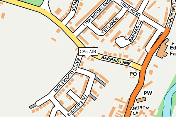
CA5 7JB is located in the Dalston and Burgh electoral ward, within the unitary authority of Cumberland and the English Parliamentary constituency of Carlisle. The Sub Integrated Care Board (ICB) Location is NHS North East and North Cumbria ICB - 01H and the police force is Cumbria. This postcode has been in use since March 2017.


GetTheData
Source: OS OpenMap – Local (Ordnance Survey)
Source: OS VectorMap District (Ordnance Survey)
Licence: Open Government Licence (requires attribution)
| Easting | 336765 |
| Northing | 550303 |
| Latitude | 54.843534 |
| Longitude | -2.986222 |
GetTheData
Source: Open Postcode Geo
Licence: Open Government Licence
| Country | England |
| Postcode District | CA5 |
➜ See where CA5 is on a map | |
GetTheData
Source: Land Registry Price Paid Data
Licence: Open Government Licence
| Ward | Dalston And Burgh |
| Constituency | Carlisle |
GetTheData
Source: ONS Postcode Database
Licence: Open Government Licence
| St Michaels School (B5299) | Dalston | 230m |
| St Michael's School (B5299) | Dalston | 234m |
| The Blue Bell (B5299) | Dalston | 238m |
| The Blue Bell (The Square) | Dalston | 253m |
| Caldew School (Carlisle Road) | Dalston | 320m |
| Dalston (Cumbria) Station | 0.3km |
GetTheData
Source: NaPTAN
Licence: Open Government Licence
| Percentage of properties with Next Generation Access | 100.0% |
| Percentage of properties with Superfast Broadband | 100.0% |
| Percentage of properties with Ultrafast Broadband | 0.0% |
| Percentage of properties with Full Fibre Broadband | 0.0% |
Superfast Broadband is between 30Mbps and 300Mbps
Ultrafast Broadband is > 300Mbps
| Percentage of properties unable to receive 2Mbps | 0.0% |
| Percentage of properties unable to receive 5Mbps | 0.0% |
| Percentage of properties unable to receive 10Mbps | 0.0% |
| Percentage of properties unable to receive 30Mbps | 0.0% |
GetTheData
Source: Ofcom
Licence: Ofcom Terms of Use (requires attribution)
GetTheData
Source: ONS Postcode Database
Licence: Open Government Licence


➜ Get more ratings from the Food Standards Agency
GetTheData
Source: Food Standards Agency
Licence: FSA terms & conditions
| Last Collection | |||
|---|---|---|---|
| Location | Mon-Fri | Sat | Distance |
| Ninerigg Dalston | 11:30 | 11:30 | 226m |
| Dalston | 17:15 | 11:30 | 227m |
| Bridge End | 12:30 | 11:30 | 1,641m |
GetTheData
Source: Dracos
Licence: Creative Commons Attribution-ShareAlike
The below table lists the International Territorial Level (ITL) codes (formerly Nomenclature of Territorial Units for Statistics (NUTS) codes) and Local Administrative Units (LAU) codes for CA5 7JB:
| ITL 1 Code | Name |
|---|---|
| TLD | North West (England) |
| ITL 2 Code | Name |
| TLD1 | Cumbria |
| ITL 3 Code | Name |
| TLD12 | East Cumbria |
| LAU 1 Code | Name |
| E07000028 | Carlisle |
GetTheData
Source: ONS Postcode Directory
Licence: Open Government Licence
The below table lists the Census Output Area (OA), Lower Layer Super Output Area (LSOA), and Middle Layer Super Output Area (MSOA) for CA5 7JB:
| Code | Name | |
|---|---|---|
| OA | E00097101 | |
| LSOA | E01019214 | Carlisle 013C |
| MSOA | E02003999 | Carlisle 013 |
GetTheData
Source: ONS Postcode Directory
Licence: Open Government Licence
| CA5 7LR | Station Road | 74m |
| CA5 7LS | Station Road | 120m |
| CA5 7LF | Bishops Way | 129m |
| CA5 7PB | Yetlands | 132m |
| CA5 7NT | Barras Close | 146m |
| CA5 7LQ | Apple Tree Close | 148m |
| CA5 7LZ | Inglewood Drive | 173m |
| CA5 7LP | Smithfield | 175m |
| CA5 7NX | Low Moorlands | 176m |
| CA5 7PW | Indian King Court | 203m |
GetTheData
Source: Open Postcode Geo; Land Registry Price Paid Data
Licence: Open Government Licence