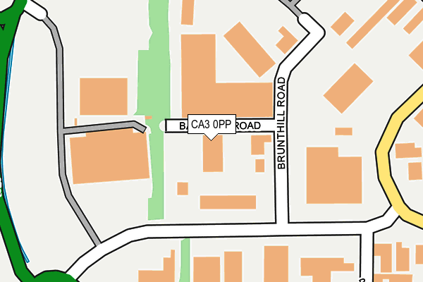
CA3 0PP is located in the Belah electoral ward, within the unitary authority of Cumberland and the English Parliamentary constituency of Carlisle. The Sub Integrated Care Board (ICB) Location is NHS North East and North Cumbria ICB - 01H and the police force is Cumbria. This postcode has been in use since January 1995.


GetTheData
Source: OS OpenMap – Local (Ordnance Survey)
Source: OS VectorMap District (Ordnance Survey)
Licence: Open Government Licence (requires attribution)
| Easting | 338632 |
| Northing | 559196 |
| Latitude | 54.923664 |
| Longitude | -2.959046 |
GetTheData
Source: Open Postcode Geo
Licence: Open Government Licence
| Country | England |
| Postcode District | CA3 |
➜ See where CA3 is on a map ➜ Where is Carlisle? | |
GetTheData
Source: Land Registry Price Paid Data
Licence: Open Government Licence
Elevation or altitude of CA3 0PP as distance above sea level:
| Metres | Feet | |
|---|---|---|
| Elevation | 20m | 66ft |
Elevation is measured from the approximate centre of the postcode, to the nearest point on an OS contour line from OS Terrain 50, which has contour spacing of ten vertical metres.
➜ How high above sea level am I? Find the elevation of your current position using your device's GPS.
GetTheData
Source: Open Postcode Elevation
Licence: Open Government Licence
| Ward | Belah |
| Constituency | Carlisle |
GetTheData
Source: ONS Postcode Database
Licence: Open Government Licence
| West Scottish Lamb Ltd (Brunthill Road) | Kingstown | 195m |
| Carlisle Warehousing Ltd (Brunthill Road) | Kingstown | 205m |
| Bendalls Engineering (Brunthill Road) | Kingstown | 223m |
| Carlisle Warehousing Lttd (Brunthill Road) | Kingstown | 223m |
| Border Food (Kingstown Broadway) | Kingstown | 404m |
| Carlisle Station | 4km |
GetTheData
Source: NaPTAN
Licence: Open Government Licence
GetTheData
Source: ONS Postcode Database
Licence: Open Government Licence


➜ Get more ratings from the Food Standards Agency
GetTheData
Source: Food Standards Agency
Licence: FSA terms & conditions
| Last Collection | |||
|---|---|---|---|
| Location | Mon-Fri | Sat | Distance |
| Kingstown Industrial Estate | 19:00 | 12:45 | 549m |
| Kingstown Meter Box | 19:00 | 12:45 | 552m |
| Lowry Hill Road | 17:00 | 12:45 | 587m |
GetTheData
Source: Dracos
Licence: Creative Commons Attribution-ShareAlike
The below table lists the International Territorial Level (ITL) codes (formerly Nomenclature of Territorial Units for Statistics (NUTS) codes) and Local Administrative Units (LAU) codes for CA3 0PP:
| ITL 1 Code | Name |
|---|---|
| TLD | North West (England) |
| ITL 2 Code | Name |
| TLD1 | Cumbria |
| ITL 3 Code | Name |
| TLD12 | East Cumbria |
| LAU 1 Code | Name |
| E07000028 | Carlisle |
GetTheData
Source: ONS Postcode Directory
Licence: Open Government Licence
The below table lists the Census Output Area (OA), Lower Layer Super Output Area (LSOA), and Middle Layer Super Output Area (MSOA) for CA3 0PP:
| Code | Name | |
|---|---|---|
| OA | E00096991 | |
| LSOA | E01019190 | Carlisle 003C |
| MSOA | E02003989 | Carlisle 003 |
GetTheData
Source: ONS Postcode Directory
Licence: Open Government Licence
| CA3 0DH | Lowry Hill Road | 475m |
| CA3 0HA | Kingstown Broadway | 542m |
| CA3 0DL | Netherby Drive | 576m |
| CA3 0DQ | Lowry Hill Road | 587m |
| CA3 0DX | Sark Close | 591m |
| CA3 0EU | Millbrook Road | 617m |
| CA3 0DJ | Lowry Hill Road | 625m |
| CA3 0DY | Sark Close | 665m |
| CA3 0DN | Lowry Close | 677m |
| CA3 0DG | Lowry Hill Road | 702m |
GetTheData
Source: Open Postcode Geo; Land Registry Price Paid Data
Licence: Open Government Licence