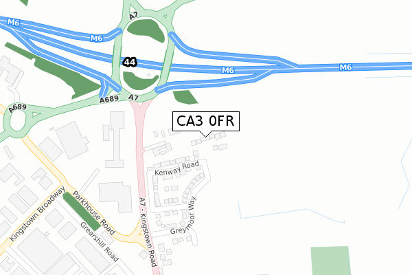
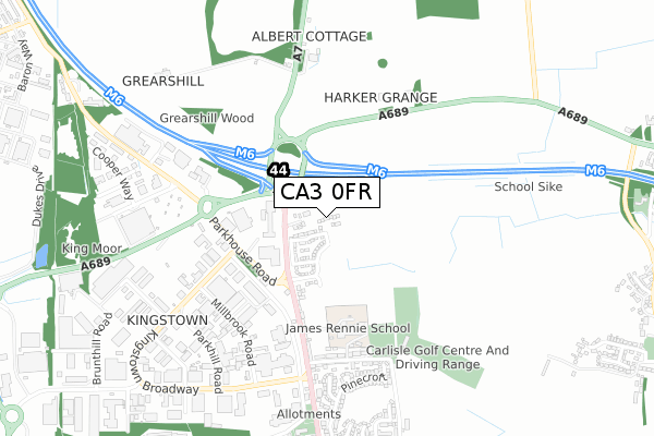
CA3 0FR is located in the Belah electoral ward, within the unitary authority of Cumberland and the English Parliamentary constituency of Carlisle. The Sub Integrated Care Board (ICB) Location is NHS North East and North Cumbria ICB - 01H and the police force is Cumbria. This postcode has been in use since February 2020.


GetTheData
Source: OS Open Zoomstack (Ordnance Survey)
Licence: Open Government Licence (requires attribution)
Attribution: Contains OS data © Crown copyright and database right 2024
Source: Open Postcode Geo
Licence: Open Government Licence (requires attribution)
Attribution: Contains OS data © Crown copyright and database right 2024; Contains Royal Mail data © Royal Mail copyright and database right 2024; Source: Office for National Statistics licensed under the Open Government Licence v.3.0
| Easting | 339617 |
| Northing | 559698 |
| Latitude | 54.928301 |
| Longitude | -2.943789 |
GetTheData
Source: Open Postcode Geo
Licence: Open Government Licence
| Country | England |
| Postcode District | CA3 |
➜ See where CA3 is on a map ➜ Where is Carlisle? | |
GetTheData
Source: Land Registry Price Paid Data
Licence: Open Government Licence
| Ward | Belah |
| Constituency | Carlisle |
GetTheData
Source: ONS Postcode Database
Licence: Open Government Licence
2022 19 JUL £385,000 |
20, ELMER PLACE, CARLISLE, CA3 0FR 2020 13 NOV £250,000 |
5, ELMER PLACE, CARLISLE, CA3 0FR 2020 18 SEP £341,950 |
2020 28 JUL £323,453 |
19, ELMER PLACE, CARLISLE, CA3 0FR 2020 28 JUL £334,853 |
18, ELMER PLACE, CARLISLE, CA3 0FR 2020 12 JUN £304,950 |
15, ELMER PLACE, CARLISLE, CA3 0FR 2020 29 MAY £299,950 |
22, ELMER PLACE, CARLISLE, CA3 0FR 2020 27 MAR £269,950 |
3, ELMER PLACE, CARLISLE, CA3 0FR 2020 27 MAR £242,202 |
9, ELMER PLACE, CARLISLE, CA3 0FR 2020 20 MAR £299,950 |
GetTheData
Source: HM Land Registry Price Paid Data
Licence: Contains HM Land Registry data © Crown copyright and database right 2024. This data is licensed under the Open Government Licence v3.0.
| Hsbc Bank (Kingstown Road) | Kingstown | 299m |
| Argos (Parkhouse Road) | Kingstown North | 306m |
| Argos (Parkhouse Road) | Kingstown North | 330m |
| Post Office (Kingstown Road) | Kingstown | 457m |
| Stores (Kingstown Road) | Kingstown | 508m |
| Carlisle Station | 4.2km |
GetTheData
Source: NaPTAN
Licence: Open Government Licence
GetTheData
Source: ONS Postcode Database
Licence: Open Government Licence


➜ Get more ratings from the Food Standards Agency
GetTheData
Source: Food Standards Agency
Licence: FSA terms & conditions
| Last Collection | |||
|---|---|---|---|
| Location | Mon-Fri | Sat | Distance |
| Kingstown | 19:00 | 13:00 | 498m |
| Kingstown Ind. Est. North | 18:55 | 12:45 | 499m |
| Kingstown North Meter Box | 19:00 | 12:45 | 501m |
GetTheData
Source: Dracos
Licence: Creative Commons Attribution-ShareAlike
The below table lists the International Territorial Level (ITL) codes (formerly Nomenclature of Territorial Units for Statistics (NUTS) codes) and Local Administrative Units (LAU) codes for CA3 0FR:
| ITL 1 Code | Name |
|---|---|
| TLD | North West (England) |
| ITL 2 Code | Name |
| TLD1 | Cumbria |
| ITL 3 Code | Name |
| TLD12 | East Cumbria |
| LAU 1 Code | Name |
| E07000028 | Carlisle |
GetTheData
Source: ONS Postcode Directory
Licence: Open Government Licence
The below table lists the Census Output Area (OA), Lower Layer Super Output Area (LSOA), and Middle Layer Super Output Area (MSOA) for CA3 0FR:
| Code | Name | |
|---|---|---|
| OA | E00096989 | |
| LSOA | E01019190 | Carlisle 003C |
| MSOA | E02003989 | Carlisle 003 |
GetTheData
Source: ONS Postcode Directory
Licence: Open Government Licence
| CA3 0HS | Kingstown Road | 114m |
| CA3 0BL | Kingstown Road | 262m |
| CA3 0BJ | Kingstown Road | 297m |
| CA3 0BN | Kingstown Road | 363m |
| CA3 0BW | Kingstown Road | 470m |
| CA3 0BP | California Road | 501m |
| CA3 0BT | California Road | 502m |
| CA3 0BS | California Road | 529m |
| CA3 0EU | Millbrook Road | 543m |
| CA3 0BY | California Road | 550m |
GetTheData
Source: Open Postcode Geo; Land Registry Price Paid Data
Licence: Open Government Licence