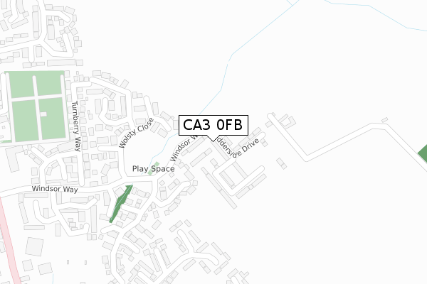
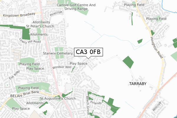
CA3 0FB is located in the Stanwix Urban electoral ward, within the unitary authority of Cumberland and the English Parliamentary constituency of Carlisle. The Sub Integrated Care Board (ICB) Location is NHS North East and North Cumbria ICB - 01H and the police force is Cumbria. This postcode has been in use since July 2018.


GetTheData
Source: OS Open Zoomstack (Ordnance Survey)
Licence: Open Government Licence (requires attribution)
Attribution: Contains OS data © Crown copyright and database right 2025
Source: Open Postcode Geo
Licence: Open Government Licence (requires attribution)
Attribution: Contains OS data © Crown copyright and database right 2025; Contains Royal Mail data © Royal Mail copyright and database right 2025; Source: Office for National Statistics licensed under the Open Government Licence v.3.0
| Easting | 340211 |
| Northing | 558457 |
| Latitude | 54.917222 |
| Longitude | -2.934262 |
GetTheData
Source: Open Postcode Geo
Licence: Open Government Licence
| Country | England |
| Postcode District | CA3 |
➜ See where CA3 is on a map ➜ Where is Carlisle? | |
GetTheData
Source: Land Registry Price Paid Data
Licence: Open Government Licence
| Ward | Stanwix Urban |
| Constituency | Carlisle |
GetTheData
Source: ONS Postcode Database
Licence: Open Government Licence
2024 10 OCT £285,000 |
2024 23 JUL £220,000 |
34, EDDERSIDE DRIVE, CARLISLE, CA3 0FB 2023 30 NOV £225,000 |
36A, EDDERSIDE DRIVE, CARLISLE, CA3 0FB 2023 24 NOV £252,000 |
18, EDDERSIDE DRIVE, CARLISLE, CA3 0FB 2023 29 SEP £250,000 |
16, EDDERSIDE DRIVE, CARLISLE, CA3 0FB 2023 29 SEP £275,000 |
28, EDDERSIDE DRIVE, CARLISLE, CA3 0FB 2023 18 AUG £220,000 |
2021 23 APR £180,000 |
2020 17 DEC £180,000 |
62, EDDERSIDE DRIVE, CARLISLE, CA3 0FB 2020 25 SEP £204,000 |
GetTheData
Source: HM Land Registry Price Paid Data
Licence: Contains HM Land Registry data © Crown copyright and database right 2025. This data is licensed under the Open Government Licence v3.0.
| Morrisons (A7) | Stanwix | 517m |
| Moorville Terrace (Kingstown Road) | Kingstown | 520m |
| The Gosling Bridge (Kingstown Road) | Kingstown | 531m |
| Moorville Terrace (Kingstown Road) | Kingstown | 537m |
| The Gosling Bridge (Kingstown Road) | Kingstown | 552m |
| Carlisle Station | 3km |
GetTheData
Source: NaPTAN
Licence: Open Government Licence
| Percentage of properties with Next Generation Access | 100.0% |
| Percentage of properties with Superfast Broadband | 100.0% |
| Percentage of properties with Ultrafast Broadband | 100.0% |
| Percentage of properties with Full Fibre Broadband | 100.0% |
Superfast Broadband is between 30Mbps and 300Mbps
Ultrafast Broadband is > 300Mbps
| Percentage of properties unable to receive 2Mbps | 0.0% |
| Percentage of properties unable to receive 5Mbps | 0.0% |
| Percentage of properties unable to receive 10Mbps | 0.0% |
| Percentage of properties unable to receive 30Mbps | 0.0% |
GetTheData
Source: Ofcom
Licence: Ofcom Terms of Use (requires attribution)
GetTheData
Source: ONS Postcode Database
Licence: Open Government Licence


➜ Get more ratings from the Food Standards Agency
GetTheData
Source: Food Standards Agency
Licence: FSA terms & conditions
| Last Collection | |||
|---|---|---|---|
| Location | Mon-Fri | Sat | Distance |
| Windsor Way | 17:15 | 13:15 | 219m |
| Woodlands Close | 16:30 | 13:15 | 533m |
| Newfield Drive | 17:30 | 13:00 | 551m |
GetTheData
Source: Dracos
Licence: Creative Commons Attribution-ShareAlike
The below table lists the International Territorial Level (ITL) codes (formerly Nomenclature of Territorial Units for Statistics (NUTS) codes) and Local Administrative Units (LAU) codes for CA3 0FB:
| ITL 1 Code | Name |
|---|---|
| TLD | North West (England) |
| ITL 2 Code | Name |
| TLD1 | Cumbria |
| ITL 3 Code | Name |
| TLD12 | East Cumbria |
| LAU 1 Code | Name |
| E07000028 | Carlisle |
GetTheData
Source: ONS Postcode Directory
Licence: Open Government Licence
The below table lists the Census Output Area (OA), Lower Layer Super Output Area (LSOA), and Middle Layer Super Output Area (MSOA) for CA3 0FB:
| Code | Name | |
|---|---|---|
| OA | E00097275 | |
| LSOA | E01019241 | Carlisle 004D |
| MSOA | E02003990 | Carlisle 004 |
GetTheData
Source: ONS Postcode Directory
Licence: Open Government Licence
| CA3 0QE | Windsor Way | 70m |
| CA3 0PB | Wolsty Close | 208m |
| CA3 0PD | Drumburgh Avenue | 256m |
| CA3 0PF | Pennington Drive | 268m |
| CA3 0PE | Askerton Close | 292m |
| CA3 9HN | Lansdowne Close | 301m |
| CA3 0QL | Turnberry Way | 306m |
| CA3 0QG | Gosling Drive | 362m |
| CA3 9HW | Lansdowne Court | 376m |
| CA3 0QJ | Abbotsford Drive | 377m |
GetTheData
Source: Open Postcode Geo; Land Registry Price Paid Data
Licence: Open Government Licence