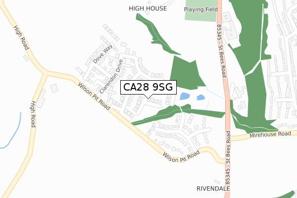
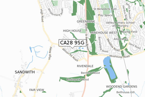
CA28 9SG is located in the Kells and Sandwith electoral ward, within the unitary authority of Cumberland and the English Parliamentary constituency of Copeland. The Sub Integrated Care Board (ICB) Location is NHS North East and North Cumbria ICB - 01H and the police force is Cumbria. This postcode has been in use since December 2017.


GetTheData
Source: OS Open Zoomstack (Ordnance Survey)
Licence: Open Government Licence (requires attribution)
Attribution: Contains OS data © Crown copyright and database right 2025
Source: Open Postcode Geo
Licence: Open Government Licence (requires attribution)
Attribution: Contains OS data © Crown copyright and database right 2025; Contains Royal Mail data © Royal Mail copyright and database right 2025; Source: Office for National Statistics licensed under the Open Government Licence v.3.0
| Easting | 297370 |
| Northing | 515336 |
| Latitude | 54.522891 |
| Longitude | -3.587154 |
GetTheData
Source: Open Postcode Geo
Licence: Open Government Licence
| Country | England |
| Postcode District | CA28 |
➜ See where CA28 is on a map ➜ Where is Whitehaven? | |
GetTheData
Source: Land Registry Price Paid Data
Licence: Open Government Licence
| Ward | Kells And Sandwith |
| Constituency | Copeland |
GetTheData
Source: ONS Postcode Database
Licence: Open Government Licence
19, CAPELLA DRIVE, WHITEHAVEN, CA28 9SG 2018 9 AUG £267,950 |
16, CAPELLA DRIVE, WHITEHAVEN, CA28 9SG 2018 6 JUL £269,950 |
7, CAPELLA DRIVE, WHITEHAVEN, CA28 9SG 2018 6 JUL £263,950 |
10, CAPELLA DRIVE, WHITEHAVEN, CA28 9SG 2018 29 JUN £269,950 |
17, CAPELLA DRIVE, WHITEHAVEN, CA28 9SG 2018 29 JUN £259,950 |
9, CAPELLA DRIVE, WHITEHAVEN, CA28 9SG 2018 25 MAY £260,950 |
14, CAPELLA DRIVE, WHITEHAVEN, CA28 9SG 2018 11 MAY £234,950 |
12, CAPELLA DRIVE, WHITEHAVEN, CA28 9SG 2018 11 MAY £262,950 |
8, CAPELLA DRIVE, WHITEHAVEN, CA28 9SG 2018 29 MAR £269,950 |
4, CAPELLA DRIVE, WHITEHAVEN, CA28 9SG 2018 15 MAR £227,950 |
GetTheData
Source: HM Land Registry Price Paid Data
Licence: Contains HM Land Registry data © Crown copyright and database right 2025. This data is licensed under the Open Government Licence v3.0.
| Gameriggs Road (St Bees Road) | Whitehaven | 492m |
| Bowness Road (Greenbank Avenue) | Greenbank | 579m |
| Bowness Road (Greenbank Avenue) | Whitehaven | 581m |
| Derwentwater Road (Meadow Road) | Mirehouse | 600m |
| Derwentwater Road (Meadow Road) | Mirehouse | 616m |
| Corkickle Station | 2.1km |
| Whitehaven Station | 3.4km |
| St Bees Station | 3.4km |
GetTheData
Source: NaPTAN
Licence: Open Government Licence
| Percentage of properties with Next Generation Access | 100.0% |
| Percentage of properties with Superfast Broadband | 100.0% |
| Percentage of properties with Ultrafast Broadband | 100.0% |
| Percentage of properties with Full Fibre Broadband | 100.0% |
Superfast Broadband is between 30Mbps and 300Mbps
Ultrafast Broadband is > 300Mbps
| Median download speed | 360.0Mbps |
| Average download speed | 360.0Mbps |
| Maximum download speed | 360.00Mbps |
| Median upload speed | 360.0Mbps |
| Average upload speed | 360.0Mbps |
| Maximum upload speed | 360.00Mbps |
| Percentage of properties unable to receive 2Mbps | 0.0% |
| Percentage of properties unable to receive 5Mbps | 0.0% |
| Percentage of properties unable to receive 10Mbps | 0.0% |
| Percentage of properties unable to receive 30Mbps | 0.0% |
GetTheData
Source: Ofcom
Licence: Ofcom Terms of Use (requires attribution)
GetTheData
Source: ONS Postcode Database
Licence: Open Government Licence


➜ Get more ratings from the Food Standards Agency
GetTheData
Source: Food Standards Agency
Licence: FSA terms & conditions
| Last Collection | |||
|---|---|---|---|
| Location | Mon-Fri | Sat | Distance |
| Kinniside Avenue | 17:00 | 12:00 | 619m |
| Greenbank Avenue | 17:00 | 08:00 | 724m |
| Kells | 18:00 | 12:00 | 1,002m |
GetTheData
Source: Dracos
Licence: Creative Commons Attribution-ShareAlike
The below table lists the International Territorial Level (ITL) codes (formerly Nomenclature of Territorial Units for Statistics (NUTS) codes) and Local Administrative Units (LAU) codes for CA28 9SG:
| ITL 1 Code | Name |
|---|---|
| TLD | North West (England) |
| ITL 2 Code | Name |
| TLD1 | Cumbria |
| ITL 3 Code | Name |
| TLD11 | West Cumbria |
| LAU 1 Code | Name |
| E07000029 | Copeland |
GetTheData
Source: ONS Postcode Directory
Licence: Open Government Licence
The below table lists the Census Output Area (OA), Lower Layer Super Output Area (LSOA), and Middle Layer Super Output Area (MSOA) for CA28 9SG:
| Code | Name | |
|---|---|---|
| OA | E00097552 | |
| LSOA | E01019302 | Copeland 005G |
| MSOA | E02004004 | Copeland 005 |
GetTheData
Source: ONS Postcode Directory
Licence: Open Government Licence
| CA28 9UB | 296m | |
| CA28 9RS | Ashness Close | 412m |
| CA28 9QT | Greenbank Avenue | 441m |
| CA28 9RR | Ashness Close | 443m |
| CA28 9RT | Lingmell Close | 443m |
| CA28 9RW | Borrowdale Road | 502m |
| CA28 9RP | Borrowdale Road | 506m |
| CA28 9RD | Valley View Road | 518m |
| CA28 9RH | Derwentwater Road | 532m |
| CA28 9RU | Mirehouse Road | 542m |
GetTheData
Source: Open Postcode Geo; Land Registry Price Paid Data
Licence: Open Government Licence