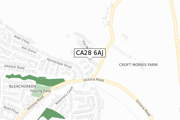
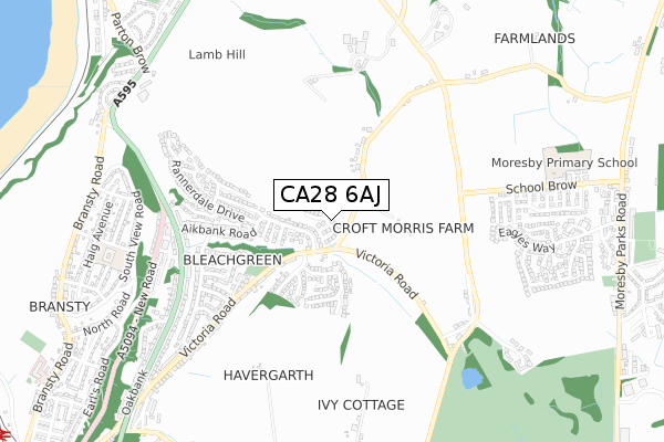
CA28 6AJ is located in the Howgate electoral ward, within the unitary authority of Cumberland and the English Parliamentary constituency of Copeland. The Sub Integrated Care Board (ICB) Location is NHS North East and North Cumbria ICB - 01H and the police force is Cumbria. This postcode has been in use since February 2018.


GetTheData
Source: OS Open Zoomstack (Ordnance Survey)
Licence: Open Government Licence (requires attribution)
Attribution: Contains OS data © Crown copyright and database right 2025
Source: Open Postcode Geo
Licence: Open Government Licence (requires attribution)
Attribution: Contains OS data © Crown copyright and database right 2025; Contains Royal Mail data © Royal Mail copyright and database right 2025; Source: Office for National Statistics licensed under the Open Government Licence v.3.0
| Easting | 298614 |
| Northing | 519595 |
| Latitude | 54.561400 |
| Longitude | -3.569411 |
GetTheData
Source: Open Postcode Geo
Licence: Open Government Licence
| Country | England |
| Postcode District | CA28 |
➜ See where CA28 is on a map ➜ Where is Whitehaven? | |
GetTheData
Source: Land Registry Price Paid Data
Licence: Open Government Licence
| Ward | Howgate |
| Constituency | Copeland |
GetTheData
Source: ONS Postcode Database
Licence: Open Government Licence
2024 11 OCT £410,000 |
2023 25 AUG £315,000 |
2022 25 AUG £369,950 |
47, THE MOUNT, WHITEHAVEN, CA28 6AJ 2022 14 APR £409,950 |
43, THE MOUNT, WHITEHAVEN, CA28 6AJ 2022 4 MAR £399,950 |
2022 3 MAR £430,000 |
45, THE MOUNT, WHITEHAVEN, CA28 6AJ 2021 15 DEC £399,950 |
62, THE MOUNT, WHITEHAVEN, CA28 6AJ 2021 26 NOV £249,950 |
60, THE MOUNT, WHITEHAVEN, CA28 6AJ 2021 30 SEP £249,950 |
41, THE MOUNT, WHITEHAVEN, CA28 6AJ 2021 29 SEP £359,950 |
GetTheData
Source: HM Land Registry Price Paid Data
Licence: Contains HM Land Registry data © Crown copyright and database right 2025. This data is licensed under the Open Government Licence v3.0.
| Rannerdale Drive (Victoria Road) | Bleachgreen | 211m |
| Rannerdale Drive (Victoria Road) | Bleachgreen | 221m |
| Aikbank Road (A595(T)) | Harras Moor | 531m |
| Aikbank Road (Loop Road North) | Harras Moor | 545m |
| Read Drive (Victoria Road) | Bleachgreen | 556m |
| Parton Station | 1.2km |
| Whitehaven Station | 1.5km |
| Corkickle Station | 2.3km |
GetTheData
Source: NaPTAN
Licence: Open Government Licence
| Percentage of properties with Next Generation Access | 100.0% |
| Percentage of properties with Superfast Broadband | 100.0% |
| Percentage of properties with Ultrafast Broadband | 0.0% |
| Percentage of properties with Full Fibre Broadband | 0.0% |
Superfast Broadband is between 30Mbps and 300Mbps
Ultrafast Broadband is > 300Mbps
| Median download speed | 55.7Mbps |
| Average download speed | 47.1Mbps |
| Maximum download speed | 79.98Mbps |
| Median upload speed | 14.8Mbps |
| Average upload speed | 12.3Mbps |
| Maximum upload speed | 20.00Mbps |
| Percentage of properties unable to receive 2Mbps | 0.0% |
| Percentage of properties unable to receive 5Mbps | 0.0% |
| Percentage of properties unable to receive 10Mbps | 0.0% |
| Percentage of properties unable to receive 30Mbps | 0.0% |
GetTheData
Source: Ofcom
Licence: Ofcom Terms of Use (requires attribution)
GetTheData
Source: ONS Postcode Database
Licence: Open Government Licence


➜ Get more ratings from the Food Standards Agency
GetTheData
Source: Food Standards Agency
Licence: FSA terms & conditions
| Last Collection | |||
|---|---|---|---|
| Location | Mon-Fri | Sat | Distance |
| Bay Vista | 17:30 | 08:45 | 228m |
| Quality Corner | 17:00 | 08:30 | 300m |
| Victoria Road | 17:15 | 09:00 | 508m |
GetTheData
Source: Dracos
Licence: Creative Commons Attribution-ShareAlike
The below table lists the International Territorial Level (ITL) codes (formerly Nomenclature of Territorial Units for Statistics (NUTS) codes) and Local Administrative Units (LAU) codes for CA28 6AJ:
| ITL 1 Code | Name |
|---|---|
| TLD | North West (England) |
| ITL 2 Code | Name |
| TLD1 | Cumbria |
| ITL 3 Code | Name |
| TLD11 | West Cumbria |
| LAU 1 Code | Name |
| E07000029 | Copeland |
GetTheData
Source: ONS Postcode Directory
Licence: Open Government Licence
The below table lists the Census Output Area (OA), Lower Layer Super Output Area (LSOA), and Middle Layer Super Output Area (MSOA) for CA28 6AJ:
| Code | Name | |
|---|---|---|
| OA | E00097531 | |
| LSOA | E01019297 | Copeland 001D |
| MSOA | E02004000 | Copeland 001 |
GetTheData
Source: ONS Postcode Directory
Licence: Open Government Licence
| CA28 6JZ | Rannerdale Drive | 139m |
| CA28 8UP | Quality Corner | 203m |
| CA28 6LE | Sycamore Close | 214m |
| CA28 6LG | Beech Grove | 218m |
| CA28 6LF | Ash Grove | 292m |
| CA28 6JJ | Victoria Road | 294m |
| CA28 6LD | Alder Close | 303m |
| CA28 6LJ | Aikbank Road | 331m |
| CA28 6JH | Rosemary Close | 356m |
| CA28 6JQ | Elizabeth Crescent | 356m |
GetTheData
Source: Open Postcode Geo; Land Registry Price Paid Data
Licence: Open Government Licence