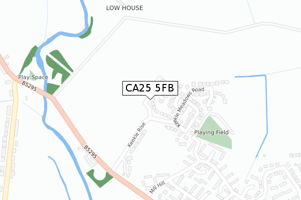
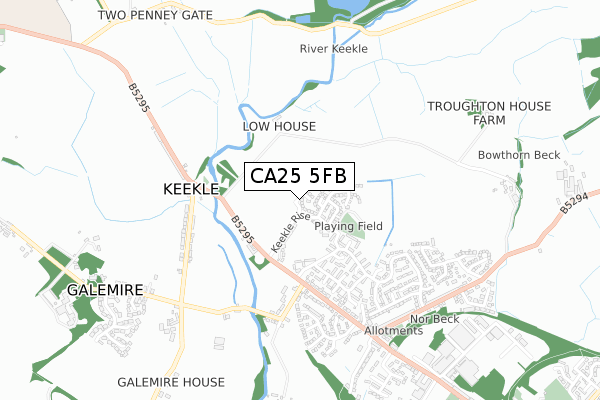
CA25 5FB is located in the Cleator Moor West electoral ward, within the unitary authority of Cumberland and the English Parliamentary constituency of Copeland. The Sub Integrated Care Board (ICB) Location is NHS North East and North Cumbria ICB - 01H and the police force is Cumbria. This postcode has been in use since September 2019.


GetTheData
Source: OS Open Zoomstack (Ordnance Survey)
Licence: Open Government Licence (requires attribution)
Attribution: Contains OS data © Crown copyright and database right 2025
Source: Open Postcode Geo
Licence: Open Government Licence (requires attribution)
Attribution: Contains OS data © Crown copyright and database right 2025; Contains Royal Mail data © Royal Mail copyright and database right 2025; Source: Office for National Statistics licensed under the Open Government Licence v.3.0
| Easting | 300894 |
| Northing | 516208 |
| Latitude | 54.531426 |
| Longitude | -3.533025 |
GetTheData
Source: Open Postcode Geo
Licence: Open Government Licence
| Country | England |
| Postcode District | CA25 |
➜ See where CA25 is on a map ➜ Where is Cleator Moor? | |
GetTheData
Source: Land Registry Price Paid Data
Licence: Open Government Licence
| Ward | Cleator Moor West |
| Constituency | Copeland |
GetTheData
Source: ONS Postcode Database
Licence: Open Government Licence
2, EMBER LANE, CLEATOR MOOR, CA25 5FB 2024 28 MAR £358,000 |
4, EMBER LANE, CLEATOR MOOR, CA25 5FB 2023 11 DEC £469,000 |
7, EMBER LANE, CLEATOR MOOR, CA25 5FB 2023 25 AUG £291,000 |
2023 6 MAR £330,000 |
12, EMBER LANE, CLEATOR MOOR, CA25 5FB 2021 25 MAR £300,000 |
11, EMBER LANE, CLEATOR MOOR, CA25 5FB 2021 10 MAR £306,000 |
14, EMBER LANE, CLEATOR MOOR, CA25 5FB 2021 22 FEB £340,000 |
16, EMBER LANE, CLEATOR MOOR, CA25 5FB 2020 4 SEP £270,000 |
20, EMBER LANE, CLEATOR MOOR, CA25 5FB 2019 17 DEC £298,000 |
2019 5 SEP £276,000 |
GetTheData
Source: HM Land Registry Price Paid Data
Licence: Contains HM Land Registry data © Crown copyright and database right 2025. This data is licensed under the Open Government Licence v3.0.
| Whinney Hill (Whitehaven Road) | Bowthorn | 391m |
| Whinney Hill (Whitehaven Road) | Bowthorn | 394m |
| Keekle Terrace (B5295) | Keekle | 570m |
| The Keekle Inn (B5295) | Keekle | 607m |
| Bowthorn Road (Whitehaven Road) | Bowthorn | 652m |
| Corkickle Station | 3.4km |
| Whitehaven Station | 4.2km |
| Parton Station | 5.3km |
GetTheData
Source: NaPTAN
Licence: Open Government Licence
GetTheData
Source: ONS Postcode Database
Licence: Open Government Licence


➜ Get more ratings from the Food Standards Agency
GetTheData
Source: Food Standards Agency
Licence: FSA terms & conditions
| Last Collection | |||
|---|---|---|---|
| Location | Mon-Fri | Sat | Distance |
| Keekle Terrace | 17:00 | 10:15 | 512m |
| Bowthorn Road | 16:45 | 08:45 | 676m |
| Gale Mire | 17:00 | 09:15 | 746m |
GetTheData
Source: Dracos
Licence: Creative Commons Attribution-ShareAlike
The below table lists the International Territorial Level (ITL) codes (formerly Nomenclature of Territorial Units for Statistics (NUTS) codes) and Local Administrative Units (LAU) codes for CA25 5FB:
| ITL 1 Code | Name |
|---|---|
| TLD | North West (England) |
| ITL 2 Code | Name |
| TLD1 | Cumbria |
| ITL 3 Code | Name |
| TLD11 | West Cumbria |
| LAU 1 Code | Name |
| E07000029 | Copeland |
GetTheData
Source: ONS Postcode Directory
Licence: Open Government Licence
The below table lists the Census Output Area (OA), Lower Layer Super Output Area (LSOA), and Middle Layer Super Output Area (MSOA) for CA25 5FB:
| Code | Name | |
|---|---|---|
| OA | E00097370 | |
| LSOA | E01019264 | Copeland 004C |
| MSOA | E02004003 | Copeland 004 |
GetTheData
Source: ONS Postcode Directory
Licence: Open Government Licence
| CA25 5RW | Keekle Meadows Road | 124m |
| CA25 5SU | Rigg Close | 141m |
| CA25 5RP | Thwaite Close | 160m |
| CA25 5RR | Garth Close | 210m |
| CA25 5RU | Hopedene | 232m |
| CA25 5SQ | Mill Hill | 277m |
| CA25 5ST | Hope Pit Cottages | 277m |
| CA25 5RX | Hopedene | 282m |
| CA25 5SJ | Mill Hill | 305m |
| CA25 5SL | Mill Hill | 349m |
GetTheData
Source: Open Postcode Geo; Land Registry Price Paid Data
Licence: Open Government Licence