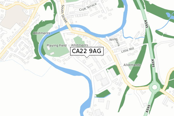
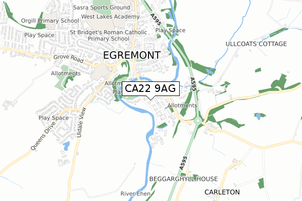
CA22 9AG is located in the Egremont electoral ward, within the unitary authority of Cumberland and the English Parliamentary constituency of Copeland. The Sub Integrated Care Board (ICB) Location is NHS North East and North Cumbria ICB - 01H and the police force is Cumbria. This postcode has been in use since August 2017.


GetTheData
Source: OS Open Zoomstack (Ordnance Survey)
Licence: Open Government Licence (requires attribution)
Attribution: Contains OS data © Crown copyright and database right 2025
Source: Open Postcode Geo
Licence: Open Government Licence (requires attribution)
Attribution: Contains OS data © Crown copyright and database right 2025; Contains Royal Mail data © Royal Mail copyright and database right 2025; Source: Office for National Statistics licensed under the Open Government Licence v.3.0
| Easting | 301208 |
| Northing | 510217 |
| Latitude | 54.477667 |
| Longitude | -3.526166 |
GetTheData
Source: Open Postcode Geo
Licence: Open Government Licence
| Country | England |
| Postcode District | CA22 |
➜ See where CA22 is on a map | |
GetTheData
Source: Land Registry Price Paid Data
Licence: Open Government Licence
| Ward | Egremont |
| Constituency | Copeland |
GetTheData
Source: ONS Postcode Database
Licence: Open Government Licence
| Bridge End (Vale View) | Egremont | 149m |
| Bridge End (Vale View) | Egremont | 159m |
| St Thomas Cross Roundabout (Vale View) | Egremont | 323m |
| Red Lion Hotel (Market Place) | Egremont | 450m |
| St Thomas Cross Roundabout (A595(T)) | Egremont | 467m |
| Nethertown Station | 3.5km |
| Braystones Station | 4.4km |
| St Bees Station | 4.5km |
GetTheData
Source: NaPTAN
Licence: Open Government Licence
GetTheData
Source: ONS Postcode Database
Licence: Open Government Licence


➜ Get more ratings from the Food Standards Agency
GetTheData
Source: Food Standards Agency
Licence: FSA terms & conditions
| Last Collection | |||
|---|---|---|---|
| Location | Mon-Fri | Sat | Distance |
| Egremont | 16:45 | 12:30 | 16m |
| Wood Bank Estate | 16:45 | 11:00 | 146m |
| Egremont | 17:30 | 12:30 | 509m |
GetTheData
Source: Dracos
Licence: Creative Commons Attribution-ShareAlike
The below table lists the International Territorial Level (ITL) codes (formerly Nomenclature of Territorial Units for Statistics (NUTS) codes) and Local Administrative Units (LAU) codes for CA22 9AG:
| ITL 1 Code | Name |
|---|---|
| TLD | North West (England) |
| ITL 2 Code | Name |
| TLD1 | Cumbria |
| ITL 3 Code | Name |
| TLD11 | West Cumbria |
| LAU 1 Code | Name |
| E07000029 | Copeland |
GetTheData
Source: ONS Postcode Directory
Licence: Open Government Licence
The below table lists the Census Output Area (OA), Lower Layer Super Output Area (LSOA), and Middle Layer Super Output Area (MSOA) for CA22 9AG:
| Code | Name | |
|---|---|---|
| OA | E00097427 | |
| LSOA | E01019275 | Copeland 006E |
| MSOA | E02004005 | Copeland 006 |
GetTheData
Source: ONS Postcode Directory
Licence: Open Government Licence
| CA22 2RH | Bridge End Park | 67m |
| CA22 2RD | Bridge End Industrial Estate | 83m |
| CA22 2RG | Vale View | 132m |
| CA22 2NL | 134m | |
| CA22 2RE | Bridge End | 158m |
| CA22 2RL | Woodbank | 186m |
| CA22 2RN | Cringlethwaite Terrace | 201m |
| CA22 2AX | South Street | 234m |
| CA22 2RW | 245m | |
| CA22 2AU | The Villas | 250m |
GetTheData
Source: Open Postcode Geo; Land Registry Price Paid Data
Licence: Open Government Licence