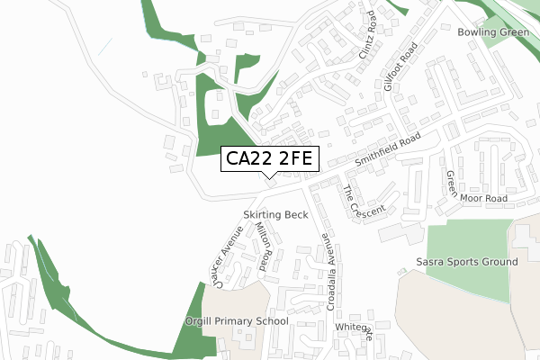
CA22 2FE is located in the Egremont electoral ward, within the unitary authority of Cumberland and the English Parliamentary constituency of Copeland. The Sub Integrated Care Board (ICB) Location is NHS North East and North Cumbria ICB - 01H and the police force is Cumbria. This postcode has been in use since January 2020.


GetTheData
Source: OS Open Zoomstack (Ordnance Survey)
Licence: Open Government Licence (requires attribution)
Attribution: Contains OS data © Crown copyright and database right 2024
Source: Open Postcode Geo
Licence: Open Government Licence (requires attribution)
Attribution: Contains OS data © Crown copyright and database right 2024; Contains Royal Mail data © Royal Mail copyright and database right 2024; Source: Office for National Statistics licensed under the Open Government Licence v.3.0
| Easting | 300433 |
| Northing | 511142 |
| Latitude | 54.485825 |
| Longitude | -3.538434 |
GetTheData
Source: Open Postcode Geo
Licence: Open Government Licence
| Country | England |
| Postcode District | CA22 |
➜ See where CA22 is on a map ➜ Where is Egremont? | |
GetTheData
Source: Land Registry Price Paid Data
Licence: Open Government Licence
| Ward | Egremont |
| Constituency | Copeland |
GetTheData
Source: ONS Postcode Database
Licence: Open Government Licence
| Dryden Way (Croadalla Avenue) | Smithfield | 173m |
| Gilfoot Road (Smithfield Road) | Smithfield | 214m |
| Dryden Way (Croadalla Avenue) | Smithfield | 216m |
| Gilfoot Road (Smithfield Road) | Smithfield | 220m |
| Orgill Junior School (Baybarrow Road) | Orgill | 358m |
| St Bees Station | 3.5km |
| Nethertown Station | 3.7km |
GetTheData
Source: NaPTAN
Licence: Open Government Licence
GetTheData
Source: ONS Postcode Database
Licence: Open Government Licence


➜ Get more ratings from the Food Standards Agency
GetTheData
Source: Food Standards Agency
Licence: FSA terms & conditions
| Last Collection | |||
|---|---|---|---|
| Location | Mon-Fri | Sat | Distance |
| Smithfield | 16:45 | 09:15 | 198m |
| Orgill | 17:00 | 09:30 | 337m |
| Castle Croft | 17:00 | 09:15 | 592m |
GetTheData
Source: Dracos
Licence: Creative Commons Attribution-ShareAlike
| Risk of CA22 2FE flooding from rivers and sea | Low |
| ➜ CA22 2FE flood map | |
GetTheData
Source: Open Flood Risk by Postcode
Licence: Open Government Licence
The below table lists the International Territorial Level (ITL) codes (formerly Nomenclature of Territorial Units for Statistics (NUTS) codes) and Local Administrative Units (LAU) codes for CA22 2FE:
| ITL 1 Code | Name |
|---|---|
| TLD | North West (England) |
| ITL 2 Code | Name |
| TLD1 | Cumbria |
| ITL 3 Code | Name |
| TLD11 | West Cumbria |
| LAU 1 Code | Name |
| E07000029 | Copeland |
GetTheData
Source: ONS Postcode Directory
Licence: Open Government Licence
The below table lists the Census Output Area (OA), Lower Layer Super Output Area (LSOA), and Middle Layer Super Output Area (MSOA) for CA22 2FE:
| Code | Name | |
|---|---|---|
| OA | E00097405 | |
| LSOA | E01019272 | Copeland 006B |
| MSOA | E02004005 | Copeland 006 |
GetTheData
Source: ONS Postcode Directory
Licence: Open Government Licence
| CA22 2QZ | Langhorn Court | 120m |
| CA22 2QL | Croadalla Avenue | 120m |
| CA22 2HD | Milton Road | 129m |
| CA22 2HB | Chaucer Avenue | 148m |
| CA22 2HA | Dryden Way | 148m |
| CA22 2QF | Smithfield Road | 174m |
| CA22 2QG | The Crescent | 176m |
| CA22 2QE | Gillfoot Avenue | 201m |
| CA22 2QJ | How Bank | 217m |
| CA22 2EZ | Croadalla Avenue | 221m |
GetTheData
Source: Open Postcode Geo; Land Registry Price Paid Data
Licence: Open Government Licence