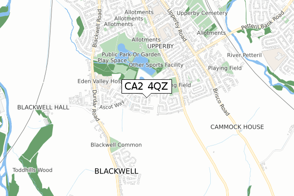
CA2 4QZ is located in the Wetheral electoral ward, within the unitary authority of Cumberland and the English Parliamentary constituency of Carlisle. The Sub Integrated Care Board (ICB) Location is NHS North East and North Cumbria ICB - 01H and the police force is Cumbria. This postcode has been in use since April 2019.


GetTheData
Source: OS Open Zoomstack (Ordnance Survey)
Licence: Open Government Licence (requires attribution)
Attribution: Contains OS data © Crown copyright and database right 2025
Source: Open Postcode Geo
Licence: Open Government Licence (requires attribution)
Attribution: Contains OS data © Crown copyright and database right 2025; Contains Royal Mail data © Royal Mail copyright and database right 2025; Source: Office for National Statistics licensed under the Open Government Licence v.3.0
| Easting | 340695 |
| Northing | 553104 |
| Latitude | 54.869183 |
| Longitude | -2.925610 |
GetTheData
Source: Open Postcode Geo
Licence: Open Government Licence
| Country | England |
| Postcode District | CA2 |
➜ See where CA2 is on a map ➜ Where is Carlisle? | |
GetTheData
Source: Land Registry Price Paid Data
Licence: Open Government Licence
| Ward | Wetheral |
| Constituency | Carlisle |
GetTheData
Source: ONS Postcode Database
Licence: Open Government Licence
2024 30 APR £284,950 |
2021 21 SEP £215,000 |
2020 14 FEB £189,952 |
14, HUNTINGDON LANE, CARLISLE, CA2 4QZ 2019 26 JUL £213,351 |
12, HUNTINGDON LANE, CARLISLE, CA2 4QZ 2019 12 JUL £210,852 |
2019 28 JUN £219,950 |
13, HUNTINGDON LANE, CARLISLE, CA2 4QZ 2019 28 JUN £219,950 |
2, HUNTINGDON LANE, CARLISLE, CA2 4QZ 2019 14 JUN £256,450 |
GetTheData
Source: HM Land Registry Price Paid Data
Licence: Contains HM Land Registry data © Crown copyright and database right 2025. This data is licensed under the Open Government Licence v3.0.
| Terminus (Scalegate Road) | Upperby | 303m |
| St John's Ambulance (Lakeview Avenue) | Upperby | 324m |
| Terminus (Scalegate Road) | Upperby | 361m |
| Greengarth (Scalegate Road) | Upperby | 408m |
| Sunnymeade (Lakeview Avenue) | Upperby | 429m |
| Carlisle Station | 2.4km |
| Dalston (Cumbria) Station | 4.8km |
GetTheData
Source: NaPTAN
Licence: Open Government Licence
| Percentage of properties with Next Generation Access | 100.0% |
| Percentage of properties with Superfast Broadband | 100.0% |
| Percentage of properties with Ultrafast Broadband | 100.0% |
| Percentage of properties with Full Fibre Broadband | 100.0% |
Superfast Broadband is between 30Mbps and 300Mbps
Ultrafast Broadband is > 300Mbps
| Percentage of properties unable to receive 2Mbps | 0.0% |
| Percentage of properties unable to receive 5Mbps | 0.0% |
| Percentage of properties unable to receive 10Mbps | 0.0% |
| Percentage of properties unable to receive 30Mbps | 0.0% |
GetTheData
Source: Ofcom
Licence: Ofcom Terms of Use (requires attribution)
GetTheData
Source: ONS Postcode Database
Licence: Open Government Licence


➜ Get more ratings from the Food Standards Agency
GetTheData
Source: Food Standards Agency
Licence: FSA terms & conditions
| Last Collection | |||
|---|---|---|---|
| Location | Mon-Fri | Sat | Distance |
| Lamb Street | 18:45 | 12:00 | 366m |
| Blackwell | 16:15 | 11:30 | 465m |
| Brisco Road | 17:00 | 12:00 | 545m |
GetTheData
Source: Dracos
Licence: Creative Commons Attribution-ShareAlike
The below table lists the International Territorial Level (ITL) codes (formerly Nomenclature of Territorial Units for Statistics (NUTS) codes) and Local Administrative Units (LAU) codes for CA2 4QZ:
| ITL 1 Code | Name |
|---|---|
| TLD | North West (England) |
| ITL 2 Code | Name |
| TLD1 | Cumbria |
| ITL 3 Code | Name |
| TLD12 | East Cumbria |
| LAU 1 Code | Name |
| E07000028 | Carlisle |
GetTheData
Source: ONS Postcode Directory
Licence: Open Government Licence
The below table lists the Census Output Area (OA), Lower Layer Super Output Area (LSOA), and Middle Layer Super Output Area (MSOA) for CA2 4QZ:
| Code | Name | |
|---|---|---|
| OA | E00097109 | |
| LSOA | E01019213 | Carlisle 013B |
| MSOA | E02003999 | Carlisle 013 |
GetTheData
Source: ONS Postcode Directory
Licence: Open Government Licence
| CA2 4NH | Oaklands Drive | 175m |
| CA2 4NG | Tarnside | 186m |
| CA2 4NJ | Oaklands Drive | 198m |
| CA2 4NQ | Oaklands Drive | 202m |
| CA2 4NB | Ascot Way | 270m |
| CA2 4NL | Scalegate Road | 288m |
| CA2 4PJ | Scalegate Road | 309m |
| CA2 4PQ | Scalegate Road | 314m |
| CA2 4NN | Woodside North | 338m |
| CA2 4SR | Lingfield Close | 346m |
GetTheData
Source: Open Postcode Geo; Land Registry Price Paid Data
Licence: Open Government Licence