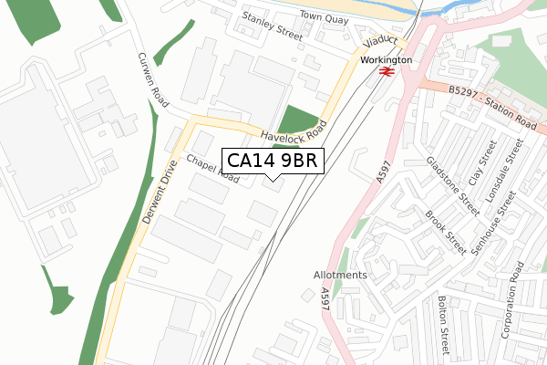
CA14 9BR is located in the St Michael's electoral ward, within the unitary authority of Cumberland and the English Parliamentary constituency of Workington. The Sub Integrated Care Board (ICB) Location is NHS North East and North Cumbria ICB - 01H and the police force is Cumbria. This postcode has been in use since November 2017.


GetTheData
Source: OS Open Zoomstack (Ordnance Survey)
Licence: Open Government Licence (requires attribution)
Attribution: Contains OS data © Crown copyright and database right 2024
Source: Open Postcode Geo
Licence: Open Government Licence (requires attribution)
Attribution: Contains OS data © Crown copyright and database right 2024; Contains Royal Mail data © Royal Mail copyright and database right 2024; Source: Office for National Statistics licensed under the Open Government Licence v.3.0
| Easting | 299311 |
| Northing | 528700 |
| Latitude | 54.643334 |
| Longitude | -3.561765 |
GetTheData
Source: Open Postcode Geo
Licence: Open Government Licence
| Country | England |
| Postcode District | CA14 |
➜ See where CA14 is on a map ➜ Where is Workington? | |
GetTheData
Source: Land Registry Price Paid Data
Licence: Open Government Licence
| Ward | St Michael's |
| Constituency | Workington |
GetTheData
Source: ONS Postcode Database
Licence: Open Government Licence
| Morrisons (Derwent Drive) | Derwent Howe | 232m |
| Rail Station (Belle Isle Place) | Workington | 312m |
| The Viaduct Hotel (Falcon Place) | Workington | 354m |
| Morrisons (Derwent Drive) | Derwent Howe | 417m |
| Queen St (Corporation Road) | Workington | 487m |
| Workington Station | 0.3km |
| Harrington Station | 3.3km |
GetTheData
Source: NaPTAN
Licence: Open Government Licence
GetTheData
Source: ONS Postcode Database
Licence: Open Government Licence


➜ Get more ratings from the Food Standards Agency
GetTheData
Source: Food Standards Agency
Licence: FSA terms & conditions
| Last Collection | |||
|---|---|---|---|
| Location | Mon-Fri | Sat | Distance |
| Workington Do | 18:30 | 12:45 | 39m |
| Workington Delivery Office | 18:30 | 12:45 | 39m |
| Safeway (Box 2) | 16:30 | 11:30 | 404m |
GetTheData
Source: Dracos
Licence: Creative Commons Attribution-ShareAlike
The below table lists the International Territorial Level (ITL) codes (formerly Nomenclature of Territorial Units for Statistics (NUTS) codes) and Local Administrative Units (LAU) codes for CA14 9BR:
| ITL 1 Code | Name |
|---|---|
| TLD | North West (England) |
| ITL 2 Code | Name |
| TLD1 | Cumbria |
| ITL 3 Code | Name |
| TLD11 | West Cumbria |
| LAU 1 Code | Name |
| E07000026 | Allerdale |
GetTheData
Source: ONS Postcode Directory
Licence: Open Government Licence
The below table lists the Census Output Area (OA), Lower Layer Super Output Area (LSOA), and Middle Layer Super Output Area (MSOA) for CA14 9BR:
| Code | Name | |
|---|---|---|
| OA | E00096640 | |
| LSOA | E01019120 | Allerdale 009D |
| MSOA | E02003973 | Allerdale 009 |
GetTheData
Source: ONS Postcode Directory
Licence: Open Government Licence
| CA14 2TU | Wesley Court | 196m |
| CA14 2XG | Findlay Place | 233m |
| CA14 2XR | Belle Isle Street | 257m |
| CA14 2TH | Wesley Street | 262m |
| CA14 2XJ | Hawksley Terrace | 262m |
| CA14 2TE | Patterson Hill Close | 268m |
| CA14 2TJ | Beeby Street | 268m |
| CA14 2XU | Wall Street | 282m |
| CA14 2JE | Marsh Street | 288m |
| CA14 2JL | Lawrence Street | 291m |
GetTheData
Source: Open Postcode Geo; Land Registry Price Paid Data
Licence: Open Government Licence