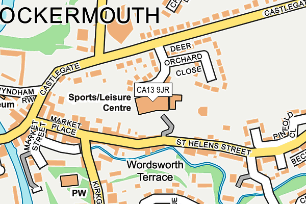
CA13 9JR is located in the Cockermouth North electoral ward, within the unitary authority of Cumberland and the English Parliamentary constituency of Workington. The Sub Integrated Care Board (ICB) Location is NHS North East and North Cumbria ICB - 01H and the police force is Cumbria. This postcode has been in use since June 1998.


GetTheData
Source: OS OpenMap – Local (Ordnance Survey)
Source: OS VectorMap District (Ordnance Survey)
Licence: Open Government Licence (requires attribution)
| Easting | 312561 |
| Northing | 530791 |
| Latitude | 54.664592 |
| Longitude | -3.357143 |
GetTheData
Source: Open Postcode Geo
Licence: Open Government Licence
| Country | England |
| Postcode District | CA13 |
➜ See where CA13 is on a map ➜ Where is Cockermouth? | |
GetTheData
Source: Land Registry Price Paid Data
Licence: Open Government Licence
Elevation or altitude of CA13 9JR as distance above sea level:
| Metres | Feet | |
|---|---|---|
| Elevation | 50m | 164ft |
Elevation is measured from the approximate centre of the postcode, to the nearest point on an OS contour line from OS Terrain 50, which has contour spacing of ten vertical metres.
➜ How high above sea level am I? Find the elevation of your current position using your device's GPS.
GetTheData
Source: Open Postcode Elevation
Licence: Open Government Licence
| Ward | Cockermouth North |
| Constituency | Workington |
GetTheData
Source: ONS Postcode Database
Licence: Open Government Licence
| Deer Orchard Close (Castlegate Drive) | Cockermouth | 118m |
| Deer Orchard Close (Castlegate Drive) | Cockermouth | 126m |
| Cottage Hospital (Isel Road) | Cockermouth | 297m |
| Beech Lane (Castlegate Drive) | Cockermouth | 314m |
| Oaktree Cresent (Isel Road) | Cockermouth | 331m |
GetTheData
Source: NaPTAN
Licence: Open Government Licence
GetTheData
Source: ONS Postcode Database
Licence: Open Government Licence


➜ Get more ratings from the Food Standards Agency
GetTheData
Source: Food Standards Agency
Licence: FSA terms & conditions
| Last Collection | |||
|---|---|---|---|
| Location | Mon-Fri | Sat | Distance |
| Pinfold Close | 17:30 | 12:45 | 178m |
| Isel Road | 17:30 | 12:45 | 190m |
| Market Place | 17:30 | 12:45 | 191m |
GetTheData
Source: Dracos
Licence: Creative Commons Attribution-ShareAlike
The below table lists the International Territorial Level (ITL) codes (formerly Nomenclature of Territorial Units for Statistics (NUTS) codes) and Local Administrative Units (LAU) codes for CA13 9JR:
| ITL 1 Code | Name |
|---|---|
| TLD | North West (England) |
| ITL 2 Code | Name |
| TLD1 | Cumbria |
| ITL 3 Code | Name |
| TLD11 | West Cumbria |
| LAU 1 Code | Name |
| E07000026 | Allerdale |
GetTheData
Source: ONS Postcode Directory
Licence: Open Government Licence
The below table lists the Census Output Area (OA), Lower Layer Super Output Area (LSOA), and Middle Layer Super Output Area (MSOA) for CA13 9JR:
| Code | Name | |
|---|---|---|
| OA | E00096418 | |
| LSOA | E01019079 | Allerdale 007B |
| MSOA | E02003971 | Allerdale 007 |
GetTheData
Source: ONS Postcode Directory
Licence: Open Government Licence
| CA13 9JH | Deer Orchard Close | 89m |
| CA13 9HY | Butts Fold | 106m |
| CA13 9HX | St Helens Street | 109m |
| CA13 9JG | St Helens Street | 143m |
| CA13 9HZ | St Helens Street | 161m |
| CA13 9HB | Castlegate Drive | 166m |
| CA13 9JW | Pinfold Close | 185m |
| CA13 9JQ | Waste Lane | 190m |
| CA13 9HD | Castlegate Drive | 200m |
| CA13 9AN | Melbreak Avenue | 209m |
GetTheData
Source: Open Postcode Geo; Land Registry Price Paid Data
Licence: Open Government Licence