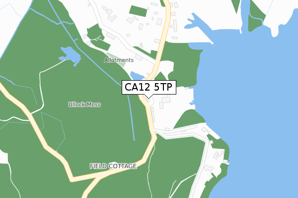
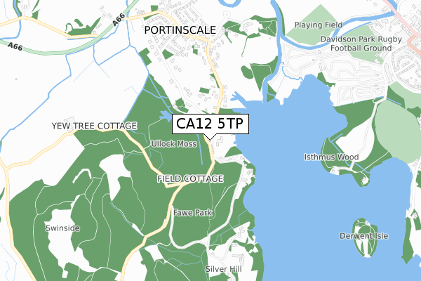
CA12 5TP is located in the Bothel and Wharrels electoral ward, within the unitary authority of Cumberland and the English Parliamentary constituency of Copeland. The Sub Integrated Care Board (ICB) Location is NHS North East and North Cumbria ICB - 01H and the police force is Cumbria. This postcode has been in use since April 2019.


GetTheData
Source: OS Open Zoomstack (Ordnance Survey)
Licence: Open Government Licence (requires attribution)
Attribution: Contains OS data © Crown copyright and database right 2025
Source: Open Postcode Geo
Licence: Open Government Licence (requires attribution)
Attribution: Contains OS data © Crown copyright and database right 2025; Contains Royal Mail data © Royal Mail copyright and database right 2025; Source: Office for National Statistics licensed under the Open Government Licence v.3.0
| Easting | 325206 |
| Northing | 522972 |
| Latitude | 54.596378 |
| Longitude | -3.159149 |
GetTheData
Source: Open Postcode Geo
Licence: Open Government Licence
| Country | England |
| Postcode District | CA12 |
➜ See where CA12 is on a map ➜ Where is Portinscale? | |
GetTheData
Source: Land Registry Price Paid Data
Licence: Open Government Licence
| Ward | Bothel And Wharrels |
| Constituency | Copeland |
GetTheData
Source: ONS Postcode Database
Licence: Open Government Licence
2024 31 MAY £450,000 |
2020 12 OCT £375,000 |
2019 23 DEC £350,000 |
3, DERWENT BANK CRESCENT, PORTINSCALE, KESWICK, CA12 5TP 2019 19 DEC £375,000 |
4, DERWENT BANK CRESCENT, PORTINSCALE, KESWICK, CA12 5TP 2019 19 DEC £399,000 |
GetTheData
Source: HM Land Registry Price Paid Data
Licence: Contains HM Land Registry data © Crown copyright and database right 2025. This data is licensed under the Open Government Licence v3.0.
| Nichol End (Unnamed Road) | Nichol End | 102m |
| Nichol End (Unnamed Road) | Nichol End | 121m |
| Harney Peak (Unnamed Road) | Portinscale | 574m |
| Portinscale House (Unnamed Road) | Portinscale | 590m |
| Portinscale House (Unnamed Road) | Portinscale | 602m |
GetTheData
Source: NaPTAN
Licence: Open Government Licence
GetTheData
Source: ONS Postcode Database
Licence: Open Government Licence


➜ Get more ratings from the Food Standards Agency
GetTheData
Source: Food Standards Agency
Licence: FSA terms & conditions
| Last Collection | |||
|---|---|---|---|
| Location | Mon-Fri | Sat | Distance |
| Portinscale | 16:30 | 10:40 | 598m |
| Low Portinscale | 16:30 | 10:50 | 840m |
| The Headlands | 17:00 | 11:00 | 1,167m |
GetTheData
Source: Dracos
Licence: Creative Commons Attribution-ShareAlike
The below table lists the International Territorial Level (ITL) codes (formerly Nomenclature of Territorial Units for Statistics (NUTS) codes) and Local Administrative Units (LAU) codes for CA12 5TP:
| ITL 1 Code | Name |
|---|---|
| TLD | North West (England) |
| ITL 2 Code | Name |
| TLD1 | Cumbria |
| ITL 3 Code | Name |
| TLD11 | West Cumbria |
| LAU 1 Code | Name |
| E07000026 | Allerdale |
GetTheData
Source: ONS Postcode Directory
Licence: Open Government Licence
The below table lists the Census Output Area (OA), Lower Layer Super Output Area (LSOA), and Middle Layer Super Output Area (MSOA) for CA12 5TP:
| Code | Name | |
|---|---|---|
| OA | E00096486 | |
| LSOA | E01019092 | Allerdale 012A |
| MSOA | E02003976 | Allerdale 012 |
GetTheData
Source: ONS Postcode Directory
Licence: Open Government Licence
| CA12 5TY | 135m | |
| CA12 5TX | 468m | |
| CA12 5RF | 483m | |
| CA12 5RD | 604m | |
| CA12 5RB | Tower Cottages | 626m |
| CA12 5RH | 627m | |
| CA12 5RJ | High Portinscale | 634m |
| CA12 5SP | 690m | |
| CA12 5RN | High Portinscale | 706m |
| CA12 5RQ | 719m |
GetTheData
Source: Open Postcode Geo; Land Registry Price Paid Data
Licence: Open Government Licence