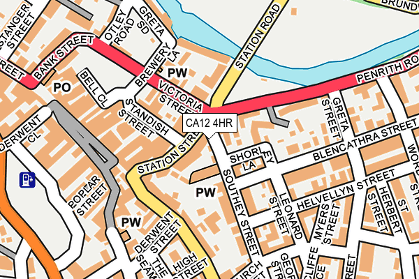
CA12 4HR is located in the Keswick electoral ward, within the unitary authority of Cumberland and the English Parliamentary constituency of Copeland. The Sub Integrated Care Board (ICB) Location is NHS North East and North Cumbria ICB - 01H and the police force is Cumbria. This postcode has been in use since June 1997.


GetTheData
Source: OS OpenMap – Local (Ordnance Survey)
Source: OS VectorMap District (Ordnance Survey)
Licence: Open Government Licence (requires attribution)
| Easting | 326801 |
| Northing | 523444 |
| Latitude | 54.600845 |
| Longitude | -3.134583 |
GetTheData
Source: Open Postcode Geo
Licence: Open Government Licence
| Country | England |
| Postcode District | CA12 |
➜ See where CA12 is on a map ➜ Where is Keswick? | |
GetTheData
Source: Land Registry Price Paid Data
Licence: Open Government Licence
Elevation or altitude of CA12 4HR as distance above sea level:
| Metres | Feet | |
|---|---|---|
| Elevation | 80m | 262ft |
Elevation is measured from the approximate centre of the postcode, to the nearest point on an OS contour line from OS Terrain 50, which has contour spacing of ten vertical metres.
➜ How high above sea level am I? Find the elevation of your current position using your device's GPS.
GetTheData
Source: Open Postcode Elevation
Licence: Open Government Licence
| Ward | Keswick |
| Constituency | Copeland |
GetTheData
Source: ONS Postcode Database
Licence: Open Government Licence
| Cars Of The Stars (Bank Street) | Keswick | 58m |
| Greta Bank (Penrith Road) | Keswick | 121m |
| Daleview Hotel (B5289) | Keswick | 298m |
| The Daleview Hotel (B5289) | Keswick | 313m |
| Fire Station (Penrith Road) | Keswick | 496m |
GetTheData
Source: NaPTAN
Licence: Open Government Licence
GetTheData
Source: ONS Postcode Database
Licence: Open Government Licence


➜ Get more ratings from the Food Standards Agency
GetTheData
Source: Food Standards Agency
Licence: FSA terms & conditions
| Last Collection | |||
|---|---|---|---|
| Location | Mon-Fri | Sat | Distance |
| Station Street | 17:15 | 11:15 | 27m |
| Lake Road | 17:00 | 11:00 | 174m |
| Ratcliffe Place | 17:00 | 11:15 | 194m |
GetTheData
Source: Dracos
Licence: Creative Commons Attribution-ShareAlike
The below table lists the International Territorial Level (ITL) codes (formerly Nomenclature of Territorial Units for Statistics (NUTS) codes) and Local Administrative Units (LAU) codes for CA12 4HR:
| ITL 1 Code | Name |
|---|---|
| TLD | North West (England) |
| ITL 2 Code | Name |
| TLD1 | Cumbria |
| ITL 3 Code | Name |
| TLD11 | West Cumbria |
| LAU 1 Code | Name |
| E07000026 | Allerdale |
GetTheData
Source: ONS Postcode Directory
Licence: Open Government Licence
The below table lists the Census Output Area (OA), Lower Layer Super Output Area (LSOA), and Middle Layer Super Output Area (MSOA) for CA12 4HR:
| Code | Name | |
|---|---|---|
| OA | E00096563 | |
| LSOA | E01019105 | Allerdale 012D |
| MSOA | E02003976 | Allerdale 012 |
GetTheData
Source: ONS Postcode Directory
Licence: Open Government Licence
| CA12 5HF | Station Street | 20m |
| CA12 4HH | Southey Street | 25m |
| CA12 4HL | Southey Street | 26m |
| CA12 4HQ | Twentyman Court | 38m |
| CA12 5HJ | Station Street | 43m |
| CA12 5HH | Station Street | 48m |
| CA12 5HQ | Banks Place | 64m |
| CA12 4NA | Station Road | 66m |
| CA12 4JX | Shorley Lane | 66m |
| CA12 5HW | Banks Court | 71m |
GetTheData
Source: Open Postcode Geo; Land Registry Price Paid Data
Licence: Open Government Licence