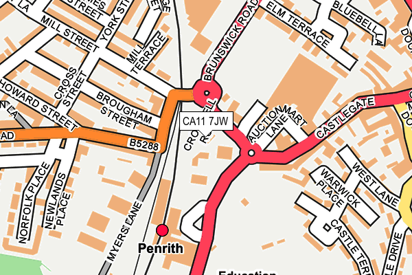
CA11 7JW is located in the Penrith South electoral ward, within the unitary authority of Westmorland and Furness and the English Parliamentary constituency of Penrith and The Border. The Sub Integrated Care Board (ICB) Location is NHS North East and North Cumbria ICB - 01H and the police force is Cumbria. This postcode has been in use since January 1980.


GetTheData
Source: OS OpenMap – Local (Ordnance Survey)
Source: OS VectorMap District (Ordnance Survey)
Licence: Open Government Licence (requires attribution)
| Easting | 351208 |
| Northing | 530033 |
| Latitude | 54.663005 |
| Longitude | -2.757926 |
GetTheData
Source: Open Postcode Geo
Licence: Open Government Licence
| Country | England |
| Postcode District | CA11 |
➜ See where CA11 is on a map ➜ Where is Penrith? | |
GetTheData
Source: Land Registry Price Paid Data
Licence: Open Government Licence
Elevation or altitude of CA11 7JW as distance above sea level:
| Metres | Feet | |
|---|---|---|
| Elevation | 140m | 459ft |
Elevation is measured from the approximate centre of the postcode, to the nearest point on an OS contour line from OS Terrain 50, which has contour spacing of ten vertical metres.
➜ How high above sea level am I? Find the elevation of your current position using your device's GPS.
GetTheData
Source: Open Postcode Elevation
Licence: Open Government Licence
| Ward | Penrith South |
| Constituency | Penrith And The Border |
GetTheData
Source: ONS Postcode Database
Licence: Open Government Licence
| Rail Station (Ullswater Road) | Penrith | 100m |
| Booth's Supermarket (Brunswick Road) | Penrith | 164m |
| Morrison's (Brunswick Road) | Penrith | 165m |
| Newlands Place (Norfolk Road) | Penrith | 185m |
| Norfolk Road (Union Lane) | Castletown | 237m |
| Penrith North Lakes Station | 0.1km |
GetTheData
Source: NaPTAN
Licence: Open Government Licence
GetTheData
Source: ONS Postcode Database
Licence: Open Government Licence


➜ Get more ratings from the Food Standards Agency
GetTheData
Source: Food Standards Agency
Licence: FSA terms & conditions
| Last Collection | |||
|---|---|---|---|
| Location | Mon-Fri | Sat | Distance |
| Castletown | 17:45 | 12:15 | 68m |
| Castlegate | 17:30 | 12:15 | 117m |
| Railway Station | 17:30 | 12:15 | 129m |
GetTheData
Source: Dracos
Licence: Creative Commons Attribution-ShareAlike
The below table lists the International Territorial Level (ITL) codes (formerly Nomenclature of Territorial Units for Statistics (NUTS) codes) and Local Administrative Units (LAU) codes for CA11 7JW:
| ITL 1 Code | Name |
|---|---|
| TLD | North West (England) |
| ITL 2 Code | Name |
| TLD1 | Cumbria |
| ITL 3 Code | Name |
| TLD12 | East Cumbria |
| LAU 1 Code | Name |
| E07000030 | Eden |
GetTheData
Source: ONS Postcode Directory
Licence: Open Government Licence
The below table lists the Census Output Area (OA), Lower Layer Super Output Area (LSOA), and Middle Layer Super Output Area (MSOA) for CA11 7JW:
| Code | Name | |
|---|---|---|
| OA | E00097712 | |
| LSOA | E01019335 | Eden 003D |
| MSOA | E02004010 | Eden 003 |
GetTheData
Source: ONS Postcode Directory
Licence: Open Government Licence
| CA11 9AB | Norfolk Road | 78m |
| CA11 9AA | Norfolk Road | 85m |
| CA11 9AD | Castle View | 91m |
| CA11 7JB | Castlegate | 118m |
| CA11 9AE | Mill Street | 120m |
| CA11 7JD | Castlegate | 126m |
| CA11 9DR | Newlands Terrace | 129m |
| CA11 9DW | Brougham Street | 134m |
| CA11 9DS | Howard Terrace | 144m |
| CA11 9AF | Mill Terrace | 144m |
GetTheData
Source: Open Postcode Geo; Land Registry Price Paid Data
Licence: Open Government Licence