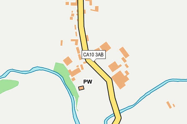
CA10 3AB lies on Church View in Cliburn, Penrith. CA10 3AB is located in the Eden and Lyvennet Vale electoral ward, within the unitary authority of Westmorland and Furness and the English Parliamentary constituency of Penrith and The Border. The Sub Integrated Care Board (ICB) Location is NHS North East and North Cumbria ICB - 01H and the police force is Cumbria. This postcode has been in use since January 1980.


GetTheData
Source: OS OpenMap – Local (Ordnance Survey)
Source: OS VectorMap District (Ordnance Survey)
Licence: Open Government Licence (requires attribution)
| Easting | 358812 |
| Northing | 524573 |
| Latitude | 54.614621 |
| Longitude | -2.639282 |
GetTheData
Source: Open Postcode Geo
Licence: Open Government Licence
| Street | Church View |
| Locality | Cliburn |
| Town/City | Penrith |
| Country | England |
| Postcode District | CA10 |
➜ See where CA10 is on a map ➜ Where is Cliburn? | |
GetTheData
Source: Land Registry Price Paid Data
Licence: Open Government Licence
Elevation or altitude of CA10 3AB as distance above sea level:
| Metres | Feet | |
|---|---|---|
| Elevation | 120m | 394ft |
Elevation is measured from the approximate centre of the postcode, to the nearest point on an OS contour line from OS Terrain 50, which has contour spacing of ten vertical metres.
➜ How high above sea level am I? Find the elevation of your current position using your device's GPS.
GetTheData
Source: Open Postcode Elevation
Licence: Open Government Licence
| Ward | Eden And Lyvennet Vale |
| Constituency | Penrith And The Border |
GetTheData
Source: ONS Postcode Database
Licence: Open Government Licence
| Wellgarth (Unnamed Road) | Cliburn | 285m |
GetTheData
Source: NaPTAN
Licence: Open Government Licence
| Percentage of properties with Next Generation Access | 100.0% |
| Percentage of properties with Superfast Broadband | 100.0% |
| Percentage of properties with Ultrafast Broadband | 0.0% |
| Percentage of properties with Full Fibre Broadband | 0.0% |
Superfast Broadband is between 30Mbps and 300Mbps
Ultrafast Broadband is > 300Mbps
| Percentage of properties unable to receive 2Mbps | 0.0% |
| Percentage of properties unable to receive 5Mbps | 0.0% |
| Percentage of properties unable to receive 10Mbps | 0.0% |
| Percentage of properties unable to receive 30Mbps | 0.0% |
GetTheData
Source: Ofcom
Licence: Ofcom Terms of Use (requires attribution)
GetTheData
Source: ONS Postcode Database
Licence: Open Government Licence
| Last Collection | |||
|---|---|---|---|
| Location | Mon-Fri | Sat | Distance |
| Cliburn | 15:15 | 11:15 | 276m |
| Crossrigg | 15:30 | 11:30 | 1,991m |
| Morland | 15:30 | 11:45 | 2,376m |
GetTheData
Source: Dracos
Licence: Creative Commons Attribution-ShareAlike
The below table lists the International Territorial Level (ITL) codes (formerly Nomenclature of Territorial Units for Statistics (NUTS) codes) and Local Administrative Units (LAU) codes for CA10 3AB:
| ITL 1 Code | Name |
|---|---|
| TLD | North West (England) |
| ITL 2 Code | Name |
| TLD1 | Cumbria |
| ITL 3 Code | Name |
| TLD12 | East Cumbria |
| LAU 1 Code | Name |
| E07000030 | Eden |
GetTheData
Source: ONS Postcode Directory
Licence: Open Government Licence
The below table lists the Census Output Area (OA), Lower Layer Super Output Area (LSOA), and Middle Layer Super Output Area (MSOA) for CA10 3AB:
| Code | Name | |
|---|---|---|
| OA | E00097662 | |
| LSOA | E01019324 | Eden 006F |
| MSOA | E02004013 | Eden 006 |
GetTheData
Source: ONS Postcode Directory
Licence: Open Government Licence
| CA10 3AD | Rectory Cottages | 123m |
| CA10 3AJ | Leith Close | 232m |
| CA10 3AA | Musgrave Terrace | 238m |
| CA10 3AF | Park Croft | 279m |
| CA10 3AL | 284m | |
| CA10 3BW | Curwen Bank | 369m |
| CA10 3AQ | Fallowfield | 538m |
| CA10 3AH | The Meadows | 550m |
| CA10 3AE | Station Road | 999m |
| CA10 3BJ | 1300m |
GetTheData
Source: Open Postcode Geo; Land Registry Price Paid Data
Licence: Open Government Licence