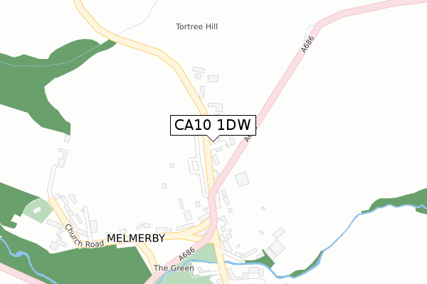
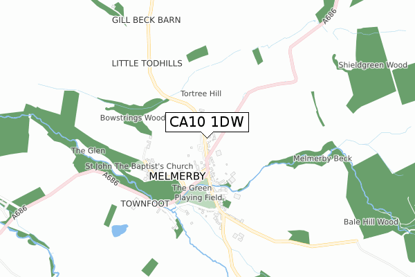
CA10 1DW is located in the Alston and Fellside electoral ward, within the unitary authority of Westmorland and Furness and the English Parliamentary constituency of Penrith and The Border. The Sub Integrated Care Board (ICB) Location is NHS North East and North Cumbria ICB - 01H and the police force is Cumbria. This postcode has been in use since October 2019.


GetTheData
Source: OS Open Zoomstack (Ordnance Survey)
Licence: Open Government Licence (requires attribution)
Attribution: Contains OS data © Crown copyright and database right 2025
Source: Open Postcode Geo
Licence: Open Government Licence (requires attribution)
Attribution: Contains OS data © Crown copyright and database right 2025; Contains Royal Mail data © Royal Mail copyright and database right 2025; Source: Office for National Statistics licensed under the Open Government Licence v.3.0
| Easting | 361525 |
| Northing | 537604 |
| Latitude | 54.731942 |
| Longitude | -2.599004 |
GetTheData
Source: Open Postcode Geo
Licence: Open Government Licence
| Country | England |
| Postcode District | CA10 |
➜ See where CA10 is on a map ➜ Where is Melmerby? | |
GetTheData
Source: Land Registry Price Paid Data
Licence: Open Government Licence
| Ward | Alston And Fellside |
| Constituency | Penrith And The Border |
GetTheData
Source: ONS Postcode Database
Licence: Open Government Licence
| The New Inn (A686) | Melmerby | 223m |
| The New Inn (A686) | Melmerby | 239m |
| Turnmoor Head Woods (A686) | Melmerby | 1,185m |
| Turnmoor Head Woods (A686) | Melmerby | 1,191m |
| Langwathby Station | 5.9km |
GetTheData
Source: NaPTAN
Licence: Open Government Licence
GetTheData
Source: ONS Postcode Database
Licence: Open Government Licence


➜ Get more ratings from the Food Standards Agency
GetTheData
Source: Food Standards Agency
Licence: FSA terms & conditions
| Last Collection | |||
|---|---|---|---|
| Location | Mon-Fri | Sat | Distance |
| Melmerby | 14:50 | 10:10 | 211m |
| Gamelsby | 15:10 | 10:00 | 1,727m |
| Ousby | 14:45 | 10:00 | 2,776m |
GetTheData
Source: Dracos
Licence: Creative Commons Attribution-ShareAlike
The below table lists the International Territorial Level (ITL) codes (formerly Nomenclature of Territorial Units for Statistics (NUTS) codes) and Local Administrative Units (LAU) codes for CA10 1DW:
| ITL 1 Code | Name |
|---|---|
| TLD | North West (England) |
| ITL 2 Code | Name |
| TLD1 | Cumbria |
| ITL 3 Code | Name |
| TLD12 | East Cumbria |
| LAU 1 Code | Name |
| E07000030 | Eden |
GetTheData
Source: ONS Postcode Directory
Licence: Open Government Licence
The below table lists the Census Output Area (OA), Lower Layer Super Output Area (LSOA), and Middle Layer Super Output Area (MSOA) for CA10 1DW:
| Code | Name | |
|---|---|---|
| OA | E00097617 | |
| LSOA | E01019314 | Eden 001B |
| MSOA | E02004008 | Eden 001 |
GetTheData
Source: ONS Postcode Directory
Licence: Open Government Licence
| CA10 1HF | 183m | |
| CA10 1HE | 211m | |
| CA10 1HL | Bridge Terrace | 317m |
| CA10 1HJ | Elseghyll Court | 329m |
| CA10 1HB | 350m | |
| CA10 1HH | Rectory Dell | 381m |
| CA10 1HD | Church Road | 389m |
| CA10 1HN | 489m | |
| CA10 1HG | Townhead Court | 492m |
| CA10 1HR | 1824m |
GetTheData
Source: Open Postcode Geo; Land Registry Price Paid Data
Licence: Open Government Licence