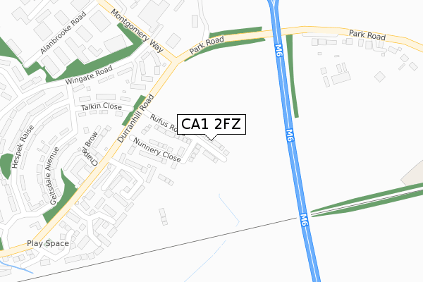
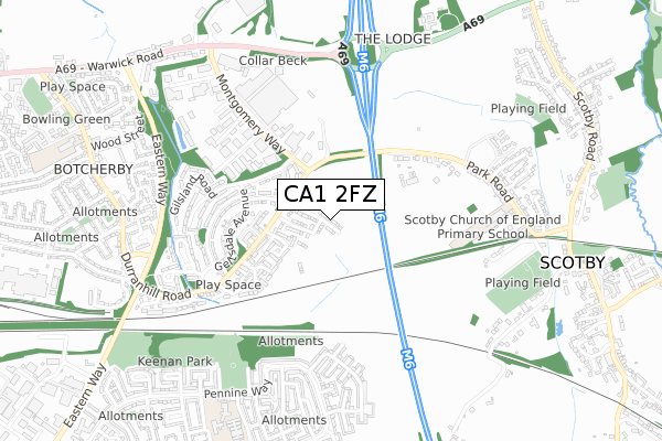
CA1 2FZ is located in the Botcherby electoral ward, within the unitary authority of Cumberland and the English Parliamentary constituency of Carlisle. The Sub Integrated Care Board (ICB) Location is NHS North East and North Cumbria ICB - 01H and the police force is Cumbria. This postcode has been in use since October 2019.


GetTheData
Source: OS Open Zoomstack (Ordnance Survey)
Licence: Open Government Licence (requires attribution)
Attribution: Contains OS data © Crown copyright and database right 2025
Source: Open Postcode Geo
Licence: Open Government Licence (requires attribution)
Attribution: Contains OS data © Crown copyright and database right 2025; Contains Royal Mail data © Royal Mail copyright and database right 2025; Source: Office for National Statistics licensed under the Open Government Licence v.3.0
| Easting | 343082 |
| Northing | 555272 |
| Latitude | 54.888941 |
| Longitude | -2.888849 |
GetTheData
Source: Open Postcode Geo
Licence: Open Government Licence
| Country | England |
| Postcode District | CA1 |
➜ See where CA1 is on a map ➜ Where is Carlisle? | |
GetTheData
Source: Land Registry Price Paid Data
Licence: Open Government Licence
| Ward | Botcherby |
| Constituency | Carlisle |
GetTheData
Source: ONS Postcode Database
Licence: Open Government Licence
2024 13 SEP £302,000 |
2024 23 AUG £332,000 |
69, RUFUS ROAD, CARLISLE, CA1 2FZ 2024 3 MAY £293,500 |
2023 8 DEC £280,000 |
33, RUFUS ROAD, CARLISLE, CA1 2FZ 2023 29 SEP £294,995 |
77, RUFUS ROAD, CARLISLE, CA1 2FZ 2023 14 JUL £240,000 |
31, RUFUS ROAD, CARLISLE, CA1 2FZ 2023 23 JUN £349,995 |
29, RUFUS ROAD, CARLISLE, CA1 2FZ 2023 16 JUN £299,995 |
1, RUFUS ROAD, CARLISLE, CA1 2FZ 2022 22 SEP £269,995 |
3, RUFUS ROAD, CARLISLE, CA1 2FZ 2022 5 AUG £291,995 |
GetTheData
Source: HM Land Registry Price Paid Data
Licence: Contains HM Land Registry data © Crown copyright and database right 2025. This data is licensed under the Open Government Licence v3.0.
| Chapel Brow (Durranhill Road) | Durranhill | 243m |
| Montgomery Court (Montgomery Way) | Rosehill | 292m |
| Montgomery Court (Montgomery Way) | Rosehill | 306m |
| Montgomery Court (Wingate Road) | Durranhill | 324m |
| Geltsdale Avenue (Talkin Gardens) | Durranhill | 384m |
| Carlisle Station | 2.9km |
| Wetheral Station | 3.7km |
GetTheData
Source: NaPTAN
Licence: Open Government Licence
GetTheData
Source: ONS Postcode Database
Licence: Open Government Licence


➜ Get more ratings from the Food Standards Agency
GetTheData
Source: Food Standards Agency
Licence: FSA terms & conditions
| Last Collection | |||
|---|---|---|---|
| Location | Mon-Fri | Sat | Distance |
| Hespek Raise | 16:15 | 12:00 | 442m |
| Brantwood Avenue | 16:15 | 13:15 | 507m |
| Rosehill Estate | 19:00 | 12:00 | 528m |
GetTheData
Source: Dracos
Licence: Creative Commons Attribution-ShareAlike
The below table lists the International Territorial Level (ITL) codes (formerly Nomenclature of Territorial Units for Statistics (NUTS) codes) and Local Administrative Units (LAU) codes for CA1 2FZ:
| ITL 1 Code | Name |
|---|---|
| TLD | North West (England) |
| ITL 2 Code | Name |
| TLD1 | Cumbria |
| ITL 3 Code | Name |
| TLD12 | East Cumbria |
| LAU 1 Code | Name |
| E07000028 | Carlisle |
GetTheData
Source: ONS Postcode Directory
Licence: Open Government Licence
The below table lists the Census Output Area (OA), Lower Layer Super Output Area (LSOA), and Middle Layer Super Output Area (MSOA) for CA1 2FZ:
| Code | Name | |
|---|---|---|
| OA | E00097298 | |
| LSOA | E01019251 | Carlisle 004F |
| MSOA | E02003990 | Carlisle 004 |
GetTheData
Source: ONS Postcode Directory
Licence: Open Government Licence
| CA1 2PG | Barley Edge | 185m |
| CA1 2PP | Chapel Brow | 255m |
| CA1 2LN | Alexandra Drive | 286m |
| CA1 2RH | Talkin Close | 295m |
| CA1 2RJ | Wingate Road | 324m |
| CA1 2LD | Heathfield Close | 354m |
| CA1 2RL | Geltsdale Avenue | 355m |
| CA1 2RQ | Durranhill Road | 412m |
| CA1 2RN | Hespek Raise | 417m |
| CA1 2UT | Allenbrook Road | 451m |
GetTheData
Source: Open Postcode Geo; Land Registry Price Paid Data
Licence: Open Government Licence