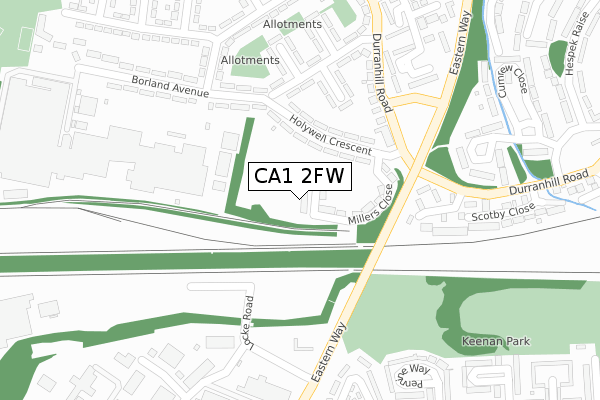
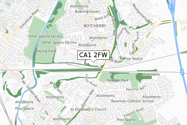
CA1 2FW is located in the Botcherby electoral ward, within the unitary authority of Cumberland and the English Parliamentary constituency of Carlisle. The Sub Integrated Care Board (ICB) Location is NHS North East and North Cumbria ICB - 01H and the police force is Cumbria. This postcode has been in use since December 2019.


GetTheData
Source: OS Open Zoomstack (Ordnance Survey)
Licence: Open Government Licence (requires attribution)
Attribution: Contains OS data © Crown copyright and database right 2025
Source: Open Postcode Geo
Licence: Open Government Licence (requires attribution)
Attribution: Contains OS data © Crown copyright and database right 2025; Contains Royal Mail data © Royal Mail copyright and database right 2025; Source: Office for National Statistics licensed under the Open Government Licence v.3.0
| Easting | 342189 |
| Northing | 555086 |
| Latitude | 54.887167 |
| Longitude | -2.902731 |
GetTheData
Source: Open Postcode Geo
Licence: Open Government Licence
| Country | England |
| Postcode District | CA1 |
➜ See where CA1 is on a map ➜ Where is Carlisle? | |
GetTheData
Source: Land Registry Price Paid Data
Licence: Open Government Licence
| Ward | Botcherby |
| Constituency | Carlisle |
GetTheData
Source: ONS Postcode Database
Licence: Open Government Licence
| Dairy (Holywell Crescent) | Botcherby | 116m |
| Dairy (Holywell Crescent) | Botcherby | 148m |
| Hollywell Crescent (Borland Avenue) | Botcherby | 161m |
| Hollywell Crescent (Borland Avenue) | Botcherby | 182m |
| Borland Avenue (Merith Avenue) | Botcherby | 240m |
| Carlisle Station | 2km |
| Wetheral Station | 4.6km |
GetTheData
Source: NaPTAN
Licence: Open Government Licence
GetTheData
Source: ONS Postcode Database
Licence: Open Government Licence


➜ Get more ratings from the Food Standards Agency
GetTheData
Source: Food Standards Agency
Licence: FSA terms & conditions
| Last Collection | |||
|---|---|---|---|
| Location | Mon-Fri | Sat | Distance |
| Borland Avenue | 16:15 | 12:15 | 155m |
| Pennine Way | 16:15 | 13:30 | 457m |
| Hespek Raise | 16:15 | 12:00 | 488m |
GetTheData
Source: Dracos
Licence: Creative Commons Attribution-ShareAlike
The below table lists the International Territorial Level (ITL) codes (formerly Nomenclature of Territorial Units for Statistics (NUTS) codes) and Local Administrative Units (LAU) codes for CA1 2FW:
| ITL 1 Code | Name |
|---|---|
| TLD | North West (England) |
| ITL 2 Code | Name |
| TLD1 | Cumbria |
| ITL 3 Code | Name |
| TLD12 | East Cumbria |
| LAU 1 Code | Name |
| E07000028 | Carlisle |
GetTheData
Source: ONS Postcode Directory
Licence: Open Government Licence
The below table lists the Census Output Area (OA), Lower Layer Super Output Area (LSOA), and Middle Layer Super Output Area (MSOA) for CA1 2FW:
| Code | Name | |
|---|---|---|
| OA | E00097032 | |
| LSOA | E01019197 | Carlisle 011A |
| MSOA | E02003997 | Carlisle 011 |
GetTheData
Source: ONS Postcode Directory
Licence: Open Government Licence
| CA1 2TD | Holywell Crescent | 96m |
| CA1 2SY | Borland Avenue | 155m |
| CA1 2TF | Borland Avenue | 159m |
| CA1 2SZ | Durranhill Road | 166m |
| CA1 2XH | Scotby Gardens | 207m |
| CA1 2TN | Merith Avenue | 235m |
| CA1 2SX | Borland Avenue | 238m |
| CA1 2TW | Merith Avenue | 282m |
| CA1 2TE | Oakleigh Way | 291m |
| CA1 2TJ | Borland Avenue | 322m |
GetTheData
Source: Open Postcode Geo; Land Registry Price Paid Data
Licence: Open Government Licence