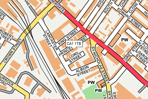
CA1 1TB is located in the Currock electoral ward, within the unitary authority of Cumberland and the English Parliamentary constituency of Carlisle. The Sub Integrated Care Board (ICB) Location is NHS North East and North Cumbria ICB - 01H and the police force is Cumbria. This postcode has been in use since January 1980.


GetTheData
Source: OS OpenMap – Local (Ordnance Survey)
Source: OS VectorMap District (Ordnance Survey)
Licence: Open Government Licence (requires attribution)
| Easting | 340569 |
| Northing | 555250 |
| Latitude | 54.888443 |
| Longitude | -2.928012 |
GetTheData
Source: Open Postcode Geo
Licence: Open Government Licence
| Country | England |
| Postcode District | CA1 |
➜ See where CA1 is on a map ➜ Where is Carlisle? | |
GetTheData
Source: Land Registry Price Paid Data
Licence: Open Government Licence
Elevation or altitude of CA1 1TB as distance above sea level:
| Metres | Feet | |
|---|---|---|
| Elevation | 20m | 66ft |
Elevation is measured from the approximate centre of the postcode, to the nearest point on an OS contour line from OS Terrain 50, which has contour spacing of ten vertical metres.
➜ How high above sea level am I? Find the elevation of your current position using your device's GPS.
GetTheData
Source: Open Postcode Elevation
Licence: Open Government Licence
| Ward | Currock |
| Constituency | Carlisle |
GetTheData
Source: ONS Postcode Database
Licence: Open Government Licence
| Fontanas Chip Shop (St Nicholas Street) | St Nicholas | 70m |
| St Nicholas (Botchergate) | Botchergate | 80m |
| St Nicholas (Botchergate) | Botchergate | 93m |
| Fontanas Chip Shop (St Nicholas Street) | St Nicholas | 108m |
| The Cranemakers (Grey Street) | St Aidens | 220m |
| Carlisle Station | 0.4km |
| Dalston (Cumbria) Station | 6.1km |
GetTheData
Source: NaPTAN
Licence: Open Government Licence
GetTheData
Source: ONS Postcode Database
Licence: Open Government Licence


➜ Get more ratings from the Food Standards Agency
GetTheData
Source: Food Standards Agency
Licence: FSA terms & conditions
| Last Collection | |||
|---|---|---|---|
| Location | Mon-Fri | Sat | Distance |
| Botchergate | 17:45 | 12:30 | 94m |
| Cecil Street | 18:15 | 12:30 | 321m |
| James Street | 17:45 | 12:30 | 393m |
GetTheData
Source: Dracos
Licence: Creative Commons Attribution-ShareAlike
The below table lists the International Territorial Level (ITL) codes (formerly Nomenclature of Territorial Units for Statistics (NUTS) codes) and Local Administrative Units (LAU) codes for CA1 1TB:
| ITL 1 Code | Name |
|---|---|
| TLD | North West (England) |
| ITL 2 Code | Name |
| TLD1 | Cumbria |
| ITL 3 Code | Name |
| TLD12 | East Cumbria |
| LAU 1 Code | Name |
| E07000028 | Carlisle |
GetTheData
Source: ONS Postcode Directory
Licence: Open Government Licence
The below table lists the Census Output Area (OA), Lower Layer Super Output Area (LSOA), and Middle Layer Super Output Area (MSOA) for CA1 1TB:
| Code | Name | |
|---|---|---|
| OA | E00097093 | |
| LSOA | E01019211 | Carlisle 010B |
| MSOA | E02003996 | Carlisle 010 |
GetTheData
Source: ONS Postcode Directory
Licence: Open Government Licence
| CA1 1SH | Botchergate | 80m |
| CA1 1SR | King Street | 104m |
| CA1 2JU | London Road | 106m |
| CA1 1SG | Botchergate | 107m |
| CA1 2EG | South View Terrace | 109m |
| CA1 2EF | St Nicholas Street | 132m |
| CA1 2EL | London Road | 134m |
| CA1 1RZ | Botchergate | 153m |
| CA1 1SN | Botchergate | 175m |
| CA1 2HA | Close Street | 180m |
GetTheData
Source: Open Postcode Geo; Land Registry Price Paid Data
Licence: Open Government Licence