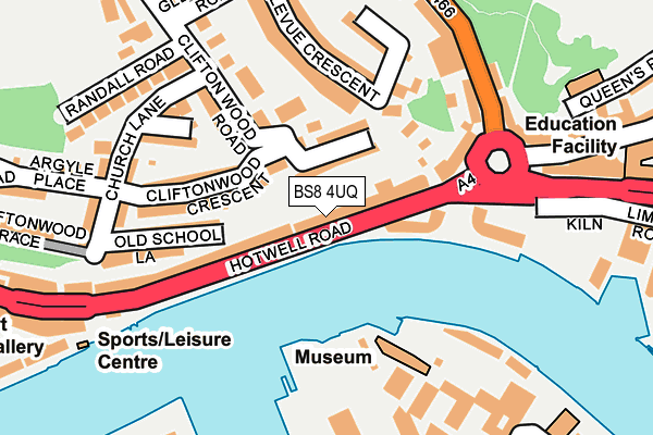
BS8 4UQ is located in the Hotwells and Harbourside electoral ward, within the unitary authority of Bristol, City of and the English Parliamentary constituency of Bristol West. The Sub Integrated Care Board (ICB) Location is NHS Bristol, North Somerset and South Gloucestershire ICB - 15C and the police force is Avon and Somerset. This postcode has been in use since September 1991.


GetTheData
Source: OS OpenMap – Local (Ordnance Survey)
Source: OS VectorMap District (Ordnance Survey)
Licence: Open Government Licence (requires attribution)
| Easting | 357705 |
| Northing | 172542 |
| Latitude | 51.450273 |
| Longitude | -2.610039 |
GetTheData
Source: Open Postcode Geo
Licence: Open Government Licence
| Country | England |
| Postcode District | BS8 |
➜ See where BS8 is on a map ➜ Where is Bristol? | |
GetTheData
Source: Land Registry Price Paid Data
Licence: Open Government Licence
Elevation or altitude of BS8 4UQ as distance above sea level:
| Metres | Feet | |
|---|---|---|
| Elevation | 10m | 33ft |
Elevation is measured from the approximate centre of the postcode, to the nearest point on an OS contour line from OS Terrain 50, which has contour spacing of ten vertical metres.
➜ How high above sea level am I? Find the elevation of your current position using your device's GPS.
GetTheData
Source: Open Postcode Elevation
Licence: Open Government Licence
| Ward | Hotwells And Harbourside |
| Constituency | Bristol West |
GetTheData
Source: ONS Postcode Database
Licence: Open Government Licence
| Jacob's Wells Road | Canon's Marsh | 218m |
| Jacob's Wells Road | Canon's Marsh | 238m |
| Hotwell Road | Hotwells | 252m |
| Hotwell Road | Hotwells | 254m |
| Gasferry Road (Anchor Road) | Canon's Marsh | 288m |
| Bedminster Station | 1.6km |
| Clifton Down Station | 1.6km |
| Parson Street Station | 1.9km |
GetTheData
Source: NaPTAN
Licence: Open Government Licence
GetTheData
Source: ONS Postcode Database
Licence: Open Government Licence


➜ Get more ratings from the Food Standards Agency
GetTheData
Source: Food Standards Agency
Licence: FSA terms & conditions
| Last Collection | |||
|---|---|---|---|
| Location | Mon-Fri | Sat | Distance |
| Church Lane | 17:30 | 11:45 | 219m |
| Glentworth Road | 17:30 | 11:45 | 225m |
| Hotwells Road | 17:30 | 11:45 | 236m |
GetTheData
Source: Dracos
Licence: Creative Commons Attribution-ShareAlike
The below table lists the International Territorial Level (ITL) codes (formerly Nomenclature of Territorial Units for Statistics (NUTS) codes) and Local Administrative Units (LAU) codes for BS8 4UQ:
| ITL 1 Code | Name |
|---|---|
| TLK | South West (England) |
| ITL 2 Code | Name |
| TLK1 | Gloucestershire, Wiltshire and Bath/Bristol area |
| ITL 3 Code | Name |
| TLK11 | Bristol, City of |
| LAU 1 Code | Name |
| E06000023 | Bristol, City of |
GetTheData
Source: ONS Postcode Directory
Licence: Open Government Licence
The below table lists the Census Output Area (OA), Lower Layer Super Output Area (LSOA), and Middle Layer Super Output Area (MSOA) for BS8 4UQ:
| Code | Name | |
|---|---|---|
| OA | E00073465 | |
| LSOA | E01014549 | Bristol 034B |
| MSOA | E02003045 | Bristol 034 |
GetTheData
Source: ONS Postcode Directory
Licence: Open Government Licence
| BS8 4UU | Hotwell Road | 40m |
| BS8 4TJ | Southernhay Avenue | 55m |
| BS8 4UJ | Hotwell Road | 65m |
| BS8 4UD | Hotwell Road | 74m |
| BS8 4UA | Hotwell Road | 84m |
| BS8 4TL | Southernhay | 104m |
| BS8 4TT | Southernhay Crescent | 109m |
| BS8 4TH | Worlds End Lane | 111m |
| BS8 4TU | Clifton Wood Crescent | 114m |
| BS8 4TQ | White Hart Steps | 115m |
GetTheData
Source: Open Postcode Geo; Land Registry Price Paid Data
Licence: Open Government Licence