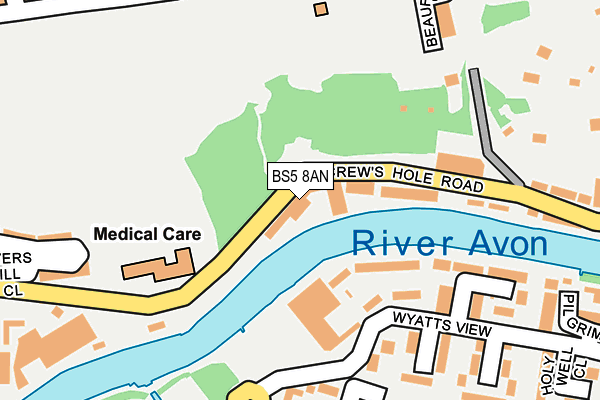
BS5 8AN is located in the St George Troopers Hill electoral ward, within the unitary authority of Bristol, City of and the English Parliamentary constituency of Bristol East. The Sub Integrated Care Board (ICB) Location is NHS Bristol, North Somerset and South Gloucestershire ICB - 15C and the police force is Avon and Somerset. This postcode has been in use since April 1985.


GetTheData
Source: OS OpenMap – Local (Ordnance Survey)
Source: OS VectorMap District (Ordnance Survey)
Licence: Open Government Licence (requires attribution)
| Easting | 362206 |
| Northing | 173130 |
| Latitude | 51.455879 |
| Longitude | -2.545333 |
GetTheData
Source: Open Postcode Geo
Licence: Open Government Licence
| Country | England |
| Postcode District | BS5 |
➜ See where BS5 is on a map ➜ Where is Bristol? | |
GetTheData
Source: Land Registry Price Paid Data
Licence: Open Government Licence
Elevation or altitude of BS5 8AN as distance above sea level:
| Metres | Feet | |
|---|---|---|
| Elevation | 10m | 33ft |
Elevation is measured from the approximate centre of the postcode, to the nearest point on an OS contour line from OS Terrain 50, which has contour spacing of ten vertical metres.
➜ How high above sea level am I? Find the elevation of your current position using your device's GPS.
GetTheData
Source: Open Postcode Elevation
Licence: Open Government Licence
| Ward | St George Troopers Hill |
| Constituency | Bristol East |
GetTheData
Source: ONS Postcode Database
Licence: Open Government Licence
| Chapel Way (St Anne's Road) | St Anne's Park | 268m |
| Chapel Way (St Anne's Road) | St Anne's Park | 310m |
| Wootton Crescent (Wootton Road) | St Anne's Park | 314m |
| Wootton Crescent (Wootton Road) | St Anne's Park | 340m |
| Northcote Road (Church Road) | Redfield | 454m |
| Lawrence Hill Station | 1.3km |
| Stapleton Road Station | 1.9km |
| Bristol Temple Meads Station | 2.6km |
GetTheData
Source: NaPTAN
Licence: Open Government Licence
Estimated total energy consumption in BS5 8AN by fuel type, 2015.
| Consumption (kWh) | 43,575 |
|---|---|
| Meter count | 6 |
| Mean (kWh/meter) | 7,262 |
| Median (kWh/meter) | 2,117 |
GetTheData
Source: Postcode level gas estimates: 2015 (experimental)
Source: Postcode level electricity estimates: 2015 (experimental)
Licence: Open Government Licence
GetTheData
Source: ONS Postcode Database
Licence: Open Government Licence


➜ Get more ratings from the Food Standards Agency
GetTheData
Source: Food Standards Agency
Licence: FSA terms & conditions
| Last Collection | |||
|---|---|---|---|
| Location | Mon-Fri | Sat | Distance |
| Boardmills Shops | 17:00 | 10:45 | 133m |
| Church Road | 16:00 | 12:00 | 437m |
| St George Post Office | 17:15 | 12:15 | 593m |
GetTheData
Source: Dracos
Licence: Creative Commons Attribution-ShareAlike
| Risk of BS5 8AN flooding from rivers and sea | Medium |
| ➜ BS5 8AN flood map | |
GetTheData
Source: Open Flood Risk by Postcode
Licence: Open Government Licence
The below table lists the International Territorial Level (ITL) codes (formerly Nomenclature of Territorial Units for Statistics (NUTS) codes) and Local Administrative Units (LAU) codes for BS5 8AN:
| ITL 1 Code | Name |
|---|---|
| TLK | South West (England) |
| ITL 2 Code | Name |
| TLK1 | Gloucestershire, Wiltshire and Bath/Bristol area |
| ITL 3 Code | Name |
| TLK11 | Bristol, City of |
| LAU 1 Code | Name |
| E06000023 | Bristol, City of |
GetTheData
Source: ONS Postcode Directory
Licence: Open Government Licence
The below table lists the Census Output Area (OA), Lower Layer Super Output Area (LSOA), and Middle Layer Super Output Area (MSOA) for BS5 8AN:
| Code | Name | |
|---|---|---|
| OA | E00074131 | |
| LSOA | E01014677 | Bristol 033A |
| MSOA | E02003044 | Bristol 033 |
GetTheData
Source: ONS Postcode Directory
Licence: Open Government Licence
| BS4 4RH | Riverside Steps | 108m |
| BS4 4DQ | Whiteway Close | 186m |
| BS4 4DG | Burgess Green Close | 201m |
| BS4 4EY | The Stepping Stones | 232m |
| BS5 8EN | Beaufort Road | 247m |
| BS5 8JX | Beaufort Heights | 250m |
| BS5 8AZ | Strawberry Lane | 260m |
| BS5 8EZ | Beaufort Road | 263m |
| BS4 4DX | Roegate Drive | 268m |
| BS5 8EG | Beaufort Road | 269m |
GetTheData
Source: Open Postcode Geo; Land Registry Price Paid Data
Licence: Open Government Licence