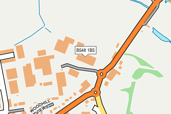
BS48 1BS is located in the Nailsea Yeo electoral ward, within the unitary authority of North Somerset and the English Parliamentary constituency of North Somerset. The Sub Integrated Care Board (ICB) Location is NHS Bristol, North Somerset and South Gloucestershire ICB - 15C and the police force is Avon and Somerset. This postcode has been in use since December 1997.


GetTheData
Source: OS OpenMap – Local (Ordnance Survey)
Source: OS VectorMap District (Ordnance Survey)
Licence: Open Government Licence (requires attribution)
| Easting | 348094 |
| Northing | 171375 |
| Latitude | 51.438979 |
| Longitude | -2.748164 |
GetTheData
Source: Open Postcode Geo
Licence: Open Government Licence
| Country | England |
| Postcode District | BS48 |
➜ See where BS48 is on a map ➜ Where is Nailsea? | |
GetTheData
Source: Land Registry Price Paid Data
Licence: Open Government Licence
Elevation or altitude of BS48 1BS as distance above sea level:
| Metres | Feet | |
|---|---|---|
| Elevation | 20m | 66ft |
Elevation is measured from the approximate centre of the postcode, to the nearest point on an OS contour line from OS Terrain 50, which has contour spacing of ten vertical metres.
➜ How high above sea level am I? Find the elevation of your current position using your device's GPS.
GetTheData
Source: Open Postcode Elevation
Licence: Open Government Licence
| Ward | Nailsea Yeo |
| Constituency | North Somerset |
GetTheData
Source: ONS Postcode Database
Licence: Open Government Licence
| Esso Garage (Bristol Road) | East End Nailsea | 104m |
| Esso Garage | East End Nailsea | 124m |
| Lodge Lane | East End Nailsea | 283m |
| Southfield Road | Nailsea | 286m |
| Southfield Road (High Street) | Nailsea | 319m |
| Nailsea & Backwell Station | 2.2km |
| Shirehampton Station | 7km |
GetTheData
Source: NaPTAN
Licence: Open Government Licence
GetTheData
Source: ONS Postcode Database
Licence: Open Government Licence


➜ Get more ratings from the Food Standards Agency
GetTheData
Source: Food Standards Agency
Licence: FSA terms & conditions
| Last Collection | |||
|---|---|---|---|
| Location | Mon-Fri | Sat | Distance |
| Trendlewood | 17:00 | 09:00 | 1,013m |
| Nailsea Post Office | 18:00 | 12:30 | 1,198m |
| Clapton In Gordano | 17:00 | 07:30 | 2,632m |
GetTheData
Source: Dracos
Licence: Creative Commons Attribution-ShareAlike
The below table lists the International Territorial Level (ITL) codes (formerly Nomenclature of Territorial Units for Statistics (NUTS) codes) and Local Administrative Units (LAU) codes for BS48 1BS:
| ITL 1 Code | Name |
|---|---|
| TLK | South West (England) |
| ITL 2 Code | Name |
| TLK1 | Gloucestershire, Wiltshire and Bath/Bristol area |
| ITL 3 Code | Name |
| TLK12 | Bath and North East Somerset, North Somerset and South Gloucestershire |
| LAU 1 Code | Name |
| E06000024 | North Somerset |
GetTheData
Source: ONS Postcode Directory
Licence: Open Government Licence
The below table lists the Census Output Area (OA), Lower Layer Super Output Area (LSOA), and Middle Layer Super Output Area (MSOA) for BS48 1BS:
| Code | Name | |
|---|---|---|
| OA | E00075043 | |
| LSOA | E01014852 | North Somerset 006E |
| MSOA | E02003070 | North Somerset 006 |
GetTheData
Source: ONS Postcode Directory
Licence: Open Government Licence
| BS48 1BT | High Street | 182m |
| BS48 1JF | Woodhill Views | 230m |
| BS48 1BL | Lodge Lane | 246m |
| BS48 1JE | Southfield Road | 266m |
| BS48 1QT | Holly Close | 301m |
| BS48 1QA | Beech Drive | 335m |
| BS48 1BY | The Hamlet | 350m |
| BS48 1PP | Vowles Close | 361m |
| BS48 1JD | Southfield Road | 371m |
| BS48 1QB | Chestnut Chase | 388m |
GetTheData
Source: Open Postcode Geo; Land Registry Price Paid Data
Licence: Open Government Licence