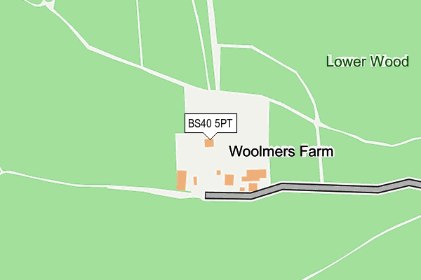
BS40 5PT lies on Wrington Hill in Wrington, Bristol. BS40 5PT is located in the Congresbury & Puxton electoral ward, within the unitary authority of North Somerset and the English Parliamentary constituency of Weston-Super-Mare. The Sub Integrated Care Board (ICB) Location is NHS Bristol, North Somerset and South Gloucestershire ICB - 15C and the police force is Avon and Somerset. This postcode has been in use since December 1997.


GetTheData
Source: OS OpenMap – Local (Ordnance Survey)
Source: OS VectorMap District (Ordnance Survey)
Licence: Open Government Licence (requires attribution)
| Easting | 345926 |
| Northing | 164540 |
| Latitude | 51.377321 |
| Longitude | -2.778312 |
GetTheData
Source: Open Postcode Geo
Licence: Open Government Licence
| Street | Wrington Hill |
| Locality | Wrington |
| Town/City | Bristol |
| Country | England |
| Postcode District | BS40 |
➜ See where BS40 is on a map | |
GetTheData
Source: Land Registry Price Paid Data
Licence: Open Government Licence
Elevation or altitude of BS40 5PT as distance above sea level:
| Metres | Feet | |
|---|---|---|
| Elevation | 110m | 361ft |
Elevation is measured from the approximate centre of the postcode, to the nearest point on an OS contour line from OS Terrain 50, which has contour spacing of ten vertical metres.
➜ How high above sea level am I? Find the elevation of your current position using your device's GPS.
GetTheData
Source: Open Postcode Elevation
Licence: Open Government Licence
| Ward | Congresbury & Puxton |
| Constituency | Weston-super-mare |
GetTheData
Source: ONS Postcode Database
Licence: Open Government Licence
| Warner Close (Main Road) | Cleeve | 1,065m |
| Warner Close (Main Road) | Cleeve | 1,080m |
| The Lord Nelson (Main Road) | Cleeve | 1,108m |
| The Lord Nelson (Main Road) | Cleeve | 1,114m |
| Bishops Road Shops (Bishops Road) | Cleeve | 1,156m |
| Yatton Station | 3.8km |
| Nailsea & Backwell Station | 5.1km |
GetTheData
Source: NaPTAN
Licence: Open Government Licence
| Percentage of properties with Next Generation Access | 100.0% |
| Percentage of properties with Superfast Broadband | 0.0% |
| Percentage of properties with Ultrafast Broadband | 0.0% |
| Percentage of properties with Full Fibre Broadband | 0.0% |
Superfast Broadband is between 30Mbps and 300Mbps
Ultrafast Broadband is > 300Mbps
| Percentage of properties unable to receive 2Mbps | 0.0% |
| Percentage of properties unable to receive 5Mbps | 0.0% |
| Percentage of properties unable to receive 10Mbps | 0.0% |
| Percentage of properties unable to receive 30Mbps | 100.0% |
GetTheData
Source: Ofcom
Licence: Ofcom Terms of Use (requires attribution)
GetTheData
Source: ONS Postcode Database
Licence: Open Government Licence


➜ Get more ratings from the Food Standards Agency
GetTheData
Source: Food Standards Agency
Licence: FSA terms & conditions
| Last Collection | |||
|---|---|---|---|
| Location | Mon-Fri | Sat | Distance |
| The Grove | 16:30 | 09:30 | 941m |
| Lower Cleeve | 17:30 | 09:15 | 1,219m |
| Rhodyate | 15:45 | 09:00 | 1,576m |
GetTheData
Source: Dracos
Licence: Creative Commons Attribution-ShareAlike
The below table lists the International Territorial Level (ITL) codes (formerly Nomenclature of Territorial Units for Statistics (NUTS) codes) and Local Administrative Units (LAU) codes for BS40 5PT:
| ITL 1 Code | Name |
|---|---|
| TLK | South West (England) |
| ITL 2 Code | Name |
| TLK1 | Gloucestershire, Wiltshire and Bath/Bristol area |
| ITL 3 Code | Name |
| TLK12 | Bath and North East Somerset, North Somerset and South Gloucestershire |
| LAU 1 Code | Name |
| E06000024 | North Somerset |
GetTheData
Source: ONS Postcode Directory
Licence: Open Government Licence
The below table lists the Census Output Area (OA), Lower Layer Super Output Area (LSOA), and Middle Layer Super Output Area (MSOA) for BS40 5PT:
| Code | Name | |
|---|---|---|
| OA | E00074580 | |
| LSOA | E01014764 | North Somerset 014A |
| MSOA | E02003078 | North Somerset 014 |
GetTheData
Source: ONS Postcode Directory
Licence: Open Government Licence
| BS49 4PH | Cleeve Hill Road | 777m |
| BS40 5PS | Cleeve Hill Road | 855m |
| BS49 4PL | Chapel Lane | 880m |
| BS49 4PQ | Plunder Street | 889m |
| BS40 5PN | Wrington Hill | 912m |
| BS49 5AS | Wrington Road | 940m |
| BS49 4PG | Cleeve Hill Road | 953m |
| BS40 5PW | Wrington Hill | 1004m |
| BS49 4NR | Main Road | 1046m |
| BS40 5NR | West Hay Road | 1069m |
GetTheData
Source: Open Postcode Geo; Land Registry Price Paid Data
Licence: Open Government Licence