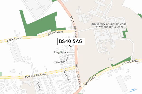
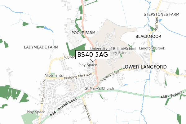
BS40 5AG is located in the Blagdon & Churchill electoral ward, within the unitary authority of North Somerset and the English Parliamentary constituency of Weston-Super-Mare. The Sub Integrated Care Board (ICB) Location is NHS Bristol, North Somerset and South Gloucestershire ICB - 15C and the police force is Avon and Somerset. This postcode has been in use since December 2019.


GetTheData
Source: OS Open Zoomstack (Ordnance Survey)
Licence: Open Government Licence (requires attribution)
Attribution: Contains OS data © Crown copyright and database right 2025
Source: Open Postcode Geo
Licence: Open Government Licence (requires attribution)
Attribution: Contains OS data © Crown copyright and database right 2025; Contains Royal Mail data © Royal Mail copyright and database right 2025; Source: Office for National Statistics licensed under the Open Government Licence v.3.0
| Easting | 345553 |
| Northing | 160765 |
| Latitude | 51.343345 |
| Longitude | -2.783092 |
GetTheData
Source: Open Postcode Geo
Licence: Open Government Licence
| Country | England |
| Postcode District | BS40 |
➜ See where BS40 is on a map ➜ Where is Churchill? | |
GetTheData
Source: Land Registry Price Paid Data
Licence: Open Government Licence
| Ward | Blagdon & Churchill |
| Constituency | Weston-super-mare |
GetTheData
Source: ONS Postcode Database
Licence: Open Government Licence
2024 18 OCT £655,000 |
2024 8 APR £635,000 |
2024 18 JAN £435,000 |
2023 30 NOV £430,000 |
2023 15 AUG £445,000 |
2022 24 AUG £445,000 |
143, MUNTJAC ROAD, LANGFORD, BRISTOL, BS40 5AG 2022 14 MAR £399,000 |
2021 22 DEC £415,000 |
123, MUNTJAC ROAD, LANGFORD, BRISTOL, BS40 5AG 2021 29 OCT £403,000 |
129, MUNTJAC ROAD, LANGFORD, BRISTOL, BS40 5AG 2021 29 OCT £405,000 |
GetTheData
Source: HM Land Registry Price Paid Data
Licence: Contains HM Land Registry data © Crown copyright and database right 2025. This data is licensed under the Open Government Licence v3.0.
| Veterinary College | Upper Langford | 135m |
| St Marys Gardens (Langford Road) | Upper Langford | 392m |
| St Marys Gardens (Langford Road) | Upper Langford | 403m |
| Langford House | Upper Langford | 517m |
| Langford House (Langford Road) | Upper Langford | 525m |
GetTheData
Source: NaPTAN
Licence: Open Government Licence
GetTheData
Source: ONS Postcode Database
Licence: Open Government Licence


➜ Get more ratings from the Food Standards Agency
GetTheData
Source: Food Standards Agency
Licence: FSA terms & conditions
| Last Collection | |||
|---|---|---|---|
| Location | Mon-Fri | Sat | Distance |
| Rowberrow | 16:30 | 10:00 | 2,568m |
| Burrington Combe | 15:00 | 09:45 | 2,703m |
| The Grove | 16:30 | 09:30 | 2,860m |
GetTheData
Source: Dracos
Licence: Creative Commons Attribution-ShareAlike
The below table lists the International Territorial Level (ITL) codes (formerly Nomenclature of Territorial Units for Statistics (NUTS) codes) and Local Administrative Units (LAU) codes for BS40 5AG:
| ITL 1 Code | Name |
|---|---|
| TLK | South West (England) |
| ITL 2 Code | Name |
| TLK1 | Gloucestershire, Wiltshire and Bath/Bristol area |
| ITL 3 Code | Name |
| TLK12 | Bath and North East Somerset, North Somerset and South Gloucestershire |
| LAU 1 Code | Name |
| E06000024 | North Somerset |
GetTheData
Source: ONS Postcode Directory
Licence: Open Government Licence
The below table lists the Census Output Area (OA), Lower Layer Super Output Area (LSOA), and Middle Layer Super Output Area (MSOA) for BS40 5AG:
| Code | Name | |
|---|---|---|
| OA | E00074499 | |
| LSOA | E01014748 | North Somerset 024E |
| MSOA | E02003088 | North Somerset 024 |
GetTheData
Source: ONS Postcode Directory
Licence: Open Government Licence
| BS40 5EW | Stock Lane | 80m |
| BS40 5JB | Stockmead | 256m |
| BS40 5HZ | Stock Lane | 268m |
| BS40 5EL | Pudding Pie Lane | 284m |
| BS40 5EJ | Jubilee Lane | 319m |
| BS40 5JD | Stockmead | 322m |
| BS40 5EN | Pudding Pie Close | 339m |
| BS40 5EP | Stock Lane | 374m |
| BS40 5JE | Bristol Road | 376m |
| BS40 5EZ | Redshard Lane | 383m |
GetTheData
Source: Open Postcode Geo; Land Registry Price Paid Data
Licence: Open Government Licence