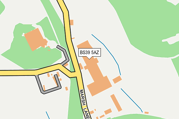
BS39 5AZ is located in the Clutton & Farmborough electoral ward, within the unitary authority of Bath and North East Somerset and the English Parliamentary constituency of North East Somerset. The Sub Integrated Care Board (ICB) Location is NHS Bath and North East Somerset, Swindon and Wiltshire ICB - 92 and the police force is Avon and Somerset. This postcode has been in use since December 1997.


GetTheData
Source: OS OpenMap – Local (Ordnance Survey)
Source: OS VectorMap District (Ordnance Survey)
Licence: Open Government Licence (requires attribution)
| Easting | 363358 |
| Northing | 157773 |
| Latitude | 51.317876 |
| Longitude | -2.527164 |
GetTheData
Source: Open Postcode Geo
Licence: Open Government Licence
| Country | England |
| Postcode District | BS39 |
➜ See where BS39 is on a map | |
GetTheData
Source: Land Registry Price Paid Data
Licence: Open Government Licence
Elevation or altitude of BS39 5AZ as distance above sea level:
| Metres | Feet | |
|---|---|---|
| Elevation | 100m | 328ft |
Elevation is measured from the approximate centre of the postcode, to the nearest point on an OS contour line from OS Terrain 50, which has contour spacing of ten vertical metres.
➜ How high above sea level am I? Find the elevation of your current position using your device's GPS.
GetTheData
Source: Open Postcode Elevation
Licence: Open Government Licence
| Ward | Clutton & Farmborough |
| Constituency | North East Somerset |
GetTheData
Source: ONS Postcode Database
Licence: Open Government Licence
| Highbury Road (Wells Road) | Hallatrow | 706m |
| Highbury Road | Hallatrow | 724m |
| Meadow Lea | Hallatrow | 778m |
| Claremont Gardens (B3355) | Hallatrow | 791m |
| Meadow Lea | Hallatrow | 803m |
GetTheData
Source: NaPTAN
Licence: Open Government Licence
GetTheData
Source: ONS Postcode Database
Licence: Open Government Licence


➜ Get more ratings from the Food Standards Agency
GetTheData
Source: Food Standards Agency
Licence: FSA terms & conditions
| Last Collection | |||
|---|---|---|---|
| Location | Mon-Fri | Sat | Distance |
| Hallatrow S O | 17:15 | 11:45 | 688m |
| White Cross | 16:15 | 08:45 | 1,058m |
| Tiledown | 16:15 | 10:30 | 1,082m |
GetTheData
Source: Dracos
Licence: Creative Commons Attribution-ShareAlike
The below table lists the International Territorial Level (ITL) codes (formerly Nomenclature of Territorial Units for Statistics (NUTS) codes) and Local Administrative Units (LAU) codes for BS39 5AZ:
| ITL 1 Code | Name |
|---|---|
| TLK | South West (England) |
| ITL 2 Code | Name |
| TLK1 | Gloucestershire, Wiltshire and Bath/Bristol area |
| ITL 3 Code | Name |
| TLK12 | Bath and North East Somerset, North Somerset and South Gloucestershire |
| LAU 1 Code | Name |
| E06000022 | Bath and North East Somerset |
GetTheData
Source: ONS Postcode Directory
Licence: Open Government Licence
The below table lists the Census Output Area (OA), Lower Layer Super Output Area (LSOA), and Middle Layer Super Output Area (MSOA) for BS39 5AZ:
| Code | Name | |
|---|---|---|
| OA | E00072660 | |
| LSOA | E01014385 | Bath and North East Somerset 020A |
| MSOA | E02003004 | Bath and North East Somerset 020 |
GetTheData
Source: ONS Postcode Directory
Licence: Open Government Licence
| BS39 5BX | Eastcourt Road | 197m |
| BS39 5BU | Eastcourt Road | 493m |
| BS39 6EA | Harts Lane | 588m |
| BS39 6EF | Highbury Road | 624m |
| BS39 6EN | Wells Road | 675m |
| BS39 6EE | Hallatrow Hill | 708m |
| BS39 6ES | The Grove | 709m |
| BS39 5BT | Eastcourt Road | 711m |
| BS39 6ED | Wells Road | 728m |
| BS39 6HE | Langfords Lane | 774m |
GetTheData
Source: Open Postcode Geo; Land Registry Price Paid Data
Licence: Open Government Licence