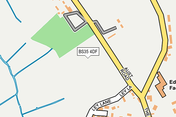
BS35 4DF is located in the Pilning & Severn Beach electoral ward, within the unitary authority of South Gloucestershire and the English Parliamentary constituency of Filton and Bradley Stoke. The Sub Integrated Care Board (ICB) Location is NHS Bristol, North Somerset and South Gloucestershire ICB - 15C and the police force is Avon and Somerset. This postcode has been in use since June 2017.


GetTheData
Source: OS OpenMap – Local (Ordnance Survey)
Source: OS VectorMap District (Ordnance Survey)
Licence: Open Government Licence (requires attribution)
| Easting | 355052 |
| Northing | 182101 |
| Latitude | 51.536011 |
| Longitude | -2.649440 |
GetTheData
Source: Open Postcode Geo
Licence: Open Government Licence
| Country | England |
| Postcode District | BS35 |
➜ See where BS35 is on a map | |
GetTheData
Source: Land Registry Price Paid Data
Licence: Open Government Licence
| Ward | Pilning & Severn Beach |
| Constituency | Filton And Bradley Stoke |
GetTheData
Source: ONS Postcode Database
Licence: Open Government Licence
| Spaniorum Farm (Berwick Lane) | Compton Greenfield | 1,048m |
| Spaniorum Farm | Compton Greenfield | 1,065m |
| Vimpennys Lane (Berwick Lane) | Compton Greenfield | 1,226m |
| Vimpennys Lane (Berwick Lane) | Compton Greenfield | 1,327m |
| Sampsons Farm Cottages (Berwick Lane) | Hallen | 1,346m |
| Pilning Station | 2.8km |
| Severn Beach Station | 2.9km |
| St Andrews Road Station | 4.2km |
GetTheData
Source: NaPTAN
Licence: Open Government Licence
GetTheData
Source: ONS Postcode Database
Licence: Open Government Licence


➜ Get more ratings from the Food Standards Agency
GetTheData
Source: Food Standards Agency
Licence: FSA terms & conditions
| Last Collection | |||
|---|---|---|---|
| Location | Mon-Fri | Sat | Distance |
| Swan Moor | 17:00 | 10:00 | 1,929m |
| Hallen | 17:00 | 11:00 | 2,092m |
| Easter Compton Post Office | 17:15 | 11:00 | 2,199m |
GetTheData
Source: Dracos
Licence: Creative Commons Attribution-ShareAlike
| Risk of BS35 4DF flooding from rivers and sea | Low |
| ➜ BS35 4DF flood map | |
GetTheData
Source: Open Flood Risk by Postcode
Licence: Open Government Licence
The below table lists the International Territorial Level (ITL) codes (formerly Nomenclature of Territorial Units for Statistics (NUTS) codes) and Local Administrative Units (LAU) codes for BS35 4DF:
| ITL 1 Code | Name |
|---|---|
| TLK | South West (England) |
| ITL 2 Code | Name |
| TLK1 | Gloucestershire, Wiltshire and Bath/Bristol area |
| ITL 3 Code | Name |
| TLK12 | Bath and North East Somerset, North Somerset and South Gloucestershire |
| LAU 1 Code | Name |
| E06000025 | South Gloucestershire |
GetTheData
Source: ONS Postcode Directory
Licence: Open Government Licence
The below table lists the Census Output Area (OA), Lower Layer Super Output Area (LSOA), and Middle Layer Super Output Area (MSOA) for BS35 4DF:
| Code | Name | |
|---|---|---|
| OA | E00075098 | |
| LSOA | E01014861 | South Gloucestershire 005A |
| MSOA | E02003094 | South Gloucestershire 005 |
GetTheData
Source: ONS Postcode Directory
Licence: Open Government Licence
| BS35 5SG | Berwick Close | 1028m |
| BS35 5RY | Vimpennys Lane | 1049m |
| BS35 5RX | Berwick Lane | 1067m |
| BS10 7RS | Berwick Lane | 1229m |
| BS35 4GG | Western Approach Distribution Park | 1312m |
| BS10 7SD | Central Avenue | 1602m |
| BS35 5RU | Berwick Lane | 1758m |
| BS10 7SH | Berwick Court | 1821m |
| BS35 5SF | Spaniorum View | 1861m |
| BS35 4JU | Marsh Common Road | 1883m |
GetTheData
Source: Open Postcode Geo; Land Registry Price Paid Data
Licence: Open Government Licence