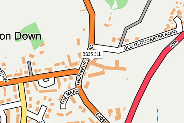
BS35 3LL is located in the Severn Vale electoral ward, within the unitary authority of South Gloucestershire and the English Parliamentary constituency of Thornbury and Yate. The Sub Integrated Care Board (ICB) Location is NHS Bristol, North Somerset and South Gloucestershire ICB - 15C and the police force is Avon and Somerset. This postcode has been in use since December 1997.


GetTheData
Source: OS OpenMap – Local (Ordnance Survey)
Source: OS VectorMap District (Ordnance Survey)
Licence: Open Government Licence (requires attribution)
| Easting | 363508 |
| Northing | 188343 |
| Latitude | 51.592746 |
| Longitude | -2.528177 |
GetTheData
Source: Open Postcode Geo
Licence: Open Government Licence
| Country | England |
| Postcode District | BS35 |
➜ See where BS35 is on a map ➜ Where is Alveston? | |
GetTheData
Source: Land Registry Price Paid Data
Licence: Open Government Licence
Elevation or altitude of BS35 3LL as distance above sea level:
| Metres | Feet | |
|---|---|---|
| Elevation | 100m | 328ft |
Elevation is measured from the approximate centre of the postcode, to the nearest point on an OS contour line from OS Terrain 50, which has contour spacing of ten vertical metres.
➜ How high above sea level am I? Find the elevation of your current position using your device's GPS.
GetTheData
Source: Open Postcode Elevation
Licence: Open Government Licence
| Ward | Severn Vale |
| Constituency | Thornbury And Yate |
GetTheData
Source: ONS Postcode Database
Licence: Open Government Licence
| The Ship (Thornbury Road) | Alveston | 95m |
| The Ship | Alveston | 100m |
| Beanhill Crescent (Down Road) | Alveston | 128m |
| Beanhill Crescent | Alveston | 130m |
| Davids Lane (A38) | Alveston | 331m |
GetTheData
Source: NaPTAN
Licence: Open Government Licence
GetTheData
Source: ONS Postcode Database
Licence: Open Government Licence


➜ Get more ratings from the Food Standards Agency
GetTheData
Source: Food Standards Agency
Licence: FSA terms & conditions
| Last Collection | |||
|---|---|---|---|
| Location | Mon-Fri | Sat | Distance |
| Alverston Cross Road | 16:00 | 09:00 | 318m |
| Alveston Post Office | 17:15 | 11:15 | 418m |
| Alverston Down | 16:45 | 09:00 | 503m |
GetTheData
Source: Dracos
Licence: Creative Commons Attribution-ShareAlike
The below table lists the International Territorial Level (ITL) codes (formerly Nomenclature of Territorial Units for Statistics (NUTS) codes) and Local Administrative Units (LAU) codes for BS35 3LL:
| ITL 1 Code | Name |
|---|---|
| TLK | South West (England) |
| ITL 2 Code | Name |
| TLK1 | Gloucestershire, Wiltshire and Bath/Bristol area |
| ITL 3 Code | Name |
| TLK12 | Bath and North East Somerset, North Somerset and South Gloucestershire |
| LAU 1 Code | Name |
| E06000025 | South Gloucestershire |
GetTheData
Source: ONS Postcode Directory
Licence: Open Government Licence
The below table lists the Census Output Area (OA), Lower Layer Super Output Area (LSOA), and Middle Layer Super Output Area (MSOA) for BS35 3LL:
| Code | Name | |
|---|---|---|
| OA | E00075106 | |
| LSOA | E01014864 | South Gloucestershire 004B |
| MSOA | E02003093 | South Gloucestershire 004 |
GetTheData
Source: ONS Postcode Directory
Licence: Open Government Licence
| BS35 3JF | Down Road | 108m |
| BS35 3JE | Down Road | 114m |
| BS35 3LG | Thornbury Hill | 160m |
| BS35 3JG | Beanhill Crescent | 174m |
| BS35 2LR | Thornbury Road | 187m |
| BS35 3LD | The Mead | 199m |
| BS35 3NA | Greenhill Road | 234m |
| BS35 3LQ | Old Gloucester Road | 261m |
| BS35 3LY | Bannetts Tree Crescent | 263m |
| BS35 3LF | Paddock Gardens | 275m |
GetTheData
Source: Open Postcode Geo; Land Registry Price Paid Data
Licence: Open Government Licence