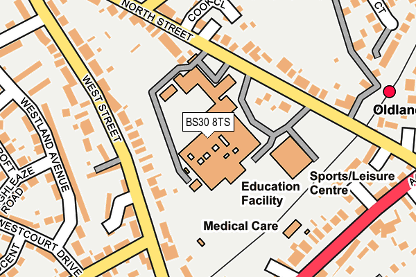
BS30 8TS is located in the Bitton & Oldland Common electoral ward, within the unitary authority of South Gloucestershire and the English Parliamentary constituency of Kingswood. The Sub Integrated Care Board (ICB) Location is NHS Bristol, North Somerset and South Gloucestershire ICB - 15C and the police force is Avon and Somerset. This postcode has been in use since December 1997.


GetTheData
Source: OS OpenMap – Local (Ordnance Survey)
Source: OS VectorMap District (Ordnance Survey)
Licence: Open Government Licence (requires attribution)
| Easting | 367344 |
| Northing | 171620 |
| Latitude | 51.442621 |
| Longitude | -2.471249 |
GetTheData
Source: Open Postcode Geo
Licence: Open Government Licence
| Country | England |
| Postcode District | BS30 |
➜ See where BS30 is on a map ➜ Where is Oldland? | |
GetTheData
Source: Land Registry Price Paid Data
Licence: Open Government Licence
Elevation or altitude of BS30 8TS as distance above sea level:
| Metres | Feet | |
|---|---|---|
| Elevation | 40m | 131ft |
Elevation is measured from the approximate centre of the postcode, to the nearest point on an OS contour line from OS Terrain 50, which has contour spacing of ten vertical metres.
➜ How high above sea level am I? Find the elevation of your current position using your device's GPS.
GetTheData
Source: Open Postcode Elevation
Licence: Open Government Licence
| Ward | Bitton & Oldland Common |
| Constituency | Kingswood |
GetTheData
Source: ONS Postcode Database
Licence: Open Government Licence
| Sir Bernard Lovell School (School Car Park) | Oldland Common | 73m |
| North Street School (North Street) | Oldland Common | 117m |
| Court Road (West Street) | Oldland Common | 129m |
| Court Road (West Street) | Oldland Common | 131m |
| North Street School (North Street) | Oldland Common | 172m |
| Oldland (Avon Valley Railway) | Oldland | 295m |
| Bitton (Avon Valley Railway) | Bitton | 1,408m |
| Keynsham Station | 3.2km |
GetTheData
Source: NaPTAN
Licence: Open Government Licence
GetTheData
Source: ONS Postcode Database
Licence: Open Government Licence


➜ Get more ratings from the Food Standards Agency
GetTheData
Source: Food Standards Agency
Licence: FSA terms & conditions
| Last Collection | |||
|---|---|---|---|
| Location | Mon-Fri | Sat | Distance |
| St Annes Drive | 17:15 | 12:00 | 603m |
| Cherry Gardens | 16:15 | 12:00 | 1,445m |
| Bridgeyate | 17:00 | 11:45 | 1,723m |
GetTheData
Source: Dracos
Licence: Creative Commons Attribution-ShareAlike
The below table lists the International Territorial Level (ITL) codes (formerly Nomenclature of Territorial Units for Statistics (NUTS) codes) and Local Administrative Units (LAU) codes for BS30 8TS:
| ITL 1 Code | Name |
|---|---|
| TLK | South West (England) |
| ITL 2 Code | Name |
| TLK1 | Gloucestershire, Wiltshire and Bath/Bristol area |
| ITL 3 Code | Name |
| TLK12 | Bath and North East Somerset, North Somerset and South Gloucestershire |
| LAU 1 Code | Name |
| E06000025 | South Gloucestershire |
GetTheData
Source: ONS Postcode Directory
Licence: Open Government Licence
The below table lists the Census Output Area (OA), Lower Layer Super Output Area (LSOA), and Middle Layer Super Output Area (MSOA) for BS30 8TS:
| Code | Name | |
|---|---|---|
| OA | E00075470 | |
| LSOA | E01014936 | South Gloucestershire 030A |
| MSOA | E02003119 | South Gloucestershire 030 |
GetTheData
Source: ONS Postcode Directory
Licence: Open Government Licence
| BS30 8TR | North Street | 103m |
| BS30 9QT | West Street | 148m |
| BS30 9QL | West Street | 149m |
| BS30 8TT | North Street | 150m |
| BS30 9QS | West Street | 179m |
| BS30 9SH | Westland Avenue | 207m |
| BS30 9TA | High Street | 212m |
| BS30 8TP | North Street | 214m |
| BS30 9AY | Gooch Court | 229m |
| BS30 9SR | Court Road | 234m |
GetTheData
Source: Open Postcode Geo; Land Registry Price Paid Data
Licence: Open Government Licence