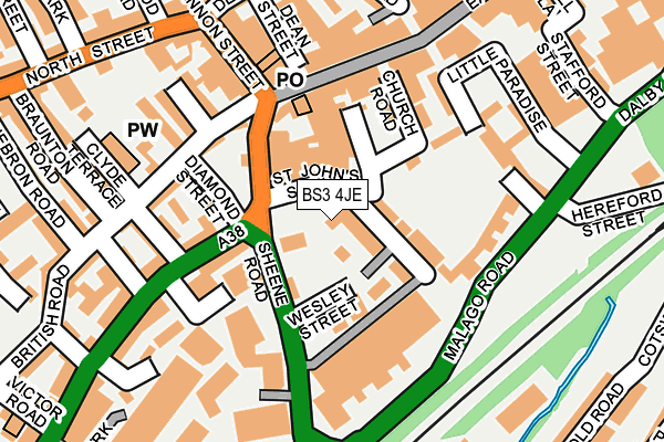
BS3 4JE is located in the Southville electoral ward, within the unitary authority of Bristol, City of and the English Parliamentary constituency of Bristol South. The Sub Integrated Care Board (ICB) Location is NHS Bristol, North Somerset and South Gloucestershire ICB - 15C and the police force is Avon and Somerset. This postcode has been in use since April 1987.


GetTheData
Source: OS OpenMap – Local (Ordnance Survey)
Source: OS VectorMap District (Ordnance Survey)
Licence: Open Government Licence (requires attribution)
| Easting | 358403 |
| Northing | 171371 |
| Latitude | 51.439796 |
| Longitude | -2.599857 |
GetTheData
Source: Open Postcode Geo
Licence: Open Government Licence
| Country | England |
| Postcode District | BS3 |
➜ See where BS3 is on a map ➜ Where is Bristol? | |
GetTheData
Source: Land Registry Price Paid Data
Licence: Open Government Licence
Elevation or altitude of BS3 4JE as distance above sea level:
| Metres | Feet | |
|---|---|---|
| Elevation | 20m | 66ft |
Elevation is measured from the approximate centre of the postcode, to the nearest point on an OS contour line from OS Terrain 50, which has contour spacing of ten vertical metres.
➜ How high above sea level am I? Find the elevation of your current position using your device's GPS.
GetTheData
Source: Open Postcode Elevation
Licence: Open Government Licence
| Ward | Southville |
| Constituency | Bristol South |
GetTheData
Source: ONS Postcode Database
Licence: Open Government Licence
| Wesley Street (Sheene Road) | Bedminster | 82m |
| Wesley Street (Sheene Road) | Bedminster | 102m |
| Cannon Street (East Street) | Bedminster | 137m |
| East Street (West Street) | Bedminster | 139m |
| Dean Street (North Street) | Bedminster | 231m |
| Bedminster Station | 0.4km |
| Parson Street Station | 0.9km |
| Bristol Temple Meads Station | 1.7km |
GetTheData
Source: NaPTAN
Licence: Open Government Licence
GetTheData
Source: ONS Postcode Database
Licence: Open Government Licence


➜ Get more ratings from the Food Standards Agency
GetTheData
Source: Food Standards Agency
Licence: FSA terms & conditions
| Last Collection | |||
|---|---|---|---|
| Location | Mon-Fri | Sat | Distance |
| Cannon Street Post Office | 18:00 | 13:00 | 143m |
| Cannon Street Post Office | 18:00 | 13:00 | 149m |
| Dalby Avenue | 17:45 | 11:45 | 362m |
GetTheData
Source: Dracos
Licence: Creative Commons Attribution-ShareAlike
The below table lists the International Territorial Level (ITL) codes (formerly Nomenclature of Territorial Units for Statistics (NUTS) codes) and Local Administrative Units (LAU) codes for BS3 4JE:
| ITL 1 Code | Name |
|---|---|
| TLK | South West (England) |
| ITL 2 Code | Name |
| TLK1 | Gloucestershire, Wiltshire and Bath/Bristol area |
| ITL 3 Code | Name |
| TLK11 | Bristol, City of |
| LAU 1 Code | Name |
| E06000023 | Bristol, City of |
GetTheData
Source: ONS Postcode Directory
Licence: Open Government Licence
The below table lists the Census Output Area (OA), Lower Layer Super Output Area (LSOA), and Middle Layer Super Output Area (MSOA) for BS3 4JE:
| Code | Name | |
|---|---|---|
| OA | E00174304 | |
| LSOA | E01033361 | Bristol 039F |
| MSOA | E02003050 | Bristol 039 |
GetTheData
Source: ONS Postcode Directory
Licence: Open Government Licence
| BS3 4JJ | St Johns Road | 68m |
| BS3 4BF | Granby Mews | 73m |
| BS3 4AE | Norfolk Place | 88m |
| BS3 4AX | Norfolk Place | 88m |
| BS3 4EQ | East Street | 93m |
| BS3 3NN | West Street | 108m |
| BS3 4EJ | East Street | 111m |
| BS3 4NF | Church Road | 111m |
| BS3 4NQ | Norfolk Place | 115m |
| BS3 3LF | Diamond Street | 122m |
GetTheData
Source: Open Postcode Geo; Land Registry Price Paid Data
Licence: Open Government Licence