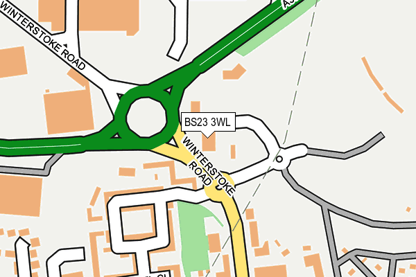
BS23 3WL lies on Weston Links in Weston-super-mare. BS23 3WL is located in the Weston-super-Mare Winterstoke electoral ward, within the unitary authority of North Somerset and the English Parliamentary constituency of Weston-Super-Mare. The Sub Integrated Care Board (ICB) Location is NHS Bristol, North Somerset and South Gloucestershire ICB - 15C and the police force is Avon and Somerset. This postcode has been in use since January 1995.


GetTheData
Source: OS OpenMap – Local (Ordnance Survey)
Source: OS VectorMap District (Ordnance Survey)
Licence: Open Government Licence (requires attribution)
| Easting | 333459 |
| Northing | 160390 |
| Latitude | 51.338687 |
| Longitude | -2.956627 |
GetTheData
Source: Open Postcode Geo
Licence: Open Government Licence
| Street | Weston Links |
| Town/City | Weston-super-mare |
| Country | England |
| Postcode District | BS23 |
➜ See where BS23 is on a map ➜ Where is Weston-Super-Mare? | |
GetTheData
Source: Land Registry Price Paid Data
Licence: Open Government Licence
Elevation or altitude of BS23 3WL as distance above sea level:
| Metres | Feet | |
|---|---|---|
| Elevation | 10m | 33ft |
Elevation is measured from the approximate centre of the postcode, to the nearest point on an OS contour line from OS Terrain 50, which has contour spacing of ten vertical metres.
➜ How high above sea level am I? Find the elevation of your current position using your device's GPS.
GetTheData
Source: Open Postcode Elevation
Licence: Open Government Licence
| Ward | Weston-super-mare Winterstoke |
| Constituency | Weston-super-mare |
GetTheData
Source: ONS Postcode Database
Licence: Open Government Licence
| Holms Road (Stuart Road) | Bourneville | 258m |
| Holms Road (Stuart Road) | Bourneville | 258m |
| Asda Store (Searle Cresent) | Bourneville | 265m |
| Waitrose (Searle Crescent) | Ashcombe | 269m |
| Asda Store (Searle Crescent) | Ashcombe | 292m |
| Weston-super-Mare Station | 1.2km |
| Weston Milton Station | 1.5km |
| Worle Station | 3.9km |
GetTheData
Source: NaPTAN
Licence: Open Government Licence
GetTheData
Source: ONS Postcode Database
Licence: Open Government Licence


➜ Get more ratings from the Food Standards Agency
GetTheData
Source: Food Standards Agency
Licence: FSA terms & conditions
| Last Collection | |||
|---|---|---|---|
| Location | Mon-Fri | Sat | Distance |
| Phillips Road | 18:00 | 11:30 | 317m |
| Drove Road | 17:45 | 13:00 | 474m |
| Weston Super Mare Post Office | 18:00 | 13:15 | 538m |
GetTheData
Source: Dracos
Licence: Creative Commons Attribution-ShareAlike
The below table lists the International Territorial Level (ITL) codes (formerly Nomenclature of Territorial Units for Statistics (NUTS) codes) and Local Administrative Units (LAU) codes for BS23 3WL:
| ITL 1 Code | Name |
|---|---|
| TLK | South West (England) |
| ITL 2 Code | Name |
| TLK1 | Gloucestershire, Wiltshire and Bath/Bristol area |
| ITL 3 Code | Name |
| TLK12 | Bath and North East Somerset, North Somerset and South Gloucestershire |
| LAU 1 Code | Name |
| E06000024 | North Somerset |
GetTheData
Source: ONS Postcode Directory
Licence: Open Government Licence
The below table lists the Census Output Area (OA), Lower Layer Super Output Area (LSOA), and Middle Layer Super Output Area (MSOA) for BS23 3WL:
| Code | Name | |
|---|---|---|
| OA | E00074820 | |
| LSOA | E01014809 | North Somerset 020E |
| MSOA | E02003084 | North Somerset 020 |
GetTheData
Source: ONS Postcode Directory
Licence: Open Government Licence
| BS23 3WG | Macfarlane Chase | 114m |
| BS23 3WP | Macfarlane Chase | 135m |
| BS23 3YW | Winterstoke Road | 159m |
| BS23 3WH | Jay View | 219m |
| BS23 3WN | Ankatel Close | 224m |
| BS23 3YU | Winterstoke Road | 236m |
| BS23 3XN | Stuart Road | 254m |
| BS23 3UZ | Phillips Road | 295m |
| BS23 3YT | Winterstoke Road | 321m |
| BS23 3XW | Stuart Road | 322m |
GetTheData
Source: Open Postcode Geo; Land Registry Price Paid Data
Licence: Open Government Licence