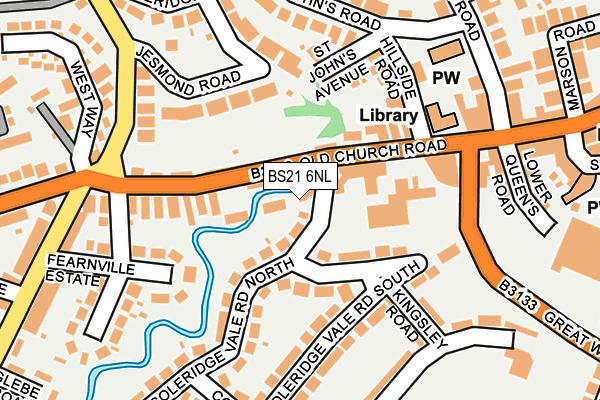
BS21 6NL is located in the Clevedon West electoral ward, within the unitary authority of North Somerset and the English Parliamentary constituency of North Somerset. The Sub Integrated Care Board (ICB) Location is NHS Bristol, North Somerset and South Gloucestershire ICB - 15C and the police force is Avon and Somerset. This postcode has been in use since January 1980.


GetTheData
Source: OS OpenMap – Local (Ordnance Survey)
Source: OS VectorMap District (Ordnance Survey)
Licence: Open Government Licence (requires attribution)
| Easting | 340518 |
| Northing | 171061 |
| Latitude | 51.435410 |
| Longitude | -2.857095 |
GetTheData
Source: Open Postcode Geo
Licence: Open Government Licence
| Country | England |
| Postcode District | BS21 |
➜ See where BS21 is on a map ➜ Where is Clevedon? | |
GetTheData
Source: Land Registry Price Paid Data
Licence: Open Government Licence
Elevation or altitude of BS21 6NL as distance above sea level:
| Metres | Feet | |
|---|---|---|
| Elevation | 10m | 33ft |
Elevation is measured from the approximate centre of the postcode, to the nearest point on an OS contour line from OS Terrain 50, which has contour spacing of ten vertical metres.
➜ How high above sea level am I? Find the elevation of your current position using your device's GPS.
GetTheData
Source: Open Postcode Elevation
Licence: Open Government Licence
| Ward | Clevedon West |
| Constituency | North Somerset |
GetTheData
Source: ONS Postcode Database
Licence: Open Government Licence
| Curzon Cinema (Old Church Road) | West Clevedon | 86m |
| Curzon Cinema | West Clevedon | 134m |
| Victoria Road (Old Church Road) | West Clevedon | 201m |
| West Way (Old Church Road) | West Clevedon | 233m |
| Morrisons (Great Western Road) | Clevedon | 242m |
| Yatton Station | 5.3km |
GetTheData
Source: NaPTAN
Licence: Open Government Licence
GetTheData
Source: ONS Postcode Database
Licence: Open Government Licence


➜ Get more ratings from the Food Standards Agency
GetTheData
Source: Food Standards Agency
Licence: FSA terms & conditions
| Last Collection | |||
|---|---|---|---|
| Location | Mon-Fri | Sat | Distance |
| Jesmond Road | 17:30 | 12:45 | 129m |
| St Johns Vicarage | 17:45 | 12:45 | 242m |
| Sunnyside Road | 17:45 | 12:45 | 324m |
GetTheData
Source: Dracos
Licence: Creative Commons Attribution-ShareAlike
| Risk of BS21 6NL flooding from rivers and sea | Low |
| ➜ BS21 6NL flood map | |
GetTheData
Source: Open Flood Risk by Postcode
Licence: Open Government Licence
The below table lists the International Territorial Level (ITL) codes (formerly Nomenclature of Territorial Units for Statistics (NUTS) codes) and Local Administrative Units (LAU) codes for BS21 6NL:
| ITL 1 Code | Name |
|---|---|
| TLK | South West (England) |
| ITL 2 Code | Name |
| TLK1 | Gloucestershire, Wiltshire and Bath/Bristol area |
| ITL 3 Code | Name |
| TLK12 | Bath and North East Somerset, North Somerset and South Gloucestershire |
| LAU 1 Code | Name |
| E06000024 | North Somerset |
GetTheData
Source: ONS Postcode Directory
Licence: Open Government Licence
The below table lists the Census Output Area (OA), Lower Layer Super Output Area (LSOA), and Middle Layer Super Output Area (MSOA) for BS21 6NL:
| Code | Name | |
|---|---|---|
| OA | E00074505 | |
| LSOA | E01014750 | North Somerset 007A |
| MSOA | E02003071 | North Somerset 007 |
GetTheData
Source: ONS Postcode Directory
Licence: Open Government Licence
| BS21 6NR | Coleridge Vale Road North | 45m |
| BS21 6FL | Coleridge Vale Road North | 68m |
| BS21 6NS | Coleridge Vale Road East | 74m |
| BS21 6PU | Old Church Road | 97m |
| BS21 6PT | Old Church Road | 99m |
| BS21 6NP | Old Church Road | 100m |
| BS21 7RZ | Jesmond Road | 120m |
| BS21 6PS | Coleridge Vale Road North | 138m |
| BS21 7XJ | Hillside Road | 146m |
| BS21 7TQ | St Johns Avenue | 147m |
GetTheData
Source: Open Postcode Geo; Land Registry Price Paid Data
Licence: Open Government Licence