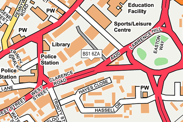
BS1 6ZA is located in the Central electoral ward, within the unitary authority of Bristol, City of and the English Parliamentary constituency of Bristol West. The Sub Integrated Care Board (ICB) Location is NHS Bristol, North Somerset and South Gloucestershire ICB - 15C and the police force is Avon and Somerset. This postcode has been in use since April 2017.


GetTheData
Source: OS OpenMap – Local (Ordnance Survey)
Source: OS VectorMap District (Ordnance Survey)
Licence: Open Government Licence (requires attribution)
| Easting | 358498 |
| Northing | 172199 |
| Latitude | 51.447246 |
| Longitude | -2.598590 |
GetTheData
Source: Open Postcode Geo
Licence: Open Government Licence
| Country | England |
| Postcode District | BS1 |
➜ See where BS1 is on a map ➜ Where is Bristol? | |
GetTheData
Source: Land Registry Price Paid Data
Licence: Open Government Licence
| Ward | Central |
| Constituency | Bristol West |
GetTheData
Source: ONS Postcode Database
Licence: Open Government Licence
| Gaol Ferry Bridge (Cumberland Road) | Harbour | 122m |
| Gaol Ferry Bridge (Cumberland Road) | Harbour | 138m |
| Dean Lane | Southville | 208m |
| Dean Lane (Coronation Road) | Southville | 211m |
| Cumberland Road | Harbour | 255m |
| Bedminster Station | 0.9km |
| Bristol Temple Meads Station | 1.2km |
| Parson Street Station | 1.7km |
GetTheData
Source: NaPTAN
Licence: Open Government Licence
GetTheData
Source: ONS Postcode Database
Licence: Open Government Licence


➜ Get more ratings from the Food Standards Agency
GetTheData
Source: Food Standards Agency
Licence: FSA terms & conditions
| Last Collection | |||
|---|---|---|---|
| Location | Mon-Fri | Sat | Distance |
| St Pauls Church | 16:45 | 11:45 | 207m |
| Cumberland Road | 17:00 | 11:15 | 254m |
| Prince Street | 17:15 | 12:30 | 337m |
GetTheData
Source: Dracos
Licence: Creative Commons Attribution-ShareAlike
| Risk of BS1 6ZA flooding from rivers and sea | Low |
| ➜ BS1 6ZA flood map | |
GetTheData
Source: Open Flood Risk by Postcode
Licence: Open Government Licence
The below table lists the International Territorial Level (ITL) codes (formerly Nomenclature of Territorial Units for Statistics (NUTS) codes) and Local Administrative Units (LAU) codes for BS1 6ZA:
| ITL 1 Code | Name |
|---|---|
| TLK | South West (England) |
| ITL 2 Code | Name |
| TLK1 | Gloucestershire, Wiltshire and Bath/Bristol area |
| ITL 3 Code | Name |
| TLK11 | Bristol, City of |
| LAU 1 Code | Name |
| E06000023 | Bristol, City of |
GetTheData
Source: ONS Postcode Directory
Licence: Open Government Licence
The below table lists the Census Output Area (OA), Lower Layer Super Output Area (LSOA), and Middle Layer Super Output Area (MSOA) for BS1 6ZA:
| Code | Name | |
|---|---|---|
| OA | E00073436 | |
| LSOA | E01014540 | Bristol 032B |
| MSOA | E02003043 | Bristol 032 |
GetTheData
Source: ONS Postcode Directory
Licence: Open Government Licence
| BS1 6UW | Gaol Ferry Steps | 115m |
| BS1 6UZ | Gaol Ferry Steps | 115m |
| BS1 4RH | Wapping Road | 141m |
| BS1 4RE | Draycot Place | 147m |
| BS1 6UQ | Cumberland Road | 186m |
| BS1 6UB | Bathurst Parade | 210m |
| BS1 4RG | Challoner Court | 218m |
| BS3 1AS | Coronation Road | 221m |
| BS1 4RL | Merchants Quay | 229m |
| BS3 1AT | Coronation Road | 246m |
GetTheData
Source: Open Postcode Geo; Land Registry Price Paid Data
Licence: Open Government Licence