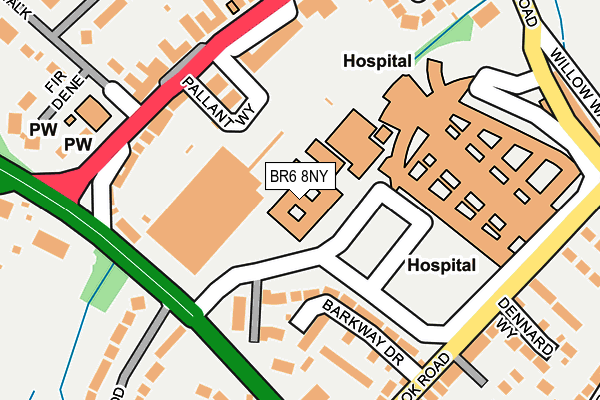
BR6 8NY is located in the Farnborough & Crofton electoral ward, within the London borough of Bromley and the English Parliamentary constituency of Orpington. The Sub Integrated Care Board (ICB) Location is NHS South East London ICB - 72Q and the police force is Metropolitan Police. This postcode has been in use since June 2000.


GetTheData
Source: OS OpenMap – Local (Ordnance Survey)
Source: OS VectorMap District (Ordnance Survey)
Licence: Open Government Licence (requires attribution)
| Easting | 543271 |
| Northing | 165008 |
| Latitude | 51.366071 |
| Longitude | 0.056668 |
GetTheData
Source: Open Postcode Geo
Licence: Open Government Licence
| Country | England |
| Postcode District | BR6 |
➜ See where BR6 is on a map ➜ Where is London? | |
GetTheData
Source: Land Registry Price Paid Data
Licence: Open Government Licence
Elevation or altitude of BR6 8NY as distance above sea level:
| Metres | Feet | |
|---|---|---|
| Elevation | 110m | 361ft |
Elevation is measured from the approximate centre of the postcode, to the nearest point on an OS contour line from OS Terrain 50, which has contour spacing of ten vertical metres.
➜ How high above sea level am I? Find the elevation of your current position using your device's GPS.
GetTheData
Source: Open Postcode Elevation
Licence: Open Government Licence
| Ward | Farnborough & Crofton |
| Constituency | Orpington |
GetTheData
Source: ONS Postcode Database
Licence: Open Government Licence
| Locksbottom Pallant Way (Pallant Way) | Locksbottom | 94m |
| Princess Royal University Hosp | Locksbottom | 113m |
| Princess Royal University Hosp | Locksbottom | 125m |
| Farnborough Common P R U Hospital (Farnborough Common) | Locksbottom | 170m |
| Locksbottom St Michael's Church (Crofton Road) | Locksbottom | 178m |
| Orpington Station | 2.4km |
| Petts Wood Station | 2.8km |
| Hayes (Kent) Station | 3.4km |
GetTheData
Source: NaPTAN
Licence: Open Government Licence
GetTheData
Source: ONS Postcode Database
Licence: Open Government Licence


➜ Get more ratings from the Food Standards Agency
GetTheData
Source: Food Standards Agency
Licence: FSA terms & conditions
| Last Collection | |||
|---|---|---|---|
| Location | Mon-Fri | Sat | Distance |
| Broadwater Gardens | 17:45 | 12:00 | 545m |
| Lakeside Drive (63) | 18:15 | 12:00 | 772m |
| Beverley Road (Opp' 1) | 18:00 | 12:00 | 1,013m |
GetTheData
Source: Dracos
Licence: Creative Commons Attribution-ShareAlike
The below table lists the International Territorial Level (ITL) codes (formerly Nomenclature of Territorial Units for Statistics (NUTS) codes) and Local Administrative Units (LAU) codes for BR6 8NY:
| ITL 1 Code | Name |
|---|---|
| TLI | London |
| ITL 2 Code | Name |
| TLI6 | Outer London - South |
| ITL 3 Code | Name |
| TLI61 | Bromley |
| LAU 1 Code | Name |
| E09000006 | Bromley |
GetTheData
Source: ONS Postcode Directory
Licence: Open Government Licence
The below table lists the Census Output Area (OA), Lower Layer Super Output Area (LSOA), and Middle Layer Super Output Area (MSOA) for BR6 8NY:
| Code | Name | |
|---|---|---|
| OA | E00003670 | |
| LSOA | E01000751 | Bromley 036C |
| MSOA | E02000162 | Bromley 036 |
GetTheData
Source: ONS Postcode Directory
Licence: Open Government Licence
| BR6 8PQ | Barkway Drive | 148m |
| BR6 8NP | Princess Parade | 153m |
| BR6 8NL | Crofton Road | 167m |
| BR6 8NN | Crofton Road | 194m |
| BR6 8PJ | Wellbrook Road | 208m |
| BR6 8NR | Crofton Road | 216m |
| BR6 8NE | Farnborough Common | 237m |
| BR6 7AB | Wellbrook Road | 240m |
| BR6 8NW | Crofton Road | 242m |
| BR6 8NS | Wolds Drive | 254m |
GetTheData
Source: Open Postcode Geo; Land Registry Price Paid Data
Licence: Open Government Licence