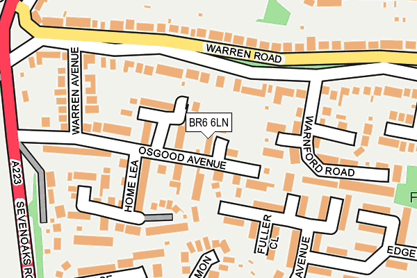
BR6 6LN lies on Wolsey Mews in Orpington. BR6 6LN is located in the Chelsfield electoral ward, within the London borough of Bromley and the English Parliamentary constituency of Orpington. The Sub Integrated Care Board (ICB) Location is NHS South East London ICB - 72Q and the police force is Metropolitan Police. This postcode has been in use since March 1988.


GetTheData
Source: OS OpenMap – Local (Ordnance Survey)
Source: OS VectorMap District (Ordnance Survey)
Licence: Open Government Licence (requires attribution)
| Easting | 545811 |
| Northing | 164257 |
| Latitude | 51.358677 |
| Longitude | 0.092821 |
GetTheData
Source: Open Postcode Geo
Licence: Open Government Licence
| Street | Wolsey Mews |
| Town/City | Orpington |
| Country | England |
| Postcode District | BR6 |
➜ See where BR6 is on a map ➜ Where is London? | |
GetTheData
Source: Land Registry Price Paid Data
Licence: Open Government Licence
Elevation or altitude of BR6 6LN as distance above sea level:
| Metres | Feet | |
|---|---|---|
| Elevation | 90m | 295ft |
Elevation is measured from the approximate centre of the postcode, to the nearest point on an OS contour line from OS Terrain 50, which has contour spacing of ten vertical metres.
➜ How high above sea level am I? Find the elevation of your current position using your device's GPS.
GetTheData
Source: Open Postcode Elevation
Licence: Open Government Licence
| Ward | Chelsfield |
| Constituency | Orpington |
GetTheData
Source: ONS Postcode Database
Licence: Open Government Licence
2021 25 JUN £725,000 |
5, WOLSEY MEWS, ORPINGTON, BR6 6LN 2003 19 SEP £363,000 |
3, WOLSEY MEWS, ORPINGTON, BR6 6LN 2003 6 JUN £349,995 |
2, WOLSEY MEWS, ORPINGTON, BR6 6LN 2000 30 JUN £262,500 |
1997 1 JUL £179,950 |
GetTheData
Source: HM Land Registry Price Paid Data
Licence: Contains HM Land Registry data © Crown copyright and database right 2025. This data is licensed under the Open Government Licence v3.0.
| Glentrammon Road (Sevenoaks Road) | Green Street Green | 343m |
| Crescent Way (Br6) (Sevenoaks Road) | Farnborough | 345m |
| Highfield Avenue (Br6) (Glentrammon Road) | Green Street Green | 352m |
| Crescent Way (Br6) (Sevenoaks Road) | Farnborough | 356m |
| Farnborough Hill (Glentrammon Road) | Green Street Green | 371m |
| Chelsfield Station | 1.2km |
| Orpington Station | 1.6km |
| Knockholt Station | 3km |
GetTheData
Source: NaPTAN
Licence: Open Government Licence
| Percentage of properties with Next Generation Access | 100.0% |
| Percentage of properties with Superfast Broadband | 100.0% |
| Percentage of properties with Ultrafast Broadband | 100.0% |
| Percentage of properties with Full Fibre Broadband | 0.0% |
Superfast Broadband is between 30Mbps and 300Mbps
Ultrafast Broadband is > 300Mbps
| Median download speed | 65.6Mbps |
| Average download speed | 114.3Mbps |
| Maximum download speed | 350.00Mbps |
| Median upload speed | 19.9Mbps |
| Average upload speed | 16.6Mbps |
| Maximum upload speed | 19.99Mbps |
| Percentage of properties unable to receive 2Mbps | 0.0% |
| Percentage of properties unable to receive 5Mbps | 0.0% |
| Percentage of properties unable to receive 10Mbps | 0.0% |
| Percentage of properties unable to receive 30Mbps | 0.0% |
GetTheData
Source: Ofcom
Licence: Ofcom Terms of Use (requires attribution)
GetTheData
Source: ONS Postcode Database
Licence: Open Government Licence


➜ Get more ratings from the Food Standards Agency
GetTheData
Source: Food Standards Agency
Licence: FSA terms & conditions
| Last Collection | |||
|---|---|---|---|
| Location | Mon-Fri | Sat | Distance |
| Cloonmore Avenue (70) | 18:00 | 12:00 | 257m |
| Glentrammon Road (47) | 18:00 | 12:00 | 308m |
| Borkwood Tso | 18:15 | 12:00 | 376m |
GetTheData
Source: Dracos
Licence: Creative Commons Attribution-ShareAlike
The below table lists the International Territorial Level (ITL) codes (formerly Nomenclature of Territorial Units for Statistics (NUTS) codes) and Local Administrative Units (LAU) codes for BR6 6LN:
| ITL 1 Code | Name |
|---|---|
| TLI | London |
| ITL 2 Code | Name |
| TLI6 | Outer London - South |
| ITL 3 Code | Name |
| TLI61 | Bromley |
| LAU 1 Code | Name |
| E09000006 | Bromley |
GetTheData
Source: ONS Postcode Directory
Licence: Open Government Licence
The below table lists the Census Output Area (OA), Lower Layer Super Output Area (LSOA), and Middle Layer Super Output Area (MSOA) for BR6 6LN:
| Code | Name | |
|---|---|---|
| OA | E00003289 | |
| LSOA | E01000686 | Bromley 037C |
| MSOA | E02000163 | Bromley 037 |
GetTheData
Source: ONS Postcode Directory
Licence: Open Government Licence
| BR6 6NP | King Henry Mews | 55m |
| BR6 6NR | Raleigh Mews | 56m |
| BR6 6JU | Osgood Gardens | 80m |
| BR6 6HY | Warren Road | 88m |
| BR6 6NG | Amberley Close | 95m |
| BR6 6LT | Home Lea | 116m |
| BR6 6JT | Osgood Avenue | 125m |
| BR6 6LU | Briarswood Way | 167m |
| BR6 6LB | Fir Tree Close | 169m |
| BR6 6NA | April Close | 173m |
GetTheData
Source: Open Postcode Geo; Land Registry Price Paid Data
Licence: Open Government Licence