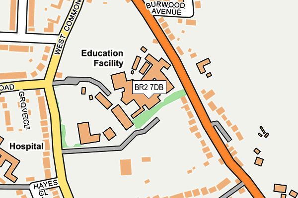
BR2 7DB is located in the Hayes & Coney Hall electoral ward, within the London borough of Bromley and the English Parliamentary constituency of Beckenham. The Sub Integrated Care Board (ICB) Location is NHS South East London ICB - 72Q and the police force is Metropolitan Police. This postcode has been in use since January 1980.


GetTheData
Source: OS OpenMap – Local (Ordnance Survey)
Source: OS VectorMap District (Ordnance Survey)
Licence: Open Government Licence (requires attribution)
| Easting | 540620 |
| Northing | 165814 |
| Latitude | 51.373976 |
| Longitude | 0.018931 |
GetTheData
Source: Open Postcode Geo
Licence: Open Government Licence
| Country | England |
| Postcode District | BR2 |
➜ See where BR2 is on a map ➜ Where is London? | |
GetTheData
Source: Land Registry Price Paid Data
Licence: Open Government Licence
Elevation or altitude of BR2 7DB as distance above sea level:
| Metres | Feet | |
|---|---|---|
| Elevation | 80m | 262ft |
Elevation is measured from the approximate centre of the postcode, to the nearest point on an OS contour line from OS Terrain 50, which has contour spacing of ten vertical metres.
➜ How high above sea level am I? Find the elevation of your current position using your device's GPS.
GetTheData
Source: Open Postcode Elevation
Licence: Open Government Licence
| Ward | Hayes & Coney Hall |
| Constituency | Beckenham |
GetTheData
Source: ONS Postcode Database
Licence: Open Government Licence
| Baston School (Baston Road) | Hayes | 92m |
| Baston School (Baston Road) | Hayes | 144m |
| Hayes Street | Hayes | 275m |
| Hayes Street (Baston Road) | Hayes | 309m |
| Five Elms Road (Baston Road) | Hayes | 322m |
| Hayes (Kent) Station | 0.6km |
| West Wickham Station | 2.5km |
| Bromley South Station | 2.9km |
GetTheData
Source: NaPTAN
Licence: Open Government Licence
GetTheData
Source: ONS Postcode Database
Licence: Open Government Licence


➜ Get more ratings from the Food Standards Agency
GetTheData
Source: Food Standards Agency
Licence: FSA terms & conditions
| Last Collection | |||
|---|---|---|---|
| Location | Mon-Fri | Sat | Distance |
| Baston Road (57) | 18:00 | 12:00 | 170m |
| Station Hill (1) | 18:30 | 12:00 | 475m |
| Husseywell Crescent (10) | 18:30 | 12:00 | 591m |
GetTheData
Source: Dracos
Licence: Creative Commons Attribution-ShareAlike
The below table lists the International Territorial Level (ITL) codes (formerly Nomenclature of Territorial Units for Statistics (NUTS) codes) and Local Administrative Units (LAU) codes for BR2 7DB:
| ITL 1 Code | Name |
|---|---|
| TLI | London |
| ITL 2 Code | Name |
| TLI6 | Outer London - South |
| ITL 3 Code | Name |
| TLI61 | Bromley |
| LAU 1 Code | Name |
| E09000006 | Bromley |
GetTheData
Source: ONS Postcode Directory
Licence: Open Government Licence
The below table lists the Census Output Area (OA), Lower Layer Super Output Area (LSOA), and Middle Layer Super Output Area (MSOA) for BR2 7DB:
| Code | Name | |
|---|---|---|
| OA | E00003718 | |
| LSOA | E01000765 | Bromley 034D |
| MSOA | E02000160 | Bromley 034 |
GetTheData
Source: ONS Postcode Directory
Licence: Open Government Licence
| BR2 7BE | Baston Road | 121m |
| BR2 7BS | Baston Road | 148m |
| BR2 7BT | Redgate Drive | 203m |
| BR2 7BH | Burwood Avenue | 206m |
| BR2 7BY | West Common Road | 258m |
| BR2 7BX | West Common Road | 263m |
| BR2 7BD | Baston Road | 277m |
| BR2 7BU | Baston Road | 279m |
| BR2 7BG | Hayes Wood Avenue | 284m |
| BR2 7AR | Grove Close | 292m |
GetTheData
Source: Open Postcode Geo; Land Registry Price Paid Data
Licence: Open Government Licence