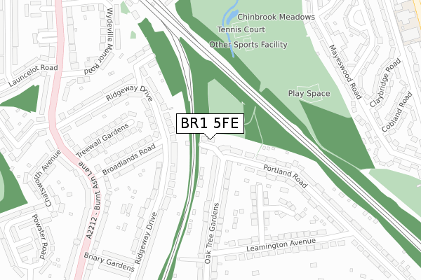
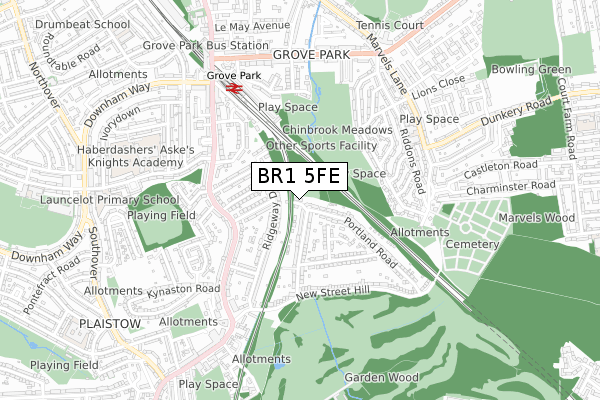
BR1 5FE is located in the Plaistow electoral ward, within the London borough of Bromley and the English Parliamentary constituency of Bromley and Chislehurst. The Sub Integrated Care Board (ICB) Location is NHS South East London ICB - 72Q and the police force is Metropolitan Police. This postcode has been in use since February 2020.


GetTheData
Source: OS Open Zoomstack (Ordnance Survey)
Licence: Open Government Licence (requires attribution)
Attribution: Contains OS data © Crown copyright and database right 2024
Source: Open Postcode Geo
Licence: Open Government Licence (requires attribution)
Attribution: Contains OS data © Crown copyright and database right 2024; Contains Royal Mail data © Royal Mail copyright and database right 2024; Source: Office for National Statistics licensed under the Open Government Licence v.3.0
| Easting | 540963 |
| Northing | 171634 |
| Latitude | 51.426189 |
| Longitude | 0.026192 |
GetTheData
Source: Open Postcode Geo
Licence: Open Government Licence
| Country | England |
| Postcode District | BR1 |
➜ See where BR1 is on a map ➜ Where is London? | |
GetTheData
Source: Land Registry Price Paid Data
Licence: Open Government Licence
| Ward | Plaistow |
| Constituency | Bromley And Chislehurst |
GetTheData
Source: ONS Postcode Database
Licence: Open Government Licence
| Treewall Gardens (Burnt Ash Lane) | Grove Park | 288m |
| Treewall Gardens (Burnt Ash Lane) | Grove Park | 357m |
| Launcelot Road (Baring Road) | Grove Park | 375m |
| Launcelot Road (Baring Road) | Grove Park | 409m |
| Grove Park Cemetery (Marvels Lane) | Grove Park | 544m |
| Grove Park Station | 0.6km |
| Sundridge Park Station | 1.4km |
| Elmstead Woods Station | 1.6km |
GetTheData
Source: NaPTAN
Licence: Open Government Licence
GetTheData
Source: ONS Postcode Database
Licence: Open Government Licence


➜ Get more ratings from the Food Standards Agency
GetTheData
Source: Food Standards Agency
Licence: FSA terms & conditions
| Last Collection | |||
|---|---|---|---|
| Location | Mon-Fri | Sat | Distance |
| Burnt Ash Lane (240) | 18:15 | 12:00 | 350m |
| Riddons Road | 17:30 | 12:00 | 566m |
| Post Office | 17:30 | 12:00 | 583m |
GetTheData
Source: Dracos
Licence: Creative Commons Attribution-ShareAlike
The below table lists the International Territorial Level (ITL) codes (formerly Nomenclature of Territorial Units for Statistics (NUTS) codes) and Local Administrative Units (LAU) codes for BR1 5FE:
| ITL 1 Code | Name |
|---|---|
| TLI | London |
| ITL 2 Code | Name |
| TLI6 | Outer London - South |
| ITL 3 Code | Name |
| TLI61 | Bromley |
| LAU 1 Code | Name |
| E09000006 | Bromley |
GetTheData
Source: ONS Postcode Directory
Licence: Open Government Licence
The below table lists the Census Output Area (OA), Lower Layer Super Output Area (LSOA), and Middle Layer Super Output Area (MSOA) for BR1 5FE:
| Code | Name | |
|---|---|---|
| OA | E00004006 | |
| LSOA | E01000818 | Bromley 040B |
| MSOA | E02006782 | Bromley 040 |
GetTheData
Source: ONS Postcode Directory
Licence: Open Government Licence
| BR1 5BE | Oaktree Gardens | 106m |
| BR1 5BG | Oaktree Gardens | 136m |
| BR1 5DE | Broadlands Road | 163m |
| BR1 5DB | Ridgeway Drive | 167m |
| BR1 5BB | Portland Road | 185m |
| BR1 5BD | Portland Road | 200m |
| BR1 5BP | Leamington Close | 211m |
| BR1 5DD | Ridgeway Drive | 215m |
| BR1 5BT | Treewall Gardens | 217m |
| BR1 5DF | Broadlands Road | 233m |
GetTheData
Source: Open Postcode Geo; Land Registry Price Paid Data
Licence: Open Government Licence