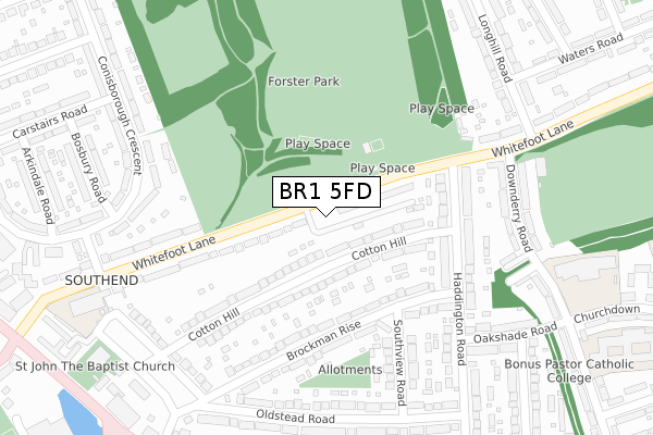
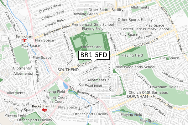
BR1 5FD is located in the Catford South electoral ward, within the London borough of Lewisham and the English Parliamentary constituency of Lewisham East. The Sub Integrated Care Board (ICB) Location is NHS South East London ICB - 72Q and the police force is Metropolitan Police. This postcode has been in use since October 2019.


GetTheData
Source: OS Open Zoomstack (Ordnance Survey)
Licence: Open Government Licence (requires attribution)
Attribution: Contains OS data © Crown copyright and database right 2025
Source: Open Postcode Geo
Licence: Open Government Licence (requires attribution)
Attribution: Contains OS data © Crown copyright and database right 2025; Contains Royal Mail data © Royal Mail copyright and database right 2025; Source: Office for National Statistics licensed under the Open Government Licence v.3.0
| Easting | 538701 |
| Northing | 172011 |
| Latitude | 51.430134 |
| Longitude | -0.006175 |
GetTheData
Source: Open Postcode Geo
Licence: Open Government Licence
| Country | England |
| Postcode District | BR1 |
➜ See where BR1 is on a map ➜ Where is London? | |
GetTheData
Source: Land Registry Price Paid Data
Licence: Open Government Licence
| Ward | Catford South |
| Constituency | Lewisham East |
GetTheData
Source: ONS Postcode Database
Licence: Open Government Licence
| Whitefoot Lane Forster House | Southend | 32m |
| Whitefoot Lane Forster House (Whitefoot Lane) | Southend | 56m |
| Haddington Road (Whitefoot Lane) | Southend | 170m |
| Haddington Road (Whitefoot Lane) | Southend | 249m |
| Downderry Road | Southend | 288m |
| Beckenham Hill Station | 0.9km |
| Bellingham Station | 1km |
| Ravensbourne Station | 1.8km |
GetTheData
Source: NaPTAN
Licence: Open Government Licence
GetTheData
Source: ONS Postcode Database
Licence: Open Government Licence


➜ Get more ratings from the Food Standards Agency
GetTheData
Source: Food Standards Agency
Licence: FSA terms & conditions
| Last Collection | |||
|---|---|---|---|
| Location | Mon-Fri | Sat | Distance |
| Downderry Road (115) | 18:00 | 12:00 | 327m |
| Beachborough Road (5) | 18:15 | 12:00 | 333m |
| Longhill Road | 17:30 | 12:00 | 434m |
GetTheData
Source: Dracos
Licence: Creative Commons Attribution-ShareAlike
The below table lists the International Territorial Level (ITL) codes (formerly Nomenclature of Territorial Units for Statistics (NUTS) codes) and Local Administrative Units (LAU) codes for BR1 5FD:
| ITL 1 Code | Name |
|---|---|
| TLI | London |
| ITL 2 Code | Name |
| TLI4 | Inner London - East |
| ITL 3 Code | Name |
| TLI44 | Lewisham and Southwark |
| LAU 1 Code | Name |
| E09000023 | Lewisham |
GetTheData
Source: ONS Postcode Directory
Licence: Open Government Licence
The below table lists the Census Output Area (OA), Lower Layer Super Output Area (LSOA), and Middle Layer Super Output Area (MSOA) for BR1 5FD:
| Code | Name | |
|---|---|---|
| OA | E00016971 | |
| LSOA | E01003348 | Lewisham 030B |
| MSOA | E02000682 | Lewisham 030 |
GetTheData
Source: ONS Postcode Directory
Licence: Open Government Licence
| BR1 5RS | Cotton Hill | 63m |
| BR1 5RR | Cotton Hill | 96m |
| BR1 5SD | Whitefoot Lane | 99m |
| BR1 5SB | Whitefoot Lane | 104m |
| BR1 5RE | Brockman Rise | 151m |
| BR1 5RT | Cotton Hill | 181m |
| BR1 5RP | Cotton Hill | 183m |
| BR1 5RG | Haddington Road | 198m |
| BR1 5RA | Brockman Rise | 210m |
| BR1 5RF | Brockman Rise | 211m |
GetTheData
Source: Open Postcode Geo; Land Registry Price Paid Data
Licence: Open Government Licence