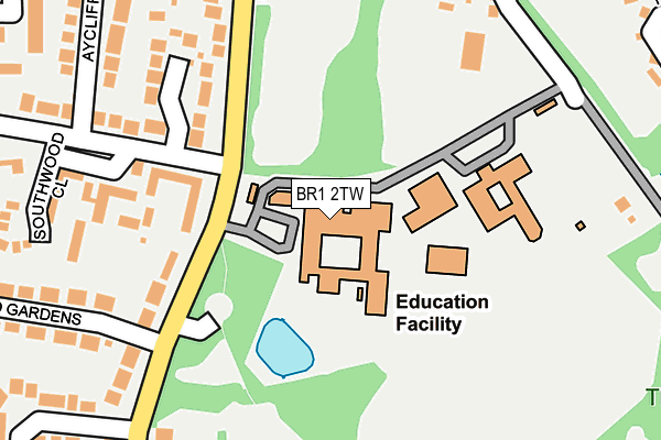
BR1 2TW is located in the Bickley & Sundridge electoral ward, within the London borough of Bromley and the English Parliamentary constituency of Bromley and Chislehurst. The Sub Integrated Care Board (ICB) Location is NHS South East London ICB - 72Q and the police force is Metropolitan Police. This postcode has been in use since April 1986.


GetTheData
Source: OS OpenMap – Local (Ordnance Survey)
Source: OS VectorMap District (Ordnance Survey)
Licence: Open Government Licence (requires attribution)
| Easting | 543210 |
| Northing | 168259 |
| Latitude | 51.395300 |
| Longitude | 0.057102 |
GetTheData
Source: Open Postcode Geo
Licence: Open Government Licence
| Country | England |
| Postcode District | BR1 |
➜ See where BR1 is on a map ➜ Where is Chislehurst? | |
GetTheData
Source: Land Registry Price Paid Data
Licence: Open Government Licence
Elevation or altitude of BR1 2TW as distance above sea level:
| Metres | Feet | |
|---|---|---|
| Elevation | 80m | 262ft |
Elevation is measured from the approximate centre of the postcode, to the nearest point on an OS contour line from OS Terrain 50, which has contour spacing of ten vertical metres.
➜ How high above sea level am I? Find the elevation of your current position using your device's GPS.
GetTheData
Source: Open Postcode Elevation
Licence: Open Government Licence
| Ward | Bickley & Sundridge |
| Constituency | Bromley And Chislehurst |
GetTheData
Source: ONS Postcode Database
Licence: Open Government Licence
| Bromley High School (Blackbrook Lane) | Southborough | 147m |
| Bromley High School (Blackbrook Lane) | Southborough | 153m |
| Northumberland Gardens (Br1) (Oldfield Road) | Southborough | 166m |
| Blackbrook Lane Southborough Lane (Blackbrook Lane) | Southborough | 424m |
| Barfield Road | Bickley | 448m |
| Bickley Station | 1km |
| Chislehurst Station | 1.1km |
| Petts Wood Station | 1.4km |
GetTheData
Source: NaPTAN
Licence: Open Government Licence
GetTheData
Source: ONS Postcode Database
Licence: Open Government Licence


➜ Get more ratings from the Food Standards Agency
GetTheData
Source: Food Standards Agency
Licence: FSA terms & conditions
| Last Collection | |||
|---|---|---|---|
| Location | Mon-Fri | Sat | Distance |
| Oldfield Road | 18:15 | 12:00 | 131m |
| Blackbrook P.o. | 18:15 | 12:00 | 575m |
| Southborough Lane (368) | 18:15 | 12:00 | 687m |
GetTheData
Source: Dracos
Licence: Creative Commons Attribution-ShareAlike
The below table lists the International Territorial Level (ITL) codes (formerly Nomenclature of Territorial Units for Statistics (NUTS) codes) and Local Administrative Units (LAU) codes for BR1 2TW:
| ITL 1 Code | Name |
|---|---|
| TLI | London |
| ITL 2 Code | Name |
| TLI6 | Outer London - South |
| ITL 3 Code | Name |
| TLI61 | Bromley |
| LAU 1 Code | Name |
| E09000006 | Bromley |
GetTheData
Source: ONS Postcode Directory
Licence: Open Government Licence
The below table lists the Census Output Area (OA), Lower Layer Super Output Area (LSOA), and Middle Layer Super Output Area (MSOA) for BR1 2TW:
| Code | Name | |
|---|---|---|
| OA | E00003151 | |
| LSOA | E01000652 | Bromley 022B |
| MSOA | E02000148 | Bromley 022 |
GetTheData
Source: ONS Postcode Directory
Licence: Open Government Licence
| BR1 2XD | Northumberland Gardens | 175m |
| BR1 2LS | Blackbrook Lane | 178m |
| BR1 2LU | Southwood Close | 250m |
| BR1 2LX | Aycliffe Close | 267m |
| BR2 8AZ | Blackbrook Lane | 296m |
| BR1 2LP | Blackbrook Lane | 296m |
| BR1 2LZ | Springfield Gardens | 339m |
| BR1 2LN | Thornet Wood Road | 341m |
| BR1 2FD | Boulter Close | 350m |
| BR1 2LY | Springfield Gardens | 353m |
GetTheData
Source: Open Postcode Geo; Land Registry Price Paid Data
Licence: Open Government Licence