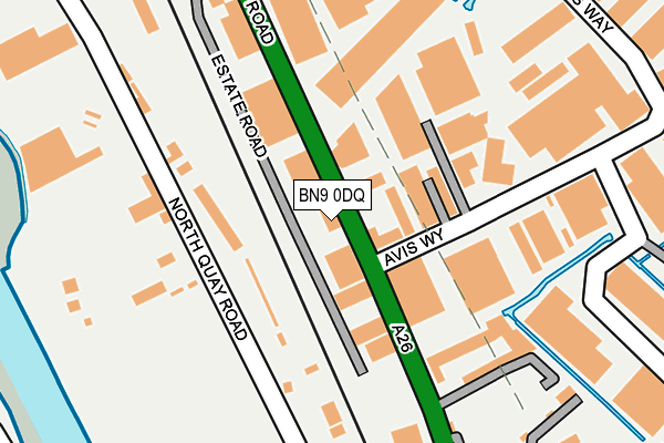
BN9 0DQ lies on Euro Business Park in Newhaven. BN9 0DQ is located in the Newhaven North electoral ward, within the local authority district of Lewes and the English Parliamentary constituency of Lewes. The Sub Integrated Care Board (ICB) Location is NHS Sussex ICB - 97R and the police force is Sussex. This postcode has been in use since July 1990.


GetTheData
Source: OS OpenMap – Local (Ordnance Survey)
Source: OS VectorMap District (Ordnance Survey)
Licence: Open Government Licence (requires attribution)
| Easting | 544852 |
| Northing | 101934 |
| Latitude | 50.798871 |
| Longitude | 0.054100 |
GetTheData
Source: Open Postcode Geo
Licence: Open Government Licence
| Street | Euro Business Park |
| Town/City | Newhaven |
| Country | England |
| Postcode District | BN9 |
➜ See where BN9 is on a map ➜ Where is Newhaven? | |
GetTheData
Source: Land Registry Price Paid Data
Licence: Open Government Licence
Elevation or altitude of BN9 0DQ as distance above sea level:
| Metres | Feet | |
|---|---|---|
| Elevation | 10m | 33ft |
Elevation is measured from the approximate centre of the postcode, to the nearest point on an OS contour line from OS Terrain 50, which has contour spacing of ten vertical metres.
➜ How high above sea level am I? Find the elevation of your current position using your device's GPS.
GetTheData
Source: Open Postcode Elevation
Licence: Open Government Licence
| Ward | Newhaven North |
| Constituency | Lewes |
GetTheData
Source: ONS Postcode Database
Licence: Open Government Licence
| Avis Way | Newhaven | 182m |
| Avis Way | Newhaven | 218m |
| Boc Edwards (Avis Way) | Newhaven | 290m |
| Boc Edwards (Avis Way) | Newhaven | 308m |
| Drove Road | Newhaven | 350m |
| Newhaven Town Station | 0.5km |
| Newhaven Harbour Station | 1km |
| Bishopstone Station | 2.9km |
GetTheData
Source: NaPTAN
Licence: Open Government Licence
| Median download speed | 76.6Mbps |
| Average download speed | 73.5Mbps |
| Maximum download speed | 80.00Mbps |
| Median upload speed | 20.0Mbps |
| Average upload speed | 17.7Mbps |
| Maximum upload speed | 20.00Mbps |
GetTheData
Source: Ofcom
Licence: Ofcom Terms of Use (requires attribution)
Estimated total energy consumption in BN9 0DQ by fuel type, 2015.
| Consumption (kWh) | 113,505 |
|---|---|
| Meter count | 13 |
| Mean (kWh/meter) | 8,731 |
| Median (kWh/meter) | 4,344 |
GetTheData
Source: Postcode level gas estimates: 2015 (experimental)
Source: Postcode level electricity estimates: 2015 (experimental)
Licence: Open Government Licence
GetTheData
Source: ONS Postcode Database
Licence: Open Government Licence


➜ Get more ratings from the Food Standards Agency
GetTheData
Source: Food Standards Agency
Licence: FSA terms & conditions
| Last Collection | |||
|---|---|---|---|
| Location | Mon-Fri | Sat | Distance |
| South Way | 17:15 | 12:00 | 611m |
| Newhaven Post Office | 17:30 | 12:30 | 629m |
| Royal Mail High Street | 18:15 | 12:30 | 728m |
GetTheData
Source: Dracos
Licence: Creative Commons Attribution-ShareAlike
| Risk of BN9 0DQ flooding from rivers and sea | Medium |
| ➜ BN9 0DQ flood map | |
GetTheData
Source: Open Flood Risk by Postcode
Licence: Open Government Licence
The below table lists the International Territorial Level (ITL) codes (formerly Nomenclature of Territorial Units for Statistics (NUTS) codes) and Local Administrative Units (LAU) codes for BN9 0DQ:
| ITL 1 Code | Name |
|---|---|
| TLJ | South East (England) |
| ITL 2 Code | Name |
| TLJ2 | Surrey, East and West Sussex |
| ITL 3 Code | Name |
| TLJ22 | East Sussex CC |
| LAU 1 Code | Name |
| E07000063 | Lewes |
GetTheData
Source: ONS Postcode Directory
Licence: Open Government Licence
The below table lists the Census Output Area (OA), Lower Layer Super Output Area (LSOA), and Middle Layer Super Output Area (MSOA) for BN9 0DQ:
| Code | Name | |
|---|---|---|
| OA | E00106899 | |
| LSOA | E01021047 | Lewes 008C |
| MSOA | E02004386 | Lewes 008 |
GetTheData
Source: ONS Postcode Directory
Licence: Open Government Licence
| BN9 0DD | The Willow Estate | 146m |
| BN9 0DH | Avis Way | 177m |
| BN9 0DS | Avis Way | 325m |
| BN9 0DP | Avis Way | 329m |
| BN9 0HE | New Road | 400m |
| BN9 0PP | Avis Road | 423m |
| BN9 0PR | Avis Road | 466m |
| BN9 0PQ | Cottage Close | 492m |
| BN9 0PS | Powell Gardens | 498m |
| BN9 0AS | Railway Road | 504m |
GetTheData
Source: Open Postcode Geo; Land Registry Price Paid Data
Licence: Open Government Licence