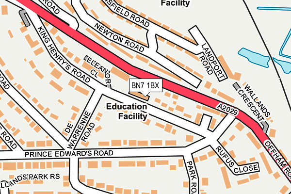
BN7 1BX is located in the Lewes Castle electoral ward, within the local authority district of Lewes and the English Parliamentary constituency of Lewes. The Sub Integrated Care Board (ICB) Location is NHS Sussex ICB - 97R and the police force is Sussex. This postcode has been in use since January 1980.


GetTheData
Source: OS OpenMap – Local (Ordnance Survey)
Source: OS VectorMap District (Ordnance Survey)
Licence: Open Government Licence (requires attribution)
| Easting | 540980 |
| Northing | 110491 |
| Latitude | 50.876727 |
| Longitude | 0.002481 |
GetTheData
Source: Open Postcode Geo
Licence: Open Government Licence
| Country | England |
| Postcode District | BN7 |
➜ See where BN7 is on a map ➜ Where is Lewes? | |
GetTheData
Source: Land Registry Price Paid Data
Licence: Open Government Licence
Elevation or altitude of BN7 1BX as distance above sea level:
| Metres | Feet | |
|---|---|---|
| Elevation | 30m | 98ft |
Elevation is measured from the approximate centre of the postcode, to the nearest point on an OS contour line from OS Terrain 50, which has contour spacing of ten vertical metres.
➜ How high above sea level am I? Find the elevation of your current position using your device's GPS.
GetTheData
Source: Open Postcode Elevation
Licence: Open Government Licence
| Ward | Lewes Castle |
| Constituency | Lewes |
GetTheData
Source: ONS Postcode Database
Licence: Open Government Licence
| Prince Edward's Road (Offham Road) | Landport | 164m |
| Prince Edward's Road (Offham Road) | Landport | 164m |
| Stansfield Road | Landport | 167m |
| Newton Road | Landport | 206m |
| Lee Road | Landport | 286m |
| Lewes Station | 0.9km |
| Cooksbridge Station | 3.1km |
| Glynde Station | 5.1km |
GetTheData
Source: NaPTAN
Licence: Open Government Licence
GetTheData
Source: ONS Postcode Database
Licence: Open Government Licence


➜ Get more ratings from the Food Standards Agency
GetTheData
Source: Food Standards Agency
Licence: FSA terms & conditions
| Last Collection | |||
|---|---|---|---|
| Location | Mon-Fri | Sat | Distance |
| The Avenue | 17:30 | 11:30 | 248m |
| Wallands Crescent | 17:30 | 11:45 | 261m |
| Paddock Road | 17:30 | 11:30 | 439m |
GetTheData
Source: Dracos
Licence: Creative Commons Attribution-ShareAlike
The below table lists the International Territorial Level (ITL) codes (formerly Nomenclature of Territorial Units for Statistics (NUTS) codes) and Local Administrative Units (LAU) codes for BN7 1BX:
| ITL 1 Code | Name |
|---|---|
| TLJ | South East (England) |
| ITL 2 Code | Name |
| TLJ2 | Surrey, East and West Sussex |
| ITL 3 Code | Name |
| TLJ22 | East Sussex CC |
| LAU 1 Code | Name |
| E07000063 | Lewes |
GetTheData
Source: ONS Postcode Directory
Licence: Open Government Licence
The below table lists the Census Output Area (OA), Lower Layer Super Output Area (LSOA), and Middle Layer Super Output Area (MSOA) for BN7 1BX:
| Code | Name | |
|---|---|---|
| OA | E00106842 | |
| LSOA | E01021036 | Lewes 003D |
| MSOA | E02004381 | Lewes 003 |
GetTheData
Source: ONS Postcode Directory
Licence: Open Government Licence
| BN7 1BS | Sackville Close | 38m |
| BN7 1BT | King Henrys Road | 43m |
| BN7 1DD | Eleanor Close | 87m |
| BN7 1BJ | Prince Edwards Road | 96m |
| BN7 1BP | De Warrenne Road | 128m |
| BN7 2SH | Newton Road | 131m |
| BN7 1BQ | Queen Annes Close | 139m |
| BN7 1BE | Prince Edwards Road | 140m |
| BN7 2SL | Stansfield Road | 160m |
| BN7 1BD | Prince Edwards Road | 187m |
GetTheData
Source: Open Postcode Geo; Land Registry Price Paid Data
Licence: Open Government Licence