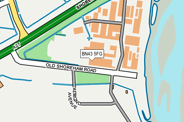
BN43 5FG is located in the Mash Barn electoral ward, within the local authority district of Adur and the English Parliamentary constituency of East Worthing and Shoreham. The Sub Integrated Care Board (ICB) Location is NHS Sussex ICB - 70F and the police force is Sussex. This postcode has been in use since February 1990.


GetTheData
Source: OS OpenMap – Local (Ordnance Survey)
Source: OS VectorMap District (Ordnance Survey)
Licence: Open Government Licence (requires attribution)
| Easting | 520358 |
| Northing | 106024 |
| Latitude | 50.841228 |
| Longitude | -0.291923 |
GetTheData
Source: Open Postcode Geo
Licence: Open Government Licence
| Country | England |
| Postcode District | BN43 |
➜ See where BN43 is on a map ➜ Where is Old Shoreham? | |
GetTheData
Source: Land Registry Price Paid Data
Licence: Open Government Licence
Elevation or altitude of BN43 5FG as distance above sea level:
| Metres | Feet | |
|---|---|---|
| Elevation | 10m | 33ft |
Elevation is measured from the approximate centre of the postcode, to the nearest point on an OS contour line from OS Terrain 50, which has contour spacing of ten vertical metres.
➜ How high above sea level am I? Find the elevation of your current position using your device's GPS.
GetTheData
Source: Open Postcode Elevation
Licence: Open Government Licence
| Ward | Mash Barn |
| Constituency | East Worthing And Shoreham |
GetTheData
Source: ONS Postcode Database
Licence: Open Government Licence
| Old Shoreham Road (A27) | North Lancing | 287m |
| Coombes Road (Old Shoreham Road) | North Lancing | 316m |
| Red Lion (Steyning Road) | Shoreham-by-sea | 438m |
| Red Lion (Old Shoreham Road) | Shoreham-by-sea | 460m |
| Connaught Avenue (Upper Shoreham Road) | Shoreham-by-sea | 500m |
| Shoreham-by-Sea (Sussex) Station | 1.6km |
| Lancing Station | 2.7km |
| Southwick Station | 4.1km |
GetTheData
Source: NaPTAN
Licence: Open Government Licence
GetTheData
Source: ONS Postcode Database
Licence: Open Government Licence


➜ Get more ratings from the Food Standards Agency
GetTheData
Source: Food Standards Agency
Licence: FSA terms & conditions
| Last Collection | |||
|---|---|---|---|
| Location | Mon-Fri | Sat | Distance |
| Old Shoreham Post Office | 17:30 | 12:15 | 572m |
| Shoreham Airport | 17:00 | 12:00 | 872m |
| Connaught Avenue | 17:30 | 11:45 | 874m |
GetTheData
Source: Dracos
Licence: Creative Commons Attribution-ShareAlike
| Risk of BN43 5FG flooding from rivers and sea | Low |
| ➜ BN43 5FG flood map | |
GetTheData
Source: Open Flood Risk by Postcode
Licence: Open Government Licence
The below table lists the International Territorial Level (ITL) codes (formerly Nomenclature of Territorial Units for Statistics (NUTS) codes) and Local Administrative Units (LAU) codes for BN43 5FG:
| ITL 1 Code | Name |
|---|---|
| TLJ | South East (England) |
| ITL 2 Code | Name |
| TLJ2 | Surrey, East and West Sussex |
| ITL 3 Code | Name |
| TLJ27 | West Sussex (South West) |
| LAU 1 Code | Name |
| E07000223 | Adur |
GetTheData
Source: ONS Postcode Directory
Licence: Open Government Licence
The below table lists the Census Output Area (OA), Lower Layer Super Output Area (LSOA), and Middle Layer Super Output Area (MSOA) for BN43 5FG:
| Code | Name | |
|---|---|---|
| OA | E00159896 | |
| LSOA | E01031358 | Adur 007A |
| MSOA | E02006540 | Adur 007 |
GetTheData
Source: ONS Postcode Directory
Licence: Open Government Licence
| BN15 0RJ | Coombes Road | 381m |
| BN43 5NG | Steyning Road | 391m |
| BN43 5NR | Valentine Close | 425m |
| BN43 5NW | The Paddock | 489m |
| BN43 5WQ | Upper Shoreham Road | 497m |
| BN43 5NH | St Nicolas Lane | 508m |
| BN43 5WP | Connaught Avenue | 567m |
| BN43 5NT | Lesser Foxholes | 588m |
| BN43 5WN | Colvill Avenue | 625m |
| BN43 5TE | Old Shoreham Road | 628m |
GetTheData
Source: Open Postcode Geo; Land Registry Price Paid Data
Licence: Open Government Licence