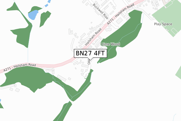
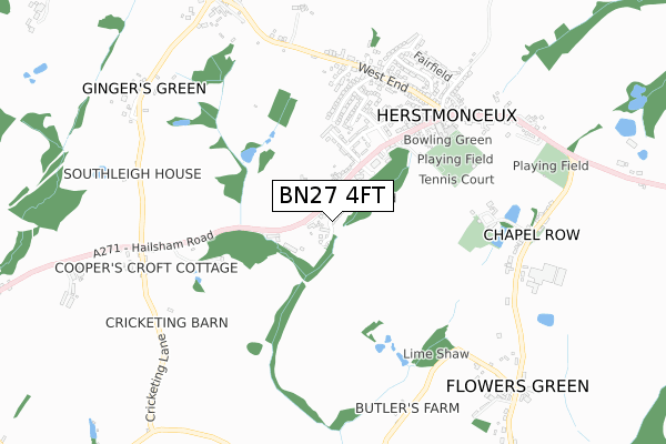
BN27 4FT is located in the Herstmonceux & Pevensey Levels electoral ward, within the local authority district of Wealden and the English Parliamentary constituency of Bexhill and Battle. The Sub Integrated Care Board (ICB) Location is NHS Sussex ICB - 97R and the police force is Sussex. This postcode has been in use since September 2019.


GetTheData
Source: OS Open Zoomstack (Ordnance Survey)
Licence: Open Government Licence (requires attribution)
Attribution: Contains OS data © Crown copyright and database right 2024
Source: Open Postcode Geo
Licence: Open Government Licence (requires attribution)
Attribution: Contains OS data © Crown copyright and database right 2024; Contains Royal Mail data © Royal Mail copyright and database right 2024; Source: Office for National Statistics licensed under the Open Government Licence v.3.0
| Easting | 563071 |
| Northing | 112181 |
| Latitude | 50.886101 |
| Longitude | 0.317003 |
GetTheData
Source: Open Postcode Geo
Licence: Open Government Licence
| Country | England |
| Postcode District | BN27 |
➜ See where BN27 is on a map | |
GetTheData
Source: Land Registry Price Paid Data
Licence: Open Government Licence
| Ward | Herstmonceux & Pevensey Levels |
| Constituency | Bexhill And Battle |
GetTheData
Source: ONS Postcode Database
Licence: Open Government Licence
| Fiennes Road (Hailsham Road) | Herstmonceux | 292m |
| Fiennes Road (Hailsham Road) | Herstmonceux | 310m |
| Brewers Arms (Gardner Street) | Herstmonceux | 620m |
| Brewers Arms (Gardner Street) | Herstmonceux | 664m |
| The Truggery (Hailsham Road) | Gingers Green | 714m |
GetTheData
Source: NaPTAN
Licence: Open Government Licence
GetTheData
Source: ONS Postcode Database
Licence: Open Government Licence


➜ Get more ratings from the Food Standards Agency
GetTheData
Source: Food Standards Agency
Licence: FSA terms & conditions
| Last Collection | |||
|---|---|---|---|
| Location | Mon-Fri | Sat | Distance |
| Fiennes Road | 16:00 | 08:15 | 370m |
| Herstmonceux Post Office | 16:15 | 09:30 | 672m |
| Coopers Croft | 16:00 | 09:30 | 746m |
GetTheData
Source: Dracos
Licence: Creative Commons Attribution-ShareAlike
The below table lists the International Territorial Level (ITL) codes (formerly Nomenclature of Territorial Units for Statistics (NUTS) codes) and Local Administrative Units (LAU) codes for BN27 4FT:
| ITL 1 Code | Name |
|---|---|
| TLJ | South East (England) |
| ITL 2 Code | Name |
| TLJ2 | Surrey, East and West Sussex |
| ITL 3 Code | Name |
| TLJ22 | East Sussex CC |
| LAU 1 Code | Name |
| E07000065 | Wealden |
GetTheData
Source: ONS Postcode Directory
Licence: Open Government Licence
The below table lists the Census Output Area (OA), Lower Layer Super Output Area (LSOA), and Middle Layer Super Output Area (MSOA) for BN27 4FT:
| Code | Name | |
|---|---|---|
| OA | E00107684 | |
| LSOA | E01021198 | Wealden 014B |
| MSOA | E02004416 | Wealden 014 |
GetTheData
Source: ONS Postcode Directory
Licence: Open Government Licence
| BN27 4JU | Ferndale | 102m |
| BN27 4JX | Hailsham Road | 150m |
| BN27 4LU | Buckwell Rise | 222m |
| BN27 4LX | Buckwell Rise | 266m |
| BN27 4LT | Buckwell Rise | 280m |
| BN27 4LY | Buckwell Rise | 299m |
| BN27 4LR | Queens Road | 310m |
| BN27 4LS | Queens Road | 329m |
| BN27 4LH | Hailsham Road | 358m |
| BN27 4PJ | Fairlawns Drive | 383m |
GetTheData
Source: Open Postcode Geo; Land Registry Price Paid Data
Licence: Open Government Licence