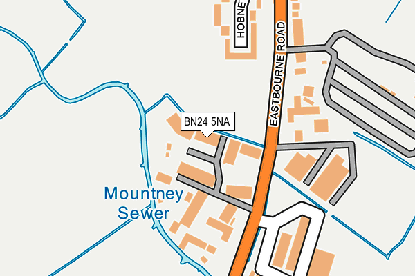
BN24 5NA is located in the Herstmonceux & Pevensey Levels electoral ward, within the local authority district of Wealden and the English Parliamentary constituency of Bexhill and Battle. The Sub Integrated Care Board (ICB) Location is NHS Sussex ICB - 97R and the police force is Sussex. This postcode has been in use since January 1992.


GetTheData
Source: OS OpenMap – Local (Ordnance Survey)
Source: OS VectorMap District (Ordnance Survey)
Licence: Open Government Licence (requires attribution)
| Easting | 563719 |
| Northing | 104016 |
| Latitude | 50.812560 |
| Longitude | 0.322531 |
GetTheData
Source: Open Postcode Geo
Licence: Open Government Licence
| Country | England |
| Postcode District | BN24 |
➜ See where BN24 is on a map ➜ Where is Westham? | |
GetTheData
Source: Land Registry Price Paid Data
Licence: Open Government Licence
Elevation or altitude of BN24 5NA as distance above sea level:
| Metres | Feet | |
|---|---|---|
| Elevation | 10m | 33ft |
Elevation is measured from the approximate centre of the postcode, to the nearest point on an OS contour line from OS Terrain 50, which has contour spacing of ten vertical metres.
➜ How high above sea level am I? Find the elevation of your current position using your device's GPS.
GetTheData
Source: Open Postcode Elevation
Licence: Open Government Licence
| Ward | Herstmonceux & Pevensey Levels |
| Constituency | Bexhill And Battle |
GetTheData
Source: ONS Postcode Database
Licence: Open Government Licence
| Hobney Rise (Eastbourne Road) | Westham | 241m |
| Hobney Rise (Eastbourne Road) | Westham | 278m |
| Pevensey & Westham Railway Station (Montague Way) | Westham | 400m |
| Eastbourne Road (Rattle Road) | Westham | 428m |
| Eastbourne Road (Rattle Road) | Westham | 439m |
| Pevensey & Westham Station | 0.4km |
| Pevensey Bay Station | 1.5km |
| Hampden Park (Sussex) Station | 3.5km |
GetTheData
Source: NaPTAN
Licence: Open Government Licence
GetTheData
Source: ONS Postcode Database
Licence: Open Government Licence


➜ Get more ratings from the Food Standards Agency
GetTheData
Source: Food Standards Agency
Licence: FSA terms & conditions
| Last Collection | |||
|---|---|---|---|
| Location | Mon-Fri | Sat | Distance |
| Westham Post Office | 16:15 | 12:00 | 683m |
| Castle View Gardens | 16:15 | 11:00 | 706m |
| Mendip Avenue | 17:15 | 11:00 | 1,109m |
GetTheData
Source: Dracos
Licence: Creative Commons Attribution-ShareAlike
| Risk of BN24 5NA flooding from rivers and sea | Low |
| ➜ BN24 5NA flood map | |
GetTheData
Source: Open Flood Risk by Postcode
Licence: Open Government Licence
The below table lists the International Territorial Level (ITL) codes (formerly Nomenclature of Territorial Units for Statistics (NUTS) codes) and Local Administrative Units (LAU) codes for BN24 5NA:
| ITL 1 Code | Name |
|---|---|
| TLJ | South East (England) |
| ITL 2 Code | Name |
| TLJ2 | Surrey, East and West Sussex |
| ITL 3 Code | Name |
| TLJ22 | East Sussex CC |
| LAU 1 Code | Name |
| E07000065 | Wealden |
GetTheData
Source: ONS Postcode Directory
Licence: Open Government Licence
The below table lists the Census Output Area (OA), Lower Layer Super Output Area (LSOA), and Middle Layer Super Output Area (MSOA) for BN24 5NA:
| Code | Name | |
|---|---|---|
| OA | E00107742 | |
| LSOA | E01021206 | Wealden 020A |
| MSOA | E02004422 | Wealden 020 |
GetTheData
Source: ONS Postcode Directory
Licence: Open Government Licence
| BN24 5NH | Eastbourne Road | 111m |
| BN24 5NN | Hobney Rise | 173m |
| BN24 5NG | Eastbourne Road | 200m |
| BN24 5NL | Pelham Close | 278m |
| BN24 5NF | Eastbourne Road | 319m |
| BN24 5NE | Eastbourne Road | 333m |
| BN24 5DF | Rattle Road | 400m |
| BN24 5ND | Eastbourne Road | 412m |
| BN24 5DE | Rattle Road | 452m |
| BN24 5NB | Montague Way | 470m |
GetTheData
Source: Open Postcode Geo; Land Registry Price Paid Data
Licence: Open Government Licence